Qañawimayu
| Qañawimayu | |
| River | |
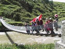 Children are waving the Peruvian flag on the new footbridge across Qañawimayu (Santo Tomás River) in Qullpatumayku, Chumbivilcas Province | |
| Name origin: Quechua | |
| Country | Peru |
|---|---|
| Region | Apurímac Region, Cusco Region |
| Coordinates | 14°41′21″S 72°22′53″W / 14.68917°S 72.38139°WCoordinates: 14°41′21″S 72°22′53″W / 14.68917°S 72.38139°W |
| Source | |
| - location | Santo Tomás District |
| - coordinates | 14°48′59″S 72°22′57″W / 14.81639°S 72.38250°W |
| Mouth | Apurímac River |
Qañawimayu (Quechua qañawi, qañiwa, qañawa a cereal from the Chenopodiaceae family, mayu river,[1][2][3] "qañawi river", hispanicized spelling Cañahuymayo) which upstream is called Cayacti and downstream successively is named Jaraucata, Qullpa (Collpa), Yawina (Yavina) and Santo Tomás River is a river in Peru. It is located in the Apurímac Region, Cotabambas Province, and in the Cusco Region, Chumbivilcas Province and Paruro Province.[4][5] It belongs to the Apurímac watershed.
Qañawimayu originates in the south-west of the Santo Tomás District in the Chumbivilcas Province of the Cusco Region between the mountains Minasniyuq and Qullpa K'uchu at a height of 4,940 metres (16,207 ft).[6] At first its direction is to the north. South of the mountain Wamanripa it turns to the northeast. It receives waters from the confluence with Sinqa Wayq'u. Near the town of Santo Tomás it turns to the north again. The confluence with the Apurímac River is at a mountain named Tinkuq (Tincoc) on the border of the districts of Tambobamba, Ccapi and Huanoquite.
References
- ↑ babylon.com/
- ↑ Teofilo Laime Ajacopa, Diccionario Bilingüe Iskay simipi yuyayk'ancha, La Paz, 2007 (Quechua-Spanish dictionary)
- ↑ Diccionario Quechua - Español - Quechua, Academía Mayor de la Lengua Quechua, Gobierno Regional Cusco, Cusco 2005 (Quechua-Spanish dictionary)
- ↑ escale.minedu.gob.pe - UGEL map of the Chumbivilcas Province (Cusco Region)
- ↑ escale.minedu.gob.pe - UGEL map of the Paruro Province (Cusco Region)
- ↑ Ministerio de Agricultura, Mapa hidrográfico e inventario de fuentes de aguas superficiales en el ámbito del ATDR Sicuani, Sicuani, 2005