Quinault River
| Quinault River | |
| River | |
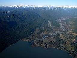 Quinault River emptying into Lake Quinault | |
| Country | United States |
|---|---|
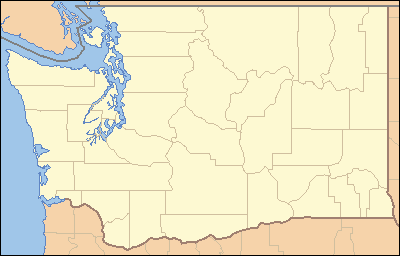
| State | Washington |
| Source | Olympic Mountains |
| - coordinates | 47°42′6″N 123°20′3″W / 47.70167°N 123.33417°W [1] |
| Mouth | Pacific Ocean |
| - location | Taholah |
| - coordinates | 47°20′58″N 124°17′59″W / 47.34944°N 124.29972°WCoordinates: 47°20′58″N 124°17′59″W / 47.34944°N 124.29972°W [1] |
| Length | 69 mi (111 km) [2] |
| Basin | 188 sq mi (487 km2) [3] |
 Mouth of the Quinault River in Washington | |
The Quinault River (/kwᵻˈnɒlt/ or /kwᵻˈnɔːlt/) is a 69-mile (111 km) long[2] river located on the Olympic Peninsula in the U.S. state of Washington. It originates deep in the Olympic Mountains in the Olympic National Park. It flows southwest through the "Enchanted Valley". Several miles above Lake Quinault the river is joined by its main tributary, the North Fork Quinault River. The main stem Quinault River above this confluence is sometimes called the East Fork Quinault River. Below the confluence the river marks the boundary of Olympic National Park for several miles before emptying into Lake Quinault. After the lake, the Quinault River flows southwest, reaching the Pacific at Taholah. From Lake Quinault to the ocean, the river is contained within the Quinault Indian Reservation.
The Quinault River's drainage basin is 188 square miles (487 km2) in area.[3] Its main tributaries include the North Fork Quinault River, Graves Creek, Fox Creek, and Cook Creek.[2]
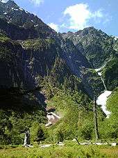
A well maintained trail follows the East Fork of the Quinault from Graves Creek to the Enchanted Valley Ranger Station through old growth rain forest.[4] In early summer snow melt creates many waterfalls in the valley, giving it the name "Valley of a Thousand Waterfalls".[5]
The Quinault River has been reaching new recorded lows in recent years, as it was fed by the Anderson Glacier which had melted away by 2011.[6]
See also
References
- 1 2 U.S. Geological Survey Geographic Names Information System: Quinault River
- 1 2 3 "National Hydrography Dataset". United States Geological Survey. Retrieved 4 September 2010. ArcExplorer GIS data viewer.
- 1 2 "Watershed Boundary Dataset". USDA, NRCS, National Cartography & Geospatial Center. Retrieved 4 September 2010. ArcExplorer GIS data viewer.
- ↑ Olympic National Park East Fork Quinault River Trail
- ↑ Seattle PI: Enchanted Valley Aptly Named
- ↑ Ahearn, Ashley (December 2, 2015). "Facing Rising Waters, A Native Tribe Takes Its Plea To Paris Climate Talks". NPR.
But without the glacier, the Quinault River was lower than ever before recorded. So low that while walking through a newly exposed stretch of river bed, one tribal member accidentally stubbed his toe on what turned out to be a mastodon jaw that may have been submerged since the last ice age.
External links
| Wikimedia Commons has media related to Quinault River. |
- U.S. Geological Survey Geographic Names Information System: North Fork Quinault River, USGS GNIS entry
- Quinault Indian Nation