R238 road (Ireland)
| |
|---|---|
|
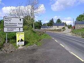
R238 at Moville, Co. Donegal | |
| Route information | |
| Length: | 88.1 km[1][2] (54.7 mi) |
| Major junctions | |
| From: |
|
| |
| To: | County Londonderry border at Liberty Bridge |
| Location | |
| Primary destinations: |
|
| Road network | |

The R238 road is a regional road in Ireland. It is a ring road around the Inishowen Peninsula in County Donegal.[2] The R238 is also part of the main road from Derry to Buncrana. Sections of the road form part of the Wild Atlantic Way.[3] In July 2010, the road was the site of Ireland's worst road crash resulting in eight deaths.[4]
The R238 travels north from the N13 at Bridge End. The road travels along Lough Swilly to reach Buncrana. From there the road proceeds inland to Carndonagh. After Carndonagh, the road goes to meet the Lough Foyle coast at Moville. From Moville the road proceeds southwest to end at the County Londonderry border just past Muff. The R238 is 88.1 km (54.7 mi) long.[1]
See also
References
- 1 2 Google (15 Mar 2016). "R238 to Main St" (Map). Google Maps. Google. Retrieved 15 Mar 2016.
- 1 2 "S.I. No. 54/2012 – Roads Act 1993 (Classification of Regional Roads) Order 2012". Government of Ireland. 28 Feb 2012. Retrieved 15 Mar 2016.
- ↑ "Wild Atlantic Way: Inishowen Cycling". Fáilte Ireland. Retrieved 15 Mar 2016.
- ↑ Greg Harkin (26 Feb 2016). "Ireland's worst ever road tragedy: verdict of unlawful killing returned in tragic crash where eight men died". Irish Independent. Retrieved 1 Jun 2016.
This article is issued from Wikipedia - version of the 6/1/2016. The text is available under the Creative Commons Attribution/Share Alike but additional terms may apply for the media files.