Raamsdonksveer
| Raamsdonksveer | |
|---|---|
| Town | |
|
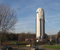
Watertower (H. Sangster, 1925) | |
| Coordinates: NL 51°41′N 4°52′E / 51.683°N 4.867°ECoordinates: NL 51°41′N 4°52′E / 51.683°N 4.867°E | |
| Country | Netherlands |
| Province | North Brabant |
| Municipality | Geertruidenberg |
| Population (2012) | 12.345[1] |
Raamsdonksveer is a town in the Dutch municipality of Geertruidenberg, North Brabant. It lies on the east side of the Donge opposite Geertruidenberg. It is a regional center of commerce and industry.
Raamsdonksveer lies between Oosterhout and Hank. Before 1950 it had a small railway station.
References
| Wikimedia Commons has media related to Raamsdonksveer. |
This article is issued from Wikipedia - version of the 10/1/2015. The text is available under the Creative Commons Attribution/Share Alike but additional terms may apply for the media files.