Radbuza
| Radbuza | |
| River | |
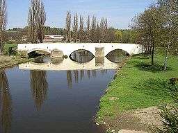 Radbuza in Dobřany | |
| Country | Czech Republic |
|---|---|
| Tributaries | |
| - right | Úhlava |
| Source | |
| - location | Český les |
| - elevation | 869 m (2,851 ft) |
| - coordinates | 49°29′13″N 12°39′58″E / 49.48694°N 12.66611°E |
| Mouth | Mže |
| - location | Plzeň |
| Length | 110 km (68 mi) |
| Basin | 2,182 km2 (842 sq mi) |
| Discharge | |
| - average | 11 m3/s (388 cu ft/s) |
The Radbuza (Czech pronunciation: [ˈradbuza]; German: Radbusa) is a 112 km long river in the Czech Republic, the right tributary of the Mže. Its source is situated at the foot of Lysá mountain (869 metres) near the village of Závist, near Domažlice. It passes through the villages and towns of Rybník, Smolov, Bělá nad Radbuzou, Horšovský Týn, Staňkov, Holýšov, Stod, Chotěšov, Zbůch and Dobřany before joining the Mže in Plzeň, and as the Berounka eventually reaching the Vltava at Prague.
Its major tributaries are the Zubřina, Merklinka and Úhlava. The basin area of the Radbuza is 2,182 km².
Gallery of the Radbuza
 Spring of Radbuza
 Radbuza one kilometer from its source, near Rybník.
 Radbuza in Pilsen during the floods in 2002
 Radbuza in Pilsen during the floods in 2002.
References
This article is issued from Wikipedia - version of the 9/17/2016. The text is available under the Creative Commons Attribution/Share Alike but additional terms may apply for the media files.