Rafha
| Rafha رفحاء | |
|---|---|
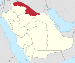 Rafha Location in Northern Borders Province, Saudi Arabia | |
| Coordinates: SA 29°38′19″N 043°30′05″E / 29.63861°N 43.50139°ECoordinates: SA 29°38′19″N 043°30′05″E / 29.63861°N 43.50139°E | |
| Country |
|
| Province | Northern Borders |
| Population (2010)[1] | |
| • Total | 80,544 |
Rafha (Arabic: رفحاء) is a town in the north of Saudi Arabia, close to the border with Iraq. It is located at around 29°38′19″N 43°30′5″E / 29.63861°N 43.50139°E. Rafha had a population of 80,544 at the 2010 Census.[1] After Arar, it is the second largest city in the Northern Borders Province (also known as Al-Hudud ash Shamaliyah). Currently the Ministry of Housing is building over 600 new villas for the local population and others and making significant improvements to the local infrastructure.[2]
Climate
Köppen-Geiger climate classification system classifies its climate as hot desert (BWh).[3][4][5]
| Climate data for Rafha (1985-2010) | |||||||||||||
|---|---|---|---|---|---|---|---|---|---|---|---|---|---|
| Month | Jan | Feb | Mar | Apr | May | Jun | Jul | Aug | Sep | Oct | Nov | Dec | Year |
| Record high °C (°F) | 29.8 (85.6) |
34.2 (93.6) |
38.4 (101.1) |
41.5 (106.7) |
46.0 (114.8) |
48.5 (119.3) |
49.0 (120.2) |
48.9 (120) |
46.5 (115.7) |
41.7 (107.1) |
46.0 (114.8) |
32.2 (90) |
49.0 (120.2) |
| Average high °C (°F) | 16.7 (62.1) |
19.6 (67.3) |
24.6 (76.3) |
31.1 (88) |
37.2 (99) |
41.0 (105.8) |
42.8 (109) |
43.4 (110.1) |
40.1 (104.2) |
34.2 (93.6) |
24.8 (76.6) |
18.6 (65.5) |
31.2 (88.2) |
| Daily mean °C (°F) | 10.1 (50.2) |
12.6 (54.7) |
17.3 (63.1) |
23.6 (74.5) |
29.6 (85.3) |
33.0 (91.4) |
34.5 (94.1) |
35.0 (95) |
31.7 (89.1) |
26.0 (78.8) |
17.6 (63.7) |
11.9 (53.4) |
23.6 (74.5) |
| Average low °C (°F) | 4.3 (39.7) |
6.0 (42.8) |
9.9 (49.8) |
15.7 (60.3) |
21.1 (70) |
23.7 (74.7) |
25.1 (77.2) |
25.5 (77.9) |
22.4 (72.3) |
18.2 (64.8) |
11.2 (52.2) |
6.1 (43) |
15.8 (60.4) |
| Record low °C (°F) | −5.8 (21.6) |
−5.0 (23) |
−2.0 (28.4) |
3.0 (37.4) |
2.1 (35.8) |
17.1 (62.8) |
19.5 (67.1) |
19.0 (66.2) |
12.2 (54) |
4.3 (39.7) |
−3.0 (26.6) |
−5.6 (21.9) |
−5.8 (21.6) |
| Average rainfall mm (inches) | 14.4 (0.567) |
9.2 (0.362) |
20.0 (0.787) |
12.0 (0.472) |
2.2 (0.087) |
0.0 (0) |
0.0 (0) |
0.0 (0) |
0.0 (0) |
2.6 (0.102) |
12.4 (0.488) |
10.8 (0.425) |
83.6 (3.29) |
| Average relative humidity (%) | 64 | 54 | 43 | 36 | 25 | 20 | 19 | 20 | 23 | 32 | 49 | 61 | 37.2 |
| Source: Jeddah Regional Climate Center[6] | |||||||||||||
References
- 1 2 "Saudi Arabia: Al-Hudud ash Shamaliyah: Rafha". Geohive.
- ↑ Kingdom of Saudi Arabia Ministry of Housing.
- ↑ . Climate-Data.org http://en.climate-data.org/location/551310/. Retrieved 2014-02-23. Missing or empty
|title=(help) - ↑ . Climate-Data.org http://en.climate-data.org/location/53600/. Retrieved 2014-02-23. Missing or empty
|title=(help) - ↑ . Climate-Data.org http://en.climate-data.org/location/278611/. Retrieved 2014-02-23. Missing or empty
|title=(help) - ↑ "Climate Data for Saudi Arabia". Jeddah Regional Climate Center. Retrieved January 29, 2016.
This article is issued from Wikipedia - version of the 11/20/2016. The text is available under the Creative Commons Attribution/Share Alike but additional terms may apply for the media files.