Ramsund, Norway
| Ramsund | |
|---|---|
| Village | |
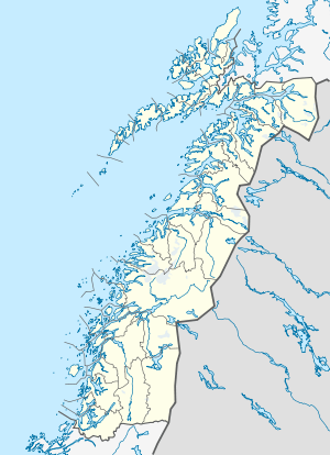 Ramsund  Ramsund Location in Nordland | |
| Coordinates: 68°30′02″N 16°29′09″E / 68.50056°N 16.48583°ECoordinates: 68°30′02″N 16°29′09″E / 68.50056°N 16.48583°E | |
| Country | Norway |
| Region | Northern Norway |
| County | Nordland |
| District | Ofoten |
| Municipality | Tjeldsund |
| Area[1] | |
| • Total | 0.56 km2 (0.22 sq mi) |
| Elevation[2] | 6 m (20 ft) |
| Population (2013)[1] | |
| • Total | 305 |
| • Density | 545/km2 (1,410/sq mi) |
| Time zone | CET (UTC+01:00) |
| • Summer (DST) | CEST (UTC+02:00) |
| Post Code | 9442 Ramsund |
Ramsund is a village in the municipality of Tjeldsund in Nordland county, Norway. It is located on the eastern shore of the Ramsundet strait, just south of the Ramsund Bridge. The 0.56-square-kilometre (140-acre) village has a population (2013) of 305. The population density is 545 inhabitants per square kilometre (1,410/sq mi).[1] Ramsund Chapel is located in this village. There is also a military base located south of the village that is the base for the Marinejegerkommandoen unit.[3]
References
- 1 2 3 Statistisk sentralbyrå (1 January 2013). "Urban settlements. Population and area, by municipality.".
- ↑ "Ramsund" (in Norwegian). yr.no. Retrieved 2012-06-11.
- ↑ Store norske leksikon. "Ramsund" (in Norwegian). Retrieved 2012-06-11.
This article is issued from Wikipedia - version of the 7/31/2016. The text is available under the Creative Commons Attribution/Share Alike but additional terms may apply for the media files.