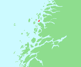
Rangsundøya
 Location in Nordland | |
 Rangsundøya | |
| Geography | |
|---|---|
| Location | Nordland, Norway |
| Coordinates | 66°34′12″N 13°1′28″E / 66.57000°N 13.02444°ECoordinates: 66°34′12″N 13°1′28″E / 66.57000°N 13.02444°E |
| Area | 7.6 km2 (2.9 sq mi) |
| Highest elevation | 267 m (876 ft) |
| Highest point | Rangsundtinden |
| Administration | |
|
Norway | |
| County | Nordland |
| Municipality | Rødøy |
Rangsundøya is an island in Rødøy municipality in Nordland county, Norway. Rangsundøya has an area of approximately 7.6 km² and the highest point is Rangsundtinden at 267 m.
See also
References
This article is issued from Wikipedia - version of the 11/17/2016. The text is available under the Creative Commons Attribution/Share Alike but additional terms may apply for the media files.