Ratitovec
| Ratitovec | |
|---|---|
 | |
| Highest point | |
| Elevation | 1,678 m (5,505 ft) |
| Coordinates | 46°14′20.364″N 14°4′27.840″E / 46.23899000°N 14.07440000°ECoordinates: 46°14′20.364″N 14°4′27.840″E / 46.23899000°N 14.07440000°E |
| Geography | |
 Ratitovec | |
| Parent range | Škofjeloško hribovje |
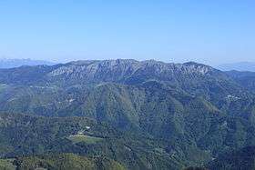
Ratitovec (sometimes also called Altemaver) is a 1678 m mountain in Slovenia, part of the Julian Alps. There is a krek hut on the top of the mountain.[1]
Starting points and routes
- From Soriška planina, 3h
- From village Prtovč, 2h
- From village Torka via Povden, 1½h
- From Bitenjska planina on Jelovica 2½h
- From Planina pečana, 1h
References
External links
| Wikimedia Commons has media related to Ratitovec. |
This article is issued from Wikipedia - version of the 11/21/2015. The text is available under the Creative Commons Attribution/Share Alike but additional terms may apply for the media files.