Riaba
| Riaba | |
|---|---|
|
Riaba from its beach, 2013 | |
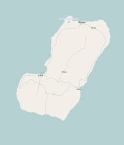 Riaba 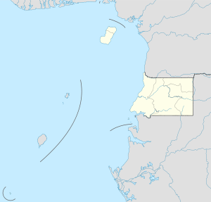 Riaba Location in Bioko | |
| Coordinates: 3°23′N 8°46′E / 3.383°N 8.767°E | |
| Country |
|
| Province | Bioko Sur |
| Population (2005) | |
| • Total | 1,071 |
| Climate | Am |

Riaba is a town in Equatorial Guinea. It is also the 30th largest settlement in the country. It was established by the British in 1821.
Location and population
It is located in Bioko Sur Province.
It has a (2005 est.) population of 1,071.
Road communications
The European Union and the ADB in cooperation with the Equatorial Guinean government have developed a road network on Bioko connecting Riaba with other towns such as Luba and Malabo. [1]
References
- ↑ African Economic Outlook. African Development Bank. 2002. p. 129. ISBN 92-64-19704-4.
Coordinates: 3°23′N 8°46′E / 3.383°N 8.767°E
This article is issued from Wikipedia - version of the 11/7/2016. The text is available under the Creative Commons Attribution/Share Alike but additional terms may apply for the media files.