Richmond Creek (Fresh Kills)
Richmond Creek is a stream in Staten Island, a borough of New York City in the United States. Its upper drainage basin includes the remote forested hills in the center of the island. It empties into the Fresh Kills.[1]
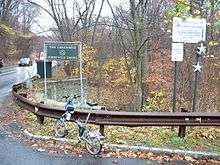
Its source is Orbach Lake, located on the grounds of the Pouch Camp, maintained by the Boy Scouts of America; from there it enters the Greenbelt, crossing underneath the intersection of Manor Road and Rockland Avenue, whereupon it enters the Egbertville Ravine, then emerges from the ravine and flows along the east side of Lighthouse Hill, skimming the western edge of the Richmondtown neighborhood (where bridges are necessary to cross it at several points, and creating dead-end streets at others) and through Historic Richmond Town. South of Richmondtown it emerges into a wide floodplain of wetlands that has been designated as part of Staten Island's "Bluebelt," a region of wetlands in which many, but not all, kinds of development are prohibited.
It flows under Richmond Avenue east of the Staten Island Mall and flows into the Fresh Kills alongside the former site of the Fresh Kills Landfill.
In colonial times and in the early 19th century the creek was used to operate several mills in the center of the island. One such mill is being restored along the creek in Historic Richmond Town.
See also
Coordinates: 40°34′6.45″N 74°10′34.21″W / 40.5684583°N 74.1761694°W
References
- ↑ Kadinsky, Sergey (2016) Hidden Waters of New York City Countryman Press. Pp. 256-259 ISBN 978-1-58157-355-8