Rio Verde de Mato Grosso
| Rio Verde de Mato Grosso | |
|---|---|
| Municipality | |
 Location in Mato Grosso do Sul state | |
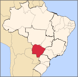
 Rio Verde de Mato Grosso Location in Brazil | |
| Coordinates: 18°55′04″S 54°50′38″W / 18.91778°S 54.84389°WCoordinates: 18°55′04″S 54°50′38″W / 18.91778°S 54.84389°W | |
| Country |
|
| Region | Central-West Region |
| State | Mato Grosso do Sul |
| Area | |
| • Total | 8,152 km2 (3,148 sq mi) |
| Elevation | 330 m (1,080 ft) |
| Population (2005) | |
| • Total | 20,057 |
| • Density | 2.5/km2 (6.4/sq mi) |
| Time zone | BRT-1/BRST-1 (UTC-4/-3) |
Rio Verde de Mato Grosso is a municipality located in the Brazilian state of Mato Grosso do Sul. Its population was 20,057 (2005) and its area is 8,152 km².[1]
Rio Verde (which means "Green River" in English), how it's popularly called among the people from northern South Mato Grosso, is a small town in the very edge of Serra da Alegria (which means "The Happiness Mountains"), close to the Pantanal of Nhecolândia (which means "The Blissful Burg"), one of the largest on earth. The following closest city is Coxim, an alternative center for backpackers and ecotourists from all over the world. Some of Rio Verde's great attractions are the Sete Quedas (Seven Falls), the Fazenda Igrejinha (Little Church Ranch) and the Jardim dos Tamanudás (Anteaters' Garden).
References
External links
Capital: Campo Grande | |||||||||||||||
| Mesoregion Centro Norte de Mato Grosso do Sul |
|  | |||||||||||||
| Mesoregion Leste de Mato Grosso do Sul |
| ||||||||||||||
| Mesoregion Pantanal Sul Mato-Grossense |
| ||||||||||||||
| Mesoregion Sudoeste de Mato Grosso do Sul |
| ||||||||||||||