Roanoke River
| Roanoke River | |
| Staunton River | |
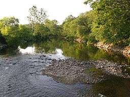 Roanoke River in Wasena, Virginia | |
| Country | United States |
|---|---|
| States | Virginia, North Carolina |
| Tributaries | |
| - left | Big Otter River, Falling River |
| - right | Dan River |
| Source | Confluence of North and South Forks |
| - location | Lafayette, Virginia |
| - elevation | 1,194 ft (364 m) |
| - coordinates | 37°14′15″N 80°12′49″W / 37.23750°N 80.21361°W |
| Mouth | Albemarle Sound |
| - location | Plymouth, North Carolina |
| - elevation | 0 ft (0 m) |
| - coordinates | 35°56′33″N 76°41′42″W / 35.94250°N 76.69500°WCoordinates: 35°56′33″N 76°41′42″W / 35.94250°N 76.69500°W |
| Length | 410 mi (660 km) |
| Basin | 9,680 sq mi (25,071 km2) |
| Discharge | for Roanoke Rapids, 133.6 mi (215.0 km) from the mouth |
| - average | 7,802 cu ft/s (221 m3/s) |
| - max | 261,000 cu ft/s (7,391 m3/s) |
| - min | 818 cu ft/s (23 m3/s) |
 Map of the Roanoke River watershed | |
The Roanoke River (/ˈroʊəˌnoʊk/) is a river in southern Virginia and northeastern North Carolina in the United States, 410 mi (660 km) long.[1] A major river of the southeastern United States, it drains a largely rural area of the coastal plain from the eastern edge of the Appalachian Mountains southeast across the Piedmont to Albemarle Sound. An important river throughout the history of the United States, it was the site of early settlement in the Virginia Colony and the Carolina Colony. An 81 mile section[2] of its lower course in Virginia between the Leesville Lake and Kerr Lake is known as the Staunton River, pronounced STAN-ten, as is the Shenandoah Valley city of that name. It is impounded along much of its middle course to form a chain of reservoirs.
Description
The river has its headwaters in the Blue Ridge Mountains in southwestern Virginia at Lafayette in Montgomery County where the North Fork and South Fork of the river merge. The North Fork, approximately 30 mi (50 km) long, rises between two mountain ridges and flows initially southwest, then loops back to the northeast. The South Fork, approximately 20 mi (30 km) long, rises in several streams in the mountains on the border of Floyd, Roanoke, and Montgomery counties and flows generally north, joining the North Fork from the south.
The combined stream flows northeast between mountain ridges through the Roanoke Valley, approximately 10 mi (15 km) to Salem, then east through the city of Roanoke, emerging from a gorge in the Blue Ridge Mountains southeast of Roanoke and forming the boundary between Franklin and Bedford counties. The river flows generally east-southeast across the Piedmont of southern Virginia and enters northeastern North Carolina, passing north of Roanoke Rapids at the fall line. The river flows southeast in a zigzag course across the coastal plain through the Roanoke River National Wildlife Refuge and then briefly turns north as it enters Batchelor Bay on the western end Albemarle Sound.
The river is impounded in three locations. The first is the Niagara dam just south of the City of Roanoke in Roanoke County adjacent to the town of Vinton. It was constructed in 1906 to supply power for the Roanoke Electric Car streetcar system. It is currently owned and operated by the Appalachian Power Company. It is then impounded twice in succession in the Piedmont of southwestern Virginia downstream from Roanoke to form the Smith Mountain Lake and Leesville Lake reservoirs. Farther downstream in southern along the North Carolina border, the river is impounded to form the expansive Kerr Lake. In northeastern North Carolina, 3 mi (5 km) west of Roanoke Rapids, the river is impounded to form the Lake Gaston reservoir, which stretches upstream into Virginia to the John H. Kerr Dam, and is impounded a final time to form Roanoke Rapids Lake.
History

The Roanoke River valley was the homeland of various Native Americans, mostly Virginia Siouan, such as the Occaneechi (today part of the Haliwa-Saponi) and the Tutelo. The name Roanoke is derived from rawrenok, an Algonquian word for wampum. The deadly spring floods earned it the name "River of Death".[3] The river's lower course began to be settled by Virginians about the middle of the 17th century, in what was known as the Albemarle Settlements. The upper reaches of the Roanoke River were explored by fur trading parties sent by Abraham Wood in the late 17th century, but these were not settled by English until the early 18th century.
In 1883, the small town of Big Lick on the river was selected as a major shops and terminal point for the new Norfolk and Western Railway to meet the Shenandoah Valley Railroad. Big Lick was renamed Roanoke for the river that bisected it, as the surrounding Roanoke County had been in 1838.[4]
See also
- List of North Carolina rivers
- List of Virginia rivers
- Bacon's Rebellion
- Roanoke Island
- South Atlantic-Gulf Water Resource Region
References
- ↑ "Roanoke River Basin" (PDF). www.deq.state.va.us/vrrbac/. Virginia Roanoke River Basin Advisory Committee.
- ↑ "Staunton River". www.dgif.virginia.gov/fishing/waterbodies/display.asp?id=175. Virginia Department of Game and Inland Fisheries.
- ↑ "The Roanoke Super Highway". www.unctv.org. UNC-TV.
- ↑ Roanoke, Visit Roanoke, Virginia Website
External links
- RoanokeRiver.com
- Roanoke River Basin Association
- Upper Roanoke River Roundtable
- Roanoke River National Wildlife Refuge
- U.S. Geological Survey Geographic Names Information System: Roanoke River