Rose Island, New Zealand
 The Auckland group | |
| Geography | |
|---|---|
| Coordinates | 50°30′50″S 166°14′56″E / 50.514°S 166.249°ECoordinates: 50°30′50″S 166°14′56″E / 50.514°S 166.249°E |
| Archipelago | Auckland Islands |
| Area | 1.21 km2 (0.47 sq mi) |
| Length | 1.6 km (0.99 mi) |
| Width | 0.8 km (0.5 mi) |
| Administration | |
|
New Zealand | |
| Demographics | |
| Population | 0 |
| Pop. density | 0 /km2 (0 /sq mi) |
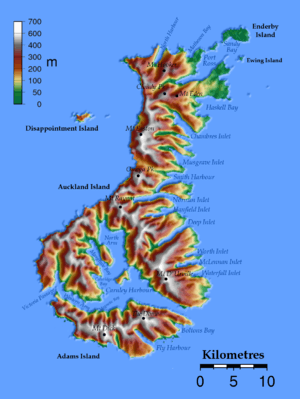
Rose Island is an uninhabited island, and with an area of 121 hectares the fifth largest of the Auckland Islands group, a subantarctic chain that forms part of the New Zealand Outlying Islands.
It is located in the northeast of the group, in the mouth of Port Ross, Auckland Island and south west of the larger Enderby Island. It was stocked with rabbits and provided with a boatshed for the relief of castaways during the nineteenth century. The rabbits have since been eradicated by the Department of Conservation, and provides a secure home for a population of Auckland Islands teal.[1] The vegetation on Rose contains rata, and while much original vegetation has been destroyed, it is less modified than much of the Auckland Islands.
See also
- Composite Antarctic Gazetteer
- List of Antarctic and subantarctic islands#List of subantarctic islands
- List of islands of New Zealand
- New Zealand Subantarctic Islands
- SCAR
- Territorial claims in Antarctica
References
This article is issued from Wikipedia - version of the 9/20/2015. The text is available under the Creative Commons Attribution/Share Alike but additional terms may apply for the media files.