Rosny-sous-Bois
| Rosny-sous-Bois | ||
|---|---|---|
|
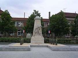
Rosny-sous-Bois war memorial | ||
| ||
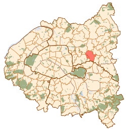 Paris and inner ring departments | ||
| Coordinates: 48°52′00″N 2°29′00″E / 48.8667°N 2.4833°ECoordinates: 48°52′00″N 2°29′00″E / 48.8667°N 2.4833°E | ||
| Country | France | |
| Region | Île-de-France | |
| Department | Seine-Saint-Denis | |
| Arrondissement | Bobigny | |
| Canton | Rosny-sous-Bois | |
| Government | ||
| • Mayor | Claude Capillon | |
| Area1 | 5.91 km2 (2.28 sq mi) | |
| Population (2006)2 | 41,565 | |
| • Density | 7,000/km2 (18,000/sq mi) | |
| Time zone | CET (UTC+1) | |
| • Summer (DST) | CEST (UTC+2) | |
| INSEE/Postal code | 93064 / 93110 | |
| Elevation | 45–116 m (148–381 ft) | |
|
1 French Land Register data, which excludes lakes, ponds, glaciers > 1 km² (0.386 sq mi or 247 acres) and river estuaries. 2 Population without double counting: residents of multiple communes (e.g., students and military personnel) only counted once. | ||
Rosny-sous-Bois is a commune in the eastern suburbs of Paris, France. It is located 10.1 km (6.3 mi) from the center of Paris.
It is the seat of the national centre of road information of the national gendarmerie.
Heraldry
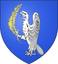 |
The arms of Rosny-sous-Bois are blazoned : Azure, an eagle rampant argent, holding in his right talon an olive branch palewise Or. |
Transport
Rosny-sous-Bois is served by two stations on Paris RER line E: Rosny – Bois-Perrier and Rosny-sous-Bois.
Education
The commune has seven public primary school groups, with each having a preschool (maternelle) and an elementary school. There is also a private Montessori French-English bilingual primary school, Ecole maternelle privée « Les merveilles ».[1]
Secondary schools:[2]
- Junior high schools: Albert Camus, Langevin-Wallon, Saint Exupery
- Senior high schools/sixth-form colleges: Lycée Charles de Gaulle and Lycée Professionnel Jean Moulin
Personalities
- Selim Bouadla—footballer
- Mamadou Diakite—footballer
- Nicolas Douchez—footballer
See also
References
- ↑ "Groupes scolaires." Rosny-sous-Bois. Retrieved on September 8, 2016.
- ↑ "Collèges et Lycées." Rosny-sous-Bois. Retrieved on September 8, 2016.
External links
| Wikimedia Commons has media related to Rosny-sous-Bois. |
- Official website (in French)
- Rosny-Rail: Railroad Museum of Rosny-sous-Bois (in English)