Ruby Peak (California)
| Ruby Peak | |
|---|---|
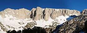 Ruby Wall is in the center with Mount Mills on the left and Mono Pass on the right | |
| Highest point | |
| Elevation | 13,194 ft (4,022 m) NAVD 88[1] |
| Prominence | 588 ft (179 m) [1] |
| Parent peak | Mount Mills[2] |
| Coordinates | 37°24′32″N 118°46′56″W / 37.408898°N 118.782256°WCoordinates: 37°24′32″N 118°46′56″W / 37.408898°N 118.782256°W [1] |
| Geography | |
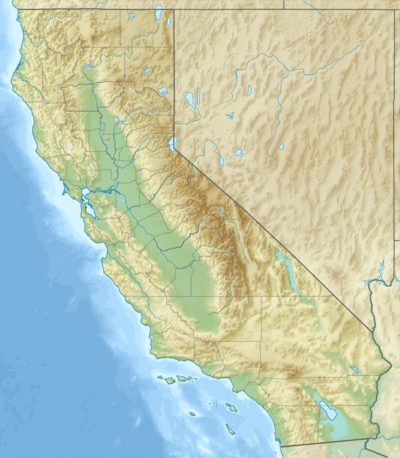 Ruby Peak Fresno and Inyo counties, California | |
| Parent range | Sierra Nevada |
| Topo map | USGS Mount Abbot |
| Climbing | |
| First ascent | 1946 by Fritz Gerstaker and Virginia Whitacre[3] |
| Easiest route | Scramble, class 3[3] |
Ruby Peak is a thirteener on the Sierra Crest, north of Mount Mills. It is in the John Muir Wilderness and on the boundary between the Sierra National Forest and the Inyo National Forest. The eastern slope drains into Rock Creek which feeds the Owens River while the western slopes drains in Mono Creek which feeds the South Fork of the San Joaquin River.
Climbing
The first ascent was on July 24, 1946 by Fritz Gerstaker and Virginia Whitacre by the class 3, west couloir route. A grade IV, class 5.11 route, known as Technical Knockout, ascends Ruby Wall and features a large roof. It was first climbed by Richard Leversee, Kim Miller and Roanne Miller in July 1989.[3]
References
- 1 2 3 "Ruby Peak, California". Peakbagger.com. Retrieved 2011-06-03.
- ↑ "Ruby Peak". ListsOfJohn.com. Retrieved 2011-06-03.
- 1 2 3 Secor, R.J. (2009). The High Sierra Peaks, Passes, and Trails (3rd ed.). Seattle: The Mountaineers. pp. 343–345. ISBN 9780898869712.
External links
- "Ruby Peak". SummitPost.org.
This article is issued from Wikipedia - version of the 12/26/2015. The text is available under the Creative Commons Attribution/Share Alike but additional terms may apply for the media files.