Sámuel Mikoviny
| Sámuel Mikoviny | |
|---|---|
|
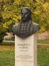
Samuel Mikoviny sculpture in Tata | |
| Born |
1686 Szinóbánya, Kingdom of Hungary (today Cinobaňa, Slovakia) |
| Died | March 23, 1750 |
| Nationality | Hungarian[1][2] |
| Occupation | Mathematician, engineer, cartographer |
.jpg)
Sámuel Mikoviny (1700 – 23 March 1750) was a renowned Hungarian[1] mathematician, engineer, cartographer, and professor. He was a leading representative of science and technology in the 18th century Kingdom of Hungary and Habsburg Monarchy. Today he is the pride of both the Hungarian and Slovak nations.
He is best known as an architect of artificial lake system near Selmecbánya (now Banská Štiavnica, Slovakia) known as tajchy that was built in order to provide energy for the silver mines in the region. Tajchy are today part of UNESCO World heritage site. He is also renowned for his cooperation with geographer and historian Matthias Bel.
Biography
Mikoviny was possibly born in Szinóbánya, Nógrád County, Kingdom of Hungary (now Cinobaňa, Slovakia) in 1686 or in Ábelfalva (now Ábelová) ca. 1700. He learnt engraving at Nuremberg, and studied mathematics at the nearby university of Altdorf and later in Jena. He probably took private lessons in astronomy and surveying in Vienna before he returned to Bratislava (called Pressburg or Pozsony at that time).
In Nuremberg, Mikoviny showed that he was a good engraver and a gifted artist. His series of engravings, views of Altdorf and Nuremberg was published in a booklet of Altdorf in 1723. The publication also included a map of the district. From 1725, he was county engineer in Bratislava, in the Kingdom of Hungary. He devoted most of his attention to improvement works, especially anti-flood works on the banks of the river Danube and Vág, work to secure their navigability, and regulation work near Tata. He also concerned himself with astronomy at an observatory which he had established at his home in present-day Laurinská Street in Bratislava. His astronomical observations served map-making.
Mikoviny made a significant contribution to the making of a new map of the Kingdom of Hungary. He relied on his own measurements and used a scientific method, based on four basic principles: astronomical, geometrical, magnetic, and hydrographic. His work was significantly influenced by another renowned scholar of the 18th century living in the multi-ethnic Kingdom of Hungary, Matthias Bel.
Earlier Mikoviny engraved a map of Demänovská Cave in nowadays Slovakia and several illustrations for Bel’s book Hungariae antiquae et novae prodromus (Messenger of Old and New Hungary), published in 1723 in Nuremberg. From 1731 Mikoviny constructed county maps for Bel’s great work, Notitia Hungariae Novae Historico-Geographica. Mikoviny created the first topographical maps of individual counties of the Kingdom of Hungary. He also contributed to the work with illustrations, especially views of towns and castles. Mikovíny used his own prime meridian for the Kingdom of Hungary, the meridianus Posoniensis, which passed through the northeast tower of Bratislava Castle.
Mikoviny made a significant contribution to the development of mining in Upper Hungary, (today central Slovakia) helping it to achieve a place among the most technically developed industries in Europe at that time. He was a leading expert on the construction of water reservoirs, mining machinery, foundries, and mills. His chief contribution is construction of a sophisticated system of reservoirs, known as tajchy, which drained water from the flooded mines in Schemnitz/Selmecbánya (now Banská Štiavnica, Slovakia) and provided energy for its local industry. In 1735, Mikoviny became the first professor of Banícka akadémia, the school of mining at Banská Štiavnica, which later became the first technical university in Europe. He lectured on mathematics, mechanics, hydraulics, and surveying methods and supervised practical work in land and mine surveying.
From 1735, Mikoviny was a member of the Prussian Academy of Sciences in Berlin. He also worked as an engineer and builder of roads and bridges. During the Silesian Wars, Empress Maria Theresa of Austria employed him as a military engineer. He designed and built defensive and fortification works on the Moravian-Silesian frontier. In 1748, he carried out regulation work in the area of Komárno, and at the time devoted attention to archaeological research. He studied and described the remains of the Roman fortress of Brigetio in Szőny, and made a plan of it. Various buildings were erected according to his plans. In 1749, he prepared plans for construction of a royal palace in Buda, and carried out preparation of the castle hill and construction of water treatment works for it. In 1750, he carried out anti-flooding works on the river Vág. During the works, he became ill and died on March 23, 1750 at a now unknown place on the road from Trencsén to Selmecbánya.
References
- 1 2 Robert John Weston Evans (2006). Austria, Hungary, and the Habsburgs: Essays on Central Europe, C.1683–1867. Oxford University Press. p. 337. ISBN 9780199281442.
- ↑ Maria Bizubova; Daniel Kollár; Jan Lacika; Gabriel Zubriczky (2001). The Slovak-Austrian-Hungarian Danubeland. Bolchazy-Carducci Publishers. p. 292. ISBN 9780865165281. Retrieved 2009-06-01.
External links
- Samuel Mikovini (Slovak)
- Mikoviny Sámuel (Hungarian)
- Samuel Mikoviny, 1698-1750. Virtual exhibition