Sør-Aukra
| Sør-Aukra herad | |
|---|---|
| Former Municipality | |
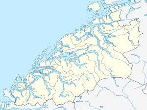 Sør-Aukra Location in Møre og Romsdal | |
| Coordinates: 62°42′49″N 06°47′46″E / 62.71361°N 6.79611°ECoordinates: 62°42′49″N 06°47′46″E / 62.71361°N 6.79611°E | |
| Country | Norway |
| Region | Western Norway |
| County | Møre og Romsdal |
| District | Romsdal |
| Adm. Center | Midsund |
| Area[1] | |
| • Total | 86 km2 (33 sq mi) |
| Time zone | CET (UTC+01:00) |
| • Summer (DST) | CEST (UTC+02:00) |
| ISO 3166 code | NO-1545 |
| Created from | Aukra in 1924 |
| Merged into | Midsund in 1964 |
Sør-Aukra is a former municipality in Møre og Romsdal county, Norway. Sør Aukra Municipality existed from 1924 until 1965 when it was all merged into Midsund Municipality. The municipality consisted of the entire island of Otrøya, the eastern part of Midøya island, and some small surrounding islands at the entrance to the Romsdalsfjorden. The village of Midsund was the administrative centre of the municipality.[1]
History
The municipality of Sør-Aukra was established on 1 January 1924 when the old Aukra Municipality was divided into Sør-Aukra (in the south) and Nord-Aukra (in the north). Initially, Sør-Aukra Municipality had a population of 1,395. On 1 January 1965, Sør-Aukra was merged with the islands of Midøya and Dryna from the municipality of Vatne to form the new Midsund Municipality. Prior to the merger, Sør-Aukra had a population of 1,912. At the same time, Nord-Aukra changed its name back to Aukra.[2]
References
- 1 2 Store norske leksikon. "Sør-Aukra" (in Norwegian). Retrieved 2010-10-23.
- ↑ Jukvam, Dag (1999). "Historisk oversikt over endringer i kommune- og fylkesinndelingen" (PDF) (in Norwegian). Statistisk sentralbyrå.