Sabula, Iowa
| Sabula, Iowa | |
|---|---|
| City | |
|
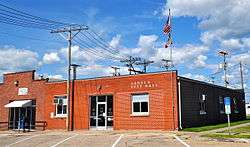
Sabula City Hall, July 2014. | |
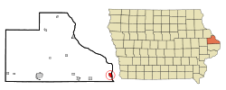 Location of Sabula, Iowa | |
| Coordinates: 42°4′4″N 90°10′27″W / 42.06778°N 90.17417°WCoordinates: 42°4′4″N 90°10′27″W / 42.06778°N 90.17417°W | |
| Country |
|
| State |
|
| County | Jackson |
| Area[1] | |
| • Total | 1.26 sq mi (3.26 km2) |
| • Land | 0.40 sq mi (1.04 km2) |
| • Water | 0.86 sq mi (2.23 km2) |
| Elevation | 591 ft (180 m) |
| Population (2010)[2] | |
| • Total | 576 |
| • Estimate (2012[3]) | 568 |
| • Density | 1,440.0/sq mi (556.0/km2) |
| Time zone | Central (CST) (UTC-6) |
| • Summer (DST) | CDT (UTC-5) |
| ZIP code | 52070 |
| Area code(s) | 563 |
| FIPS code | 19-69510 |
| GNIS feature ID | 0460877 |
Sabula is a city in Jackson County, Iowa, United States. The population was 576 at the 2010 census. Sabula is the site of Iowa's only island city. The island has a beach and a campground. It also has a harbor with boat docks and storage sheds to store some boats during the winter. Because of its proximity to Chicago (three-hour drive), Sabula has become a popular vacationing destination during the summer months.
Sabula has two churches: one Lutheran, one Methodist.
Sabula is the northern terminus of U.S. Route 67, a 1,560 mile (2,511 km) long north–south U.S. highway in the Central United States. The southern terminus of the route is at the United States–Mexico border in Presidio, Texas.
History
Sabula was established in 1835 when, according to legend, Isaac Dorman crossed the river from the Illinois side on a log and decided to settle on the present site of Sabula.[4] Sabula is a name of Native American origin meaning "sand"; this refers to the sandy soil of the area.[5]
In the late 19th century the principal industries in the community included a large "pearl button" factory—which produced buttons from clam shells harvested from large clam beds located in the river adjacent to the shoreline. (The factory is no longer there.) The thriving community also supported a large hog slaughtering industry.
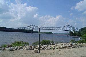
The community did not actually become an island until the lock and dam system was constructed by the Army Corps of Engineers on the upper Mississippi in the 1930s. The construction of Lock and Dam No. 13 between Clinton, Iowa and Fulton, Illinois in 1939 left the lowlands west of the townsite permanently flooded, creating the "Island City," as the town is now known.[6]
Geography
Sabula is located at 42°4′4″N 90°10′27″W / 42.06778°N 90.17417°W (42.067866, −90.174270).[7]
According to the United States Census Bureau, the city has a total area of 1.26 square miles (3.26 km2), of which 0.40 square miles (1.04 km2) is land and 0.86 square miles (2.23 km2) is water.[1]
Sabula is connected to Iowa via a roadway that runs between two lakes and with Savanna, Illinois, by another roadway that leads to a bridge that crosses the Mississippi River.
Demographics
| Historical populations | ||
|---|---|---|
| Year | Pop. | ±% |
| 1850 | 168 | — |
| 1860 | 406 | +141.7% |
| 1870 | 920 | +126.6% |
| 1880 | 1,223 | +32.9% |
| 1890 | 918 | −24.9% |
| 1900 | 1,029 | +12.1% |
| 1910 | 918 | −10.8% |
| 1920 | 865 | −5.8% |
| 1930 | 759 | −12.3% |
| 1940 | 771 | +1.6% |
| 1950 | 888 | +15.2% |
| 1960 | 894 | +0.7% |
| 1970 | 845 | −5.5% |
| 1980 | 824 | −2.5% |
| 1990 | 710 | −13.8% |
| 2000 | 670 | −5.6% |
| 2010 | 576 | −14.0% |
| 2014 | 556 | −3.5% |
| 2015 | 552 | −0.7% |
| Source:"American FactFinder". United States Census Bureau. and Iowa Data Center Source: | ||
2010 census
As of the census[2] of 2010, there were 576 people, 270 households, and 157 families residing in the city. The population density was 1,440.0 inhabitants per square mile (556.0/km2). There were 321 housing units at an average density of 802.5 per square mile (309.8/km2). The racial makeup of the city was 99.1% White, 0.2% African American, 0.2% Native American, 0.2% from other races, and 0.3% from two or more races. Hispanic or Latino of any race were 0.7% of the population.
There were 270 households of which 24.8% had children under the age of 18 living with them, 43.3% were married couples living together, 12.2% had a female householder with no husband present, 2.6% had a male householder with no wife present, and 41.9% were non-families. 37.0% of all households were made up of individuals and 19.3% had someone living alone who was 65 years of age or older. The average household size was 2.13 and the average family size was 2.81.
The median age in the city was 45 years. 22.4% of residents were under the age of 18; 6% were between the ages of 18 and 24; 21.6% were from 25 to 44; 29.6% were from 45 to 64; and 20.3% were 65 years of age or older. The gender makeup of the city was 46.9% male and 53.1% female.
2000 census
As of the census[9] of 2000, there were 670 people, 308 households, and 182 families residing in the city. The population density was 1,709.3 people per square mile (663.3/km²). There were 337 housing units at an average density of 859.8/sq mi (333.6/km²). The racial makeup of the city was 100.00% White. Hispanic or Latino of any race were 1.04% of the population.
There were 308 households out of which 23.4% had children under the age of 18 living with them, 43.2% were married couples living together, 12.0% had a female householder with no husband present, and 40.6% were non-families. 36.0% of all households were made up of individuals and 19.2% had someone living alone who was 65 years of age or older. The average household size was 2.18 and the average family size was 2.78.
In the city the population was spread out with 22.1% under the age of 18, 6.0% from 18 to 24, 23.7% from 25 to 44, 25.8% from 45 to 64, and 22.4% who were 65 years of age or older. The median age was 43 years. For every 100 females there were 92.5 males. For every 100 females age 18 and over, there were 89.8 males.
The median income for a household in the city was $30,192, and the median income for a family was $39,688. Males had a median income of $29,000 versus $20,500 for females. The per capita income for the city was $16,901. About 11.5% of families and 14.4% of the population were below the poverty line, including 24.3% of those under age 18 and 4.7% of those age 65 or over.
Government
Sabula has a post office and a community center. Fire protection is provided by the Sabula Volunteer Fire Department. The Sabula Fire Department protects everything within city limits as well as accident response in the ambulance district and is also available to respond mutual aid to other cities in Iowa and Illinois. Most of the city firefighters are certified as Iowa Firefighter Ones and Hazmat Operations. Quartered with the Fire Department is an Ambulance service also made up of volunteers which provides ambulances to the city and outlying areas. The Ambulance service operates two Basic Life Support Ambulances. Prior to the Sabula Ambulance (Originally called the "Emergency Unit") the local funeral home provided a for profit ambulance. In 1974 the Fire Chief created the Emergency Unit and brought the first trained EMTs to the city drawn from firemen. Sabula has a public works department that plows the roads in winter and provides other services. Police protection is provided by the Sabula Police and Jackson County Sheriffs Office.
Sabula has a Mayor-Council city government. Meetings and elections are held in city hall.
References
- 1 2 "US Gazetteer files 2010". United States Census Bureau. Retrieved 2012-05-11.
- 1 2 "American FactFinder". United States Census Bureau. Retrieved 2012-05-11.
- ↑ "Population Estimates". United States Census Bureau. Retrieved 2013-05-23.
- ↑ History of Jackson County, Iowa, Volume 1. S.J. Clarke Publishing Company. 1910. p. 522.
- ↑ Owen's Gazetteer and Directory of Jackson County, Iowa. Walsworth. 1878. p. 69.
- ↑ "Area History (archived)". Island City Harbor. Archived from the original on October 6, 2013. Retrieved 1 March 2014.
- ↑ "US Gazetteer files: 2010, 2000, and 1990". United States Census Bureau. 2011-02-12. Retrieved 2011-04-23.
- ↑ "Census of Population and Housing". Census.gov. Retrieved June 4, 2015.
- ↑ "American FactFinder". United States Census Bureau. Retrieved 2008-01-31.
Municipalities and communities of Jackson County, Iowa, United States | ||
|---|---|---|
| Cities | ||
| Townships | ||
| Unincorporated communities | ||
| Footnotes | ‡This populated place also has portions in an adjacent county or counties | |