Sachin, Gujarat
| Sachin સચીન | |
|---|---|
| Suburb | |
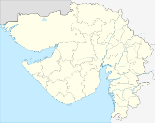 Sachin  Sachin Location in Gujarat, India | |
| Coordinates: 21°05′N 72°53′E / 21.08°N 72.88°ECoordinates: 21°05′N 72°53′E / 21.08°N 72.88°E | |
| Country |
|
| State | Gujarat |
| District | Surat |
| Talukas | Choryasi |
| Government | |
| • Body | Sachin Municipality |
| Area | |
| • Total | 15.12 km2 (5.84 sq mi) |
| Elevation | 13 m (43 ft) |
| Population (2011) | |
| • Total | 32,852 |
| • Density | 16,000/km2 (40,000/sq mi) |
| Languages | |
| • Official | Gujarati, Hindi |
| Time zone | IST (UTC+5:30) |
| PIN | 394230 |
| Telephone code | 0261 |
| Vehicle registration | GJ-5 |
| Sex ratio | 664/1000 males ♂/♀ |
| Civic agency | Sachin Municipality |
| Website |
gujaratindia |
Sachin is City and Municipality in the Surat Metropolitan Region in the Indian state of Gujarat. The town has a large industrial area managed by Gujarat Industrial Development Corporation (GIDC), SurSEZ (Surat Special Economic Zone), Diamond SEZ and many other private SEZs, In Land Container Depot (ICD) Sachin are located in Sachin.
The town is located 9 km from Surat by railway and 13 km from Surat by road and in south of Udhana on Surat-Navsari-Mumbai State Highway which is known as Surat-Navsari Twin City Road. Sachin is also a railway junction on Delhi-Mumbai railway line. Sachin is on junction of NH-6, NH-228, NH-8 and other major State Highways. Sachin is in important area on Surat-Navsari Industrial Area, Delhi Mumbai Industrial Corridor and Dedicated Freight Corridor Corporation of India.
Sachin is under the Surat Urban Development Authority (SUDA). Some area are under governing body Surat Municipal Corporation (SMC), some is in Sachin INA Development Authority and some is in Kanakpur-Kansad Municipality. In 2015, Sachin was upgraded to a municipality status to provide better amenities to residents of the town.
Sachin is the southernmost town of Surat district. The town had good location as a result of which many industries were established by GIDC. The Sachin Industrial Area is Asia's second largest industrial settlement in terms of area.
Geography
The city is located at 21°05′N 72°53′E / 21.08°N 72.88°E.[1] It has an average elevation of 22 metres (66 feet).
Demographics
As of 2008 estimate Sachin had a population of 75000 Males constitute 55% of the population and females 45. Sachin has an average literacy rate of 74%, higher than the national average of 59.5%: male literacy is 81%, and female literacy is 63%. In Sachin, 14% of the population is under 6 years of age.
History
Sachin State was a princely state in India during the British Raj. The African origin Sidi rulers held the title of Nawab, and were Sunni Muslim Sufis. They were granted the right of a 9 gun salute by the British authorities.[2] After the accession to the Indian Union Sachin State was merged in Surat district.
Transport
Sachin is 9 km by road from Udhana and 13 km from Surat. It has a railway station on Vadodara-Surat-Navsari-Mumbai railway line. The nearest airport is Surat which is 15 km from Sachin.
Road
Sachin is located on junction of NH6 (Surat-Kolkata), NH8 (Mumbai-Delhi), NH228 (Sabarmati-Dandi Heritage Highway) and many State Highways. Sachin is well connected on Surat-Navsari Twin City Road, Sachin-Magdalla Road (Sachin to Surat Airport Road), Sachin-Palsana Road (connecting to NH-8).
Railway
Sachin has a railway station under HQ Western Railway Mumbai Division and it is on Mumbai-Surat-Ahmedabad-Delhi main Line. Sachin is also in Dedicated Freight Corridor Corporation of India.
See also
| Wikimedia Commons has media related to Sachin, Gujarat. |