Saint-Genest-Lerpt
| Saint-Genest-Lerpt | ||
|---|---|---|
|
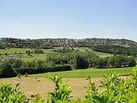
A general view of Saint-Genest-Lerpt | ||
| ||
 Saint-Genest-Lerpt | ||
|
Location within Auvergne-Rhône-Alpes region  Saint-Genest-Lerpt | ||
| Coordinates: 45°26′49″N 4°20′15″E / 45.4469°N 4.3375°ECoordinates: 45°26′49″N 4°20′15″E / 45.4469°N 4.3375°E | ||
| Country | France | |
| Region | Auvergne-Rhône-Alpes | |
| Department | Loire | |
| Arrondissement | Saint-Étienne | |
| Canton | Saint-Étienne-Nord-Ouest-2 | |
| Intercommunality | Saint-Étienne Métropole | |
| Government | ||
| • Mayor (2001–2008) | Christian Julien | |
| Area1 | 12.68 km2 (4.90 sq mi) | |
| Population (1999)2 | 5,672 | |
| • Density | 450/km2 (1,200/sq mi) | |
| Time zone | CET (UTC+1) | |
| • Summer (DST) | CEST (UTC+2) | |
| INSEE/Postal code | 42223 / 42530 | |
| Elevation |
437–698 m (1,434–2,290 ft) (avg. 576 m or 1,890 ft) | |
|
1 French Land Register data, which excludes lakes, ponds, glaciers > 1 km² (0.386 sq mi or 247 acres) and river estuaries. 2 Population without double counting: residents of multiple communes (e.g., students and military personnel) only counted once. | ||

Saint-Genest-Lerpt is a commune in the Loire department in central France.
Twin towns
Saint-Genest-Lerpt is twinned with:
-
 Palau, Sardinia, Italy, since 2005
See also
References
| Wikimedia Commons has media related to Saint-Genest-Lerpt. |
This article is issued from Wikipedia - version of the 10/28/2016. The text is available under the Creative Commons Attribution/Share Alike but additional terms may apply for the media files.