Saint-Julien-d'Arpaon
| Saint-Julien-d'Arpaon | |
|---|---|
|
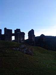
The ruins of the château in Saint-Julien-d'Arpaon | |
 Saint-Julien-d'Arpaon | |
|
Location within Occitanie region  Saint-Julien-d'Arpaon | |
| Coordinates: 44°18′01″N 3°39′59″E / 44.3003°N 3.6664°ECoordinates: 44°18′01″N 3°39′59″E / 44.3003°N 3.6664°E | |
| Country | France |
| Region | Occitanie |
| Department | Lozère |
| Arrondissement | Florac |
| Canton | Le Collet-de-Dèze |
| Intercommunality | Tarnon-Mimente |
| Government | |
| • Mayor (2008–2014) | Henri Couderc |
| Area1 | 20.72 km2 (8.00 sq mi) |
| Population (1999)2 | 134 |
| • Density | 6.5/km2 (17/sq mi) |
| Time zone | CET (UTC+1) |
| • Summer (DST) | CEST (UTC+2) |
| INSEE/Postal code | 48162 / 48400 |
| Elevation |
580–1,421 m (1,903–4,662 ft) (avg. 610 m or 2,000 ft) |
|
1 French Land Register data, which excludes lakes, ponds, glaciers > 1 km² (0.386 sq mi or 247 acres) and river estuaries. 2 Population without double counting: residents of multiple communes (e.g., students and military personnel) only counted once. | |
Saint-Julien-d'Arpaon is a former commune in the Lozère department in southern France. On 1 January 2016, it was merged into the new commune of Cans-et-Cévennes.[1]
See also
References
- ↑ Arrêté préfectoral 2-14 December 2015
| Wikimedia Commons has media related to Saint-Julien-d'Arpaon. |
This article is issued from Wikipedia - version of the 3/3/2016. The text is available under the Creative Commons Attribution/Share Alike but additional terms may apply for the media files.