Saint-Pois
| Saint-Pois | |
|---|---|
|
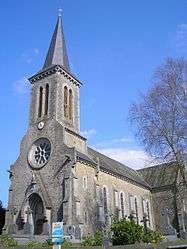
The church | |
 Saint-Pois | |
|
Location within Normandy region  Saint-Pois | |
| Coordinates: 48°45′01″N 1°03′56″W / 48.7503°N 1.0656°WCoordinates: 48°45′01″N 1°03′56″W / 48.7503°N 1.0656°W | |
| Country | France |
| Region | Normandy |
| Department | Manche |
| Arrondissement | Avranches |
| Canton | Saint-Pois |
| Intercommunality | Canton of Saint-Pois |
| Government | |
| • Mayor (2008–2014) | Casimir Lechevalier |
| Area1 | 7.78 km2 (3.00 sq mi) |
| Population (1999)2 | 528 |
| • Density | 68/km2 (180/sq mi) |
| Time zone | CET (UTC+1) |
| • Summer (DST) | CEST (UTC+2) |
| INSEE/Postal code | 50542 / 50670 |
| Elevation |
73–289 m (240–948 ft) (avg. 180 m or 590 ft) |
|
1 French Land Register data, which excludes lakes, ponds, glaciers > 1 km² (0.386 sq mi or 247 acres) and river estuaries. 2 Population without double counting: residents of multiple communes (e.g., students and military personnel) only counted once. | |
Saint-Pois is a commune in the Manche department in Normandy in north-western France. We note civilians from the World War II fighting in Mortain, just to the south seeking refuge in Saint-Pois (August 1944). Mortain was the final battle for Normandy.
See also
References
| Wikimedia Commons has media related to Saint-Pois. |
This article is issued from Wikipedia - version of the 2/25/2015. The text is available under the Creative Commons Attribution/Share Alike but additional terms may apply for the media files.