Sakari Station
Sakari Station 盛駅 | |
|---|---|
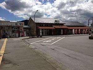 Sakari Station in May 2013 | |
| Location |
16 Ura, HIgashimachi, Sakari-cho, Ōfunato-shi, Iwate-ken 022-0003 Japan |
| Operated by | |
| Line(s) |
|
| Platforms | 1 side + 1 island platform |
| History | |
| Opened | 19 September 1935 |
| Location | |
 Sakari Station Location within Japan | |
Sakari Station (盛駅 Sakari-eki) is a railway station in the city of Ōfunato in Iwate Prefecture, Japan, jointly operated by East Japan Railway Company (JR East), the third-sector operator Sanriku Railway, and the freight operator Iwate Development Railway.
Lines
- Ōfunato Line (JR East)
- Minami-Rias Line (Sanriku Railway)
Sakari Station is the terminal station for the JR East Ōfunato Line and the Sanriku Railway Minami-Rias Line. It is also served by the Iwate Development Railway Company for freight operations.
Station layout
Sakari Station has one side platform and one island platform connected to the station building by a footbridge.
Platforms
| 1 | ■ Ōfunato Line | siding |
| 2 | ■ Ōfunato Line | for Kesennuma |
| 3 | ■ Minami-Rias Line | for Kamaishi |
History
Sakari Station opened on 19 September 1935 as a station on the Ōfunato Line. The Iwate Development Railway Company Hikoroichi Line connected to the station on 21 October 1950 and the Akasaki Line from 21 June 1957. The Minami-Rias Line began operations on 1 March 1970. The Minami-Rias Line was privatized to the Sanriku Railway Company on 1 April 1984, and the Ōfunato Line was privatized on 1 April 1987, becoming part of JR East.
During the 11 March 2011 Tōhoku earthquake and tsunami, the station was flooded and part of the tracks on both the Ōfunato Line and Minami-Rias Line were swept away, thus suspending services. The line resumed operations on the Minami-Rias Line on 3 April 2013 between Sakari and Yoshihama. Services between Yoshihama and Kamaishi resumed on 5 April 2014.
Adjacent stations
| ← | Service | → | ||
|---|---|---|---|---|
| Ōfunato Line | ||||
| Ōfunato | Local | Terminus | ||
| Minami-Rias Line | ||||
| Terminus | Local | Rikuzen-Akasaki | ||
Surrounding area
- Ōfunato City Hall
- Ōfunato Post Office
- National Route 45
- National Route 107
See also
External links
- JR East station information (Japanese)
- Sanriku Railway station information (Japanese)
Coordinates: 39°05′09″N 141°42′39″E / 39.08583°N 141.71083°E