San Augustin Mountains
| San Augustin Mountains | |
|---|---|
|
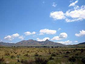
view looking northeast x east, south section of mountains, San Augustin Peak on right | |
| Highest point | |
| Peak | Bear Peak (New Mexico) (San Augustin Mountains) |
| Elevation | 7,087 ft (2,160 m) |
| Coordinates | 32°30′44″N 106°32′19″W / 32.512311°N 106.538608°W |
| Dimensions | |
| Length | 8 mi (13 km) SW-NE |
| Width | 6 mi (9.7 km) |
| Geography | |
 San Augustin Mountains-(San Augustin Peak) in New Mexico | |
| Country | United States |
| State | New Mexico |
| Region | (northwest)-Chihuahuan Desert |
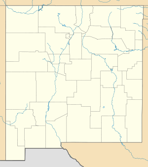
| District | Doña Ana County, NM |
| Settlement | Organ, NM–White Sands, NM |
| Range coordinates | 32°26′N 106°34′W / 32.44°N 106.56°WCoordinates: 32°26′N 106°34′W / 32.44°N 106.56°W |
| Borders on |
San Andres Mountains-N San Augustin Pass-S Organ Mountains-S Organ, NM & Las Cruces, NM-W White Sands-NE, E & SE |
| Wikimedia Commons has media related to San Augustin Mountains. |
The San Augustin Mountains are a small mountain subrange at the southern terminus of the San Andres Mountains east of Las Cruces, New Mexico. Organ lies at the southwest foothills; the townsite, White Sands, NM lies to the southeast at the southwest of the Tularosa Valley.
Description
The San Augustin Mountains are only about an 8 mi (13 km) long range, trending slightly northeast. The southern border is San Augustin Pass, where U.S. Route 70 goes from Las Cruces and Organ and turns northeast through White Sands to meet Alamogordo.
The north of the range is delimited by Bear Canyon, an east-west canyon with its outlet to the northeast. Also north is the San Andres National Wildlife Refuge which takes up about a 30 mi stretch of the San Andres Mountains ridgeline.
The high Black Mountain section is on the southeast of Bear Canyon, and is separated northeast from the ridgeline of the San Augustins.
Peaks
The ridgeline of the San Augustin Mountains has the range's highpoint, Bear Peak, 7,087 feet (2,160 m)[1] at the north, and the south is terminated by San Augustin Peak, at 7,030 feet (2,143 m). Black Mountain at 7,008 feet (2,136 m), is in the northeast, and an outlier peak at the northwest is Quartzite Mountain, at 6,763 feet (2,061 m). Another outlier mountain is on the southeast, Mineral Hill at 6,154 feet (1,876 m). The highpoint, Bear Peak is located at 32°30′44″N 106°32′19″W / 32.512311°N 106.538608°W.[2]
See also
References
- ↑ DeLorme New Mexico Atlas & Gazetteer, p. 46-47.
- ↑ Bear Mountain, mountainzone
External links
Peaks
San Augustin Mountains