Sandy Ground, Saint Martin
| Sandy Ground Sableuse du Sol | |
|---|---|
 Sandy Ground | |
| Coordinates: 18°03′32″N 63°05′49″W / 18.05889°N 63.09694°WCoordinates: 18°03′32″N 63°05′49″W / 18.05889°N 63.09694°W | |
| Country | France |
| Overseas collectivity | Saint Martin |
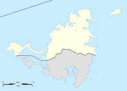
Sandy Ground (French: Sableuse du Sol) is a coastal community on the French side of the island of Saint Martin in the Caribbean. It lies on the west coast of the island, on the road towards the Lowlands and the Princess Juliana International Airport.
Originally, wild designs (squats) this blank space located in zone because of the fifty geometric therefore not allowed without subdivisions. At the time, the "squatters" are mostly Guadeloupean workers wishing to settle in St. Martin, could not find where to stay. Were soon added the first Haitian migrant workers. Since then, several actions regularization (building permits, title, connection to the power grid, etc. ...) have occurred or have been proposed.
Following the tax exemption in 1985, to the bleak Nettle Lowlands, many buildings of hotels on both sides of both sides of the road. But tourists who have not followed, about half were ceased their hotel business and have been sold to the studios cutting, T1 or T2. The fact that the terraces of the hotel rooms have been from the beginning landscaped kitchenettes (something exceptional) raises the issue of speculation (and diversion of the waiver of the 50 geometrical Act).