Sass Rigais
| Sass Rigais | |
|---|---|
 Sass Rigais | |
| Highest point | |
| Elevation | 3,025 m (9,925 ft) |
| Listing | Alpine mountains above 3000 m |
| Coordinates | 46°36′31.93″N 11°46′1.28″E / 46.6088694°N 11.7670222°ECoordinates: 46°36′31.93″N 11°46′1.28″E / 46.6088694°N 11.7670222°E |
| Geography | |
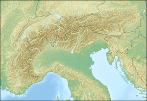 Sass Rigais Location in the Alps | |
| Location | South Tyrol, Italy |
| Parent range | Dolomites |
| Climbing | |
| Easiest route | Hike |
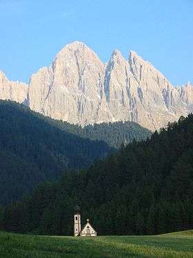
Sass Rigais (3,025 m) is a mountain of the northwestern Dolomites in South Tyrol, northern Italy. Along with the nearby Furchetta, which is exactly the same height and only 600m away, it is the highest peak of the Geisler group. Sass Rigais offers hikers one of few Dolomites' three-thousanders the entire crossing from one side of the mountain to the other. The Via ferrata Villnössersteig is categorized between a B and C difficulty and the trail Sass Rigais steig is rated C. A crucifix is located at the summit.

The Sass Rigais and Furchetta from the south
External links
This article is issued from Wikipedia - version of the 7/12/2016. The text is available under the Creative Commons Attribution/Share Alike but additional terms may apply for the media files.