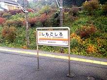
Shimo-Goshiro Station
Shimo-goshiro Station 下小代駅 | |
|---|---|
|
Shimo-goshiro Station entrance in May 2011 | |
| Location |
329 Goshiro, Nikkō, Tochigi (栃木県日光市小代329) Japan |
| Operated by |
|
| Line(s) |
|
| Platforms | 1 island platform |
| Other information | |
| Station code | TN-21 |
| History | |
| Opened | 1929 |
| Traffic | |
| Passengers (FY2014) | 215 daily |

Shimo-goshiro Station (下小代駅 Shimo-goshiro-eki) is a railway station on the Tobu Nikko Line in Nikkō, Tochigi, Japan, operated by the private railway operator Tobu Railway. The station is numbered "TN-21".
Lines
Shimo-goshiro Station is served by the Tobu Nikko Line, and is 78.5 km from the starting point of the line at Tōbu-Dōbutsu-Kōen.[1]
Station layout
The station is unmanned with a single island platform connected to the station entrance by a footbridge.
Platforms
| 1 | ■ Tobu Nikko Line | for Tōbu-Nikkō |
| 2 | ■ Tobu Nikko Line | for Shin-Tochigi and Tōbu-Dōbutsu-Kōen |
Adjacent stations
| « | Service | » | ||
|---|---|---|---|---|
| Tobu Nikko Line | ||||
| Itaga | Local | Myōjin | ||
History
Shimo-goshiro Station opened on 7 July 1929.[1] It became unstaffed from 1 September 1973.[1] A new station building was completed in 2007.
From 17 March 2012, station numbering was introduced on all Tobu lines, with Shimo-goshiro Station becoming "TN-21".[2]
Passenger statistics
In fiscal 2014, the station was used by an average of 215 passengers daily.[3] >
Surrounding area
- Goshiro Middle School
See also
References
- 1 2 3 Terada, Hirokazu (19 January 2013). データブック日本の私鉄 [Databook: Japan's Private Railways]. Japan: Neko Publishing. p. 223. ISBN 978-4-7770-1336-4.
- ↑ 「東武スカイツリーライン」誕生! あわせて駅ナンバリングを導入し、よりわかりやすくご案内します [Tobu Sky Tree Line created! Station numbering to be introduced at same time] (pdf). Tobu News (in Japanese). Tobu Railway. 9 February 2012. Retrieved 11 November 2013.
- ↑ 駅情報(乗降人員) [Station information: Passenger figures] (in Japanese). Japan: Tobu Railway. 2015. Retrieved 19 February 2016.
External links
| Wikimedia Commons has media related to Shimo-Goshiro Station. |
- Shimo-goshiro Station information (Japanese)
Coordinates: 36°39′06″N 139°42′50″E / 36.6516°N 139.7139°E