Sihanoukville Province
| Sihanoukville Province ខេត្តព្រះសីហនុ Khaet Preah Sihanouk Preah Sihanouk Province | |
|---|---|
| Province | |
|
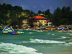
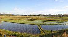
Ochheuteal Beach | |
|
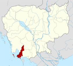
highlighting Sihanoukville Province | |
| Coordinates: 10°37′24″N 103°31′30″E / 10.62333°N 103.52500°ECoordinates: 10°37′24″N 103°31′30″E / 10.62333°N 103.52500°E | |
| Country |
|
| Provincial status | 2008 |
| Named for | Norodom Sihanouk |
| Capital | Sihanoukville |
| Government | |
| • Governor | Yun Min (CPP) |
| Area | |
| • Total | 2,536.68 km2 (979.42 sq mi) |
| Area rank | Ranked 22nd |
| Elevation | 316 m (1,037 ft) |
| Population (2008)[1] | |
| • Total | 199,902 |
| • Rank | Ranked 17th |
| • Density | 79/km2 (200/sq mi) |
| Human Development Index | |
| • HDI |
|
| Time zone | UTC+07 |
| Postcode | 18000 |
| Dialing code | 034 |
| ISO 3166 code | KH-18 |
| Districts | 4 |
| Communes | 26 |
| Villages | 108[2] |
Preah Sihanouk Province (Khmer: ខេត្តព្រះសីហនុ, Khaet Preah Sihanouk), commonly referred to as Sihanoukville Province, is a province (ខេត្ត, khaet) in the south-west of Cambodia at the Gulf of Thailand. The provincial capital, also called Sihanoukville, is a deep-water port city and a steadily growing and diversifying urban center located on an elevated peninsula.[3]
The province is named in honor of former king Norodom Sihanouk, who personally orchestrated the establishment of Sihanoukville city and the Sihanoukville municipality as this took place alongside the construction of the Sihanoukville Port, which commenced in June 1955. The only deep water port of Cambodia includes a mineral Oil terminal and a transport logistics facility.[4][5]
Sihanoukville Province is divided into four districts, each with a distinct economic character, defined largely by location and access to resources.[6] In addition to the port and the growing tourism industry, the activities of countless NGO's and international investment have contributed to an unprecedented economic growth of the province over the course of the last decade.[7] Economic sectors that deserve mentioning are the transport & logistics industry, process manufacturing, agriculture & fishery, textile industry and the real estate market.
The islands and beaches of Sihanoukville province are an international tourist destination as visitor numbers have risen steadily since the late 20th century.[8][9]
The initial Sihanoukville municipality was elevated to a regular province on 22 December 2008 after King Norodom Sihamoni signed a Royal Decree converting the municipalities of Kep, Pailin and Sihanoukville into provinces, as well as incorporating Kompong Seila district.[10][11] As one of Cambodia's agriculturally and industrially most diverse province its economic future has a solid basis, although the essential sectors agriculture and tourism require a strict and permanent administrative protection of the local natural resources.[12][13][14]
Etymology
The official name in Khmer is: Khaet (province) Preah (holy) Sihanouk (name of the former king), which adds up to: "Province of the holy Sihanouk" or "Honorable Sihanouk Province". It honors the former king Norodom Sihanouk (reigned 1941–1955 and 1993–2004) who was and still is revered as the Father of the modern Nation,.[15] Sihanouk himself suggested the official Western variant Sihanoukville. The name "Sihanouk" is derived from Sanskrit through two Pali words: Siha (lion), and Hanu (jaws).
The former name, Kompong Saom (also romanized as Kompong Som and Kampong Som), (Khmer: កំពង់សោម) means "Port of the Moon" or "Shiva's Port".[16] Saom is derived from the Sanskrit word "saumya", the original (Rig Vedic) meaning of which was "Soma, the juice or sacrifice of the moon-god", but evolved into Pali "moon", "moonlike" "name of Shiva".[17] The word Kampong or Kompong is of Malayan origin[18] and means village or hamlet. Its meaning underwent extension towards pier or river landing bridge.[19]
History
Classical Period (before 1700)
Prior to the ports' and city's foundation works of 1955, no recorded settlement on the peninsula existed that was larger than a traditional trade and/or - fishing community. During the many centuries of pre-Angkorian and Angkorian history – from Funan to Chenla and during the Khmer Empire, regional trade was centered at O Keo (Vietnamese: Óc Eo) in the Mekong Delta, now the province of Rạch Giá in Vietnam. The township of Prei Nokor (Saigon) was a commercial center of the Khmer Empire.[20][21] The Chronicle of Samtec Cauva Vamn Juon – one of the 18th- and 19th-century Cambodian Royal Chronicles – briefly mentions the region as the country was split into 3 parts during a 9-year civil war from 1476 to 1485: "In 1479, Dhammaraja took on the throne at Catumukh (Phnom Penh) and controlled the provinces of Samrong Tong, Thpong, Kompong Saom, Kampot up to the Bassak, Preah Trapeang, Kramuon Sar, Koh Slaket and Peam".[22]
Early Modern Period (around 1700 – 1863)
From the end of the seventeenth century, Cambodia lost control of the Mekong River route as Vietnamese power expanded into the lower Mekong. During the Nguyen-Siamese War (1717–18) a Siamese fleet burned the port of Kompong Som in 1717 but was defeated by the Vietnamese at Banteay Meas/Ha Tien.[23] A Cambodian king of the late eighteenth century, Outey-Reachea III allied with a Chinese pirate,[24] Mac-Thien-Tu, who had established an autonomous polity based in Ha Tien and controlled the maritime network on the eastern part of the Gulf of Thailand.[25] Ha Tien was located at a point where a river linking to the Bassac River flows into the Gulf of Thailand. Landlocked Cambodia tried to keep its access to maritime trade through Ha Tien. In 1757 Ha Tien acquired the ports of Kampot and Kompong Som as a reward for Mac's military support to the King of Cambodia. Until its destruction in 1771 the port developed into an independent duty-free entrepot - linked with several Chinese trading networks.[26]
Alexander Hamilton, who traveled on the Gulf of Thailand in 1720, wrote that "Kompong Som and Banteay Meas (later Ha Tien) belonged to Cambodia, as Cochin-China was divided from Cambodia by a river (Bassac river) of three leagues broad." and "King Ang Duong constructed a road from his capital of Oudong to Kampot". Kampot remained the only international seaport of Cambodia. "The traveling time between Udong and Kampot was eight days by oxcart and four days by elephants." French Résident Adhemard Leclère wrote: "...Until 1840s, the Vietnamese governed Kampot and Péam [Mekong Delta], but Kompong Som belonged to Cambodia. The Vietnamese constructed a road from Ha Tien to Svai village - on the border with Kompong-Som - via Kampot."[27]
The British Empire followed a distinct policy by the 1850s, seeking to consolidate its influence. Eye witness reports give rare insights, as Foreign Secretary Lord Palmerston's agent John Crawfurd reports: "Cambodia was...the Keystone of our policy in these countries, - the King of that ancient Kingdom is ready to throw himself under the protection of any European nation...The Vietnamese were interfering with the trade at Kampot, and this would be the basis of an approach..." Palmerston concluded: "The trade at Kampot - one of the few remaining ports, could never be considerable, in consequence of the main entrance to the country, the Mekong, with all its feeders flowing into the Sea through the territory of Cochin China The country, too, had been devastated by recent Siam - Vietnam wars. Thus, without the aid of Great Britain, Kampot or any other port in Cambodia, can never become a commercial Emporium." Crawfurd later wrote: "The Cambodians... sought to use intervals of peace in the Siam - Vietnam wars to develop intercourse with outside nations. The trade at Kampot which they sought to foster was imperiled by pirates. Here is a point where the wedge might be inserted, that would open the interior of the Indo-Chinese Peninsula to British Commerce, as the great River of the Cambodians traverses its entire length and even affords communication into the heart of Siam".[28]
French Rule (1863 - 1954)
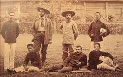
and Pierre Lefèvre-Pontalis in 1893
with Cambodian interpreters
Under French rule Vietnam, Laos and Cambodia became a single administrative and economic unit. The coastal region Circonscription Résidentielle with Kampot as its capital contained the Arrondissements of Kampot, Kompong Som, Trang and Kong-Pisey. The establishment of another international trading center near the existing city of Saigon was not considered necessary. Focus remained the Mekong, and the idea to establish an alternative route to Chinese and Thai internal markets along an uninterrupted navigable waterway from the Red River to the Mekong Delta.
Insurrection
An insurrection that took place from 1885 to 1887 further discouraged French ambition. It started in Kampot and quickly spread to Veal Rinh, Kampong Seila, and Kompong Som, where the insurgents were led by a Chinese pirate named Quan-Khiem. He managed to control the northern part of Preah Sihanouk for some time until he - an old man - was arrested by Preah Sihanouk's governor.[29]
The most notable infrastructural improvements of this period were the construction of Route Coloniale No.17, later renamed National Road No.3 and the national railway system, although work on the "Southern Line" - from Phnom Penh to Sihanoukville - only began in 1960.
After Independence (since 1954)
The city's and province's alternative name Kompong Saom (Kampong Som) was adopted from the local indigenous community. After the dissolution of French Indochina in 1954, it became apparent that the steadily tightening control of the Mekong Delta by Vietnam required a solution to gain unrestricted access to the seas. Plans were made to construct an entirely new deep-water port. Kompong Saom (Kampong Som) was selected for water depth and ease of access. In August 1955, a French/Cambodian construction team cut a base camp into the unoccupied jungle in the area that is now known as Hawaii Beach. Funds for construction of the port came from France and the road was financed by the United States.[30]
During the Vietnam War the port became an intensive military facility on both sides, in the service of National Front for the Liberation of South Vietnam and after 1970, under the government of Lon Nol, in the service of the United States.[31]
The port was the last place to be evacuated by the US Army, only days before Khmer Rouge guerrillas took control of the government in April 1975. The events surrounding the taking of the US container ship SS Mayaguez and its crew on 12 May by the Khmer Rouge and the subsequent rescue operation by US Marines played out on the waters of Koh Tang off the coast of Sihanoukville. During the two days of action, the US commenced air strikes on targets on the mainland of Sihanoukville including the port, the Ream Naval Base, an airfield, the railroad yard and the petroleum refinery in addition to strikes and naval gun fire on several islands.[32]
After the fall of the Khmer Rouge regime in 1979 and the subsequent opening of the economy, the port of Sihanoukville resumed its importance in the development and recovery of the country. With the further opening of new markets in 1999, the city regained its role in the economic growth of Cambodia.
In 1993, the Ream National Park was established per royal decree of former King Sihanouk.[33]
The Sihanoukville Municipality was elevated to a regular province on 22 December 2008 after King Norodom Sihamoni signed a Royal Decree converting the municipalities of Kep, Pailin and Sihanoukville into provinces.[34]
In 2006 the Koh Puos (Cambodia) Investment Group submitted an application, planning to invest $276 million in converting the 116-hectare Koh Puos - Snake island into a luxury residential - and resort complex. After the completion of certain elements of the infrastructure, the investor announced alterations of the original blueprints, as "Reapplying for permission will happen in 2014..." according to the Council of the Development of Cambodia.[35][36]
On 26 May 2011 Preah Sihanouk area joined the Paris-based club Les Plus Belles Baies Du Monde (The most Beautiful Bays in the World). The organisation officially accepts the Bay of Cambodia as one of its members at the 7th General Assembly.[37]
Geography
Sihanoukville province is located at the coast of the Gulf of Thailand in southern Cambodia, occupying an area of 2536 km2 that includes the foothills of the Elephant Mountains and a sizable peninsula. Moderately developed beaches, a National Park and a number of pristine islands in proximity are natural assets that attract national and foreign visitors. A small group of islands dot the near coast due south and west. Sihanoukville province borders Koh Kong and Kampong Speu province to the North and West, Kampot province to the East and the Gulf of Thailand to the South.
The peninsula is separated from the central plains of Cambodia by the Elephant Mountains. The province incorporates the Ream National Park with a size of 210 km2 that includes the islands of Koh Thmei and Koh Seh.[38]
Being a comparatively small province, Sihanoukville province has only two urban centers: the Sihanoukville city itself and Veal Rinh in the Prey Nob District, 46 kilometers north of Sihanoukville town. Prey Nob district in the East is predominantly rural and agricultural. Stung Hauv district in the north-west, only half the size of Prey Nob has the largest fishery sector of the province. Kampong Seila district in the North is still in the process of incorporation. Mittakpheap district in the south about the size of Stung Hauv, including the islands of Sangkat Koh Rong is one of the most advanced settlement centers of Cambodia with a developed and versatile industry, a large pool of skilled work force and a high HDI.
The province is connected to Phnom Penh by National Highway No 4; to Kampot Province by National Highway No 3 and to Koh Kong Province by National Highway No 48. National Highway No 4 represents the southern end of Asian Highway 11, which in turn is a section of the Asian Highway Network.
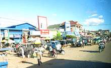
Sihanoukville town: The town’s layout reflects little structural planning. Neighborhoods accumulate around the major road "Ekreach(Engl.=independence)". It winds along the headland's rolling hills and halfway between Victory Hill in the north - and Ochheuteal quarter in the south are banks, shops, the local markets, hotels, administrative facilities and most corporate businesses. The post office and the inter-provincial bus station are located towards the north between Victory Hill and the port.
Beaches
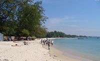
Sihanoukville's beaches are one of the province's most valuable economic resource with varying degrees of commercial exploitation. The beaches listed below do not include any of the island's beaches.
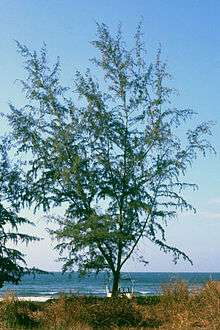
- Ochheuteal Beach : Ochheuteal Beach is a 3.3 km long strip of white sand beach lined with Casuarina and Tamarisk trees, grass umbrellas, rental chairs and around 30 standardized beach huts which serve meals and drinks, some serve also as night-time party spot. Well established middle class hotels and high-profile residences flank the beach along its Northern part. The sustainability of Ochheuteal beach was a primary consideration of various stakeholders, which brought about the development of a tourism development and management plan in 2005. The Southern half remains - apart from some hotels at its far end - essentially undeveloped.
- Serendipity Beach: Technically the western end (roughly one fifth or 600 m) of Ochheuteal beach, is very popular with Western tourists and has a few small guesthouses right on the beach. It has been named by an American fellow, who came here in the Nineties. Struck by its (then) unspoiled beauty and pristine condition, he came up with the term, which quickly entered common vocabulary.[39][40]
- Otres Beach: is around 4.6 km long and beyond the small "Queen hill" headland at the southern end of Ochheuteal Beach. Its long white sand strip, also completely lined with Casuarina and Tamarisk trees, is far less developed and commercialized than Ochheuteal Beach and has developed into a preferred lodging place for Western visitors. From 2004 to 2011 this beach was occupied by numerous bungalows and dormitories, run by Western people. Due to the element of illegality of on-beach accommodation, among other reasons, police cleaned up the area in May 2011, removing the greater part of the beach-side bungalows. Permanent structures beyond the beach road supplement the remaining places since 2012. It is a very popular, well established holiday retreat – where prices have risen considerably over the course of the last years.[39]
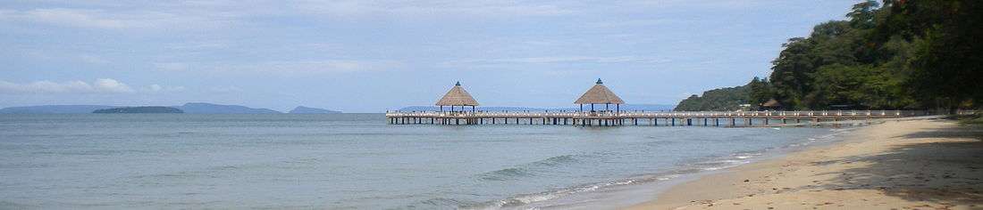
- Sokha Beach: Sokha Beach is around 1.2 km long and located west of Serendipity Beach. The beach is privately owned by - and its southern half occupied by the Sokha Beach Hotel,[41] the first five-star luxury beach hotel in Cambodia. While the beach is well kept and many facilities are provided, visitors have to pay for their use and beach vendors are not allowed.
- Independence Beach: Independence Beach is around 1.3 km long and located north-west of Sokha Beach. The beach is named after the Independence Hotel, towering on top of a rock at its northern end.
- Victory Beach: Victory beach is around 300 m long and situated at the furthest north of the peninsula of Sihanoukville. It was heavily used by backpackers and is still popular with budget travelers. The deep water port is located at the northern end of the beach. A consortium of Russian business people undertook large scale development here. The beach is regularly maintained.
- Lamherkay/Hawaii Beach: is the southern succession of Victory Beach, situated north of Independence Beach. It is a strip of similar length as Victory Beach - around 300 m. Here is the very place where the French/Cambodian construction team's groundwork began for the construction of the Sihanoukville Autonomous Port in 1955.
- Treasure Island Beach south of Lamherkay/Hawaii Beach is less than 50 m long and its entire length is fringed with concrete steps and wooden pavilions of a big Cambodian seafood restaurant.
- Hun Sen (Prek Treng) Beach: is the northernmost beach of the city with a length of around 1.5 km, situated behind the local port and essentially empty without beach huts and bars, it sees only weekend - and holiday visitors. The water is very shallow, but the area is lacking favorable infrastructure and is not regularly cleaned.
- Ream Beach: is situated south of Otres beach and with an overall length of around 7.7 km it consists of several sections with occasional stretches of rocks and vegetation. Koh Ta Kiev island lies just 800 m off its southern end.
- Beaches inside the National park : At Ream National Park's southern coast exist several unnamed beaches with an approximate length of 10 km.
- Beaches of Steung Hav district : Beyond Sihanoukville's oil port lie two sizable beaches inside the Komong Saom bay, belonging to Prey Nob district.
Islands
There are 22 islands administered by Sihanoukville province. An increasing number are either in the process of or have been assigned for extensive touristic development. Koh Rong and Koh Rong Sanloem in particular have so far undergone years of unplanned development with plenty of guesthouses and bungalow resorts that offer accommodation.
- Koh Russei, កោះបស្សី: Also known as Bamboo Island. This medium-sized island is located a few kilometers out from Otres Beach or Ream. There is a small navy base and is currently under large scale development.
- Koh Rong, កោះរ៉ុង: Situated 26 km west of the Sihanoukville coast. Koh Rong is the biggest of the islands here. It encompasses an area of 78 km2. The terrain is predominantly hilly with a sizable mountain at the island’s south west. The hills provide water for creeks, lagoons and estuaries. The island’s interior is almost completely forested. Although there are already lots of guest houses and pubs in and around Koh Tuich village, the island remains virtually deserted – its sheer size dwarfs all settlement centers. As of 2016, there is a well-functioning ferry network between Sihanoukville and Koh Rong.[42] There are now many different types of accommodation on the island, including guest houses, bungalows, luxury resorts, and one international 5-star resort.[43]
- Koh Rong Sanloem, កោះរុងសន្លឹម: South of Koh Rong and smaller, beautiful beaches are on the west and east coast. South of Koh Rong, it resembles its bigger sister in shape and geography – although a bit thinner, it is covered in dense forest, generally more flat (still, though there are lovely hills ) and it has noticeably less landmass in relation to its coastline. The marine life around Koh Rong Sanloem is very diverse and offers many diving spots. As of 2016, there is a well-functioning ferry network between Sihanoukville and Koh Rong Sanloem.[44] Accommodation and prices range from cheap dorm beds to modern villas.[45]
- Koh Kaong Kang/Thass, កោះកោងកាង/ថាស: Mangrove Island, Ile des Paletuviers (old French name), Koh Kaong Kang/Thass – one of the inner islands – it is a popular place for snorkelers. Koh Kaong Kang/Thass is very flat, hence freshwater is scarce - one of the reasons why nobody lives there permanently.
- Koh Koun, កោះកូន: Child Island, Ile de Cone (old French name), a small island between Koh Rong and Koh Rong Sanloem, has no beach, is uninhabited, but a popular dive - and snorkel spot.
- Koh Tuich, កោះតូច: Small island, a tiny and beautiful island off Koh Rong’s Koh Tuich village. There is a little pagoda on it in service since around 2010. Shallow waters provide good snorkeling spots around the whole island.
- Koh Pos, កោះពស់: also known as Morokot Island or Snake Island. This island lies 800 metres (2,625 ft) off Victory Beach. It is under development by Russian investors and being converted into a luxury holiday destination and high standard residential area.[46] Snake Island was linked to the mainland with a regular road traffic bridge since around July 2011. The bridge is not currently open for public traffic.
- Koh Dek Koul, កោះដេកកោល: This small island lies 7 kilometres (4 mi) off Victory Beach and only a further few hundred meters off Snake Island. The Russian Mirax Luxury Resort corporation operates a hotel business on this predominantly rocky island.
- Koh Bong Po-oun/Song Saa, កោះបងកោះប្អូន: – Siblings/Lovers Islands – Les Frères (old French name), renamed to Koh Song Saa – Lovers islands – two tiny islets off Koh Rong’s north-east, it is home of the exclusive Song Saa Resort.
- Koh Tres/Kteah, កោះខ្ទះ: Pan Island, Ile Ronde (old French name), off Otres beach and easy to reach (15 min by Kayak) and has got a “beach” of around 10 m2 in size, which is submerged during high tide. Only one Cambodian family (officials) lives there.
- Koh Preus,កោះប្រឺស, Deer Island – Ile Nord-Ouest (old French name)
- Koh Thmei,កោះថ្មី, New Island – Ile du Milieu (old French name), immediately south-east of the Sihanoukville headland inside Ream National Park
- Koh Seh,កោះសេះ, Horse Island – Ile a L’eau (old French name), 1.5 km (1 mi) south of Koh Thmei and around 9 km (6 mi) south of the main-land of Sihanoukville's Ream commune. Less than 400 meters south-west of Koh Seh lies the tiny islet of Koh Ky.

Climate
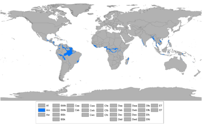
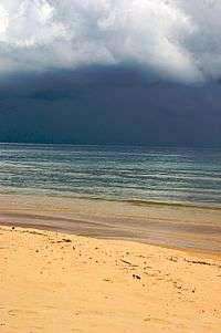
Sihanoukville lies in the Tropical monsoon (Am) climate zone. The city has two seasons: a wet season and a dry season. Monthly averages range from 14 °C (57.2 °F) in January to 36.0 °C (96.8 °F) in July.
The maximum mean is about 30 °C ; the minimum mean, about 24 °C. Maximum temperatures of higher than 32 °C (89.6 °F), however, are common and, just before the start of the rainy season, they may rise to more than 38 °C (100.4 °F). Minimum temperatures rarely fall below 20 °C (50 °F). January is the coolest month, and April is the warmest. Tropical cyclones cause much less damage in Cambodia than they do in Vietnam.[47]
The total annual rainfall average is between 1,000 and 1,500 millimeters (39.4 and 59.1 in). The heaviest amounts fall in August and September. The relative humidity is high at night throughout the year; usually it exceeds 90 percent. During the daytime in the dry season, humidity averages about 50 percent or slightly lower, but it may remain about 60 percent in the rainy period.
| Climate data for Sihanoukville, Cambodia | |||||||||||||
|---|---|---|---|---|---|---|---|---|---|---|---|---|---|
| Month | Jan | Feb | Mar | Apr | May | Jun | Jul | Aug | Sep | Oct | Nov | Dec | Year |
| Average high °C (°F) | 31.3 (88.3) |
31.2 (88.2) |
32.1 (89.8) |
33.7 (92.7) |
32.3 (90.1) |
31.2 (88.2) |
30.0 (86) |
30.8 (87.4) |
30.8 (87.4) |
30.8 (87.4) |
31.2 (88.2) |
31.7 (89.1) |
31.43 (88.57) |
| Average low °C (°F) | 23.9 (75) |
24.6 (76.3) |
25.4 (77.7) |
25.0 (77) |
26.8 (80.2) |
26.3 (79.3) |
25.9 (78.6) |
25.1 (77.2) |
25.2 (77.4) |
24.7 (76.5) |
24.4 (75.9) |
23.5 (74.3) |
25.07 (77.12) |
| Average precipitation mm (inches) | 28.3 (1.114) |
25.2 (0.992) |
50.3 (1.98) |
124.8 (4.913) |
207.3 (8.161) |
252.7 (9.949) |
341.4 (13.441) |
377.2 (14.85) |
320.6 (12.622) |
290.4 (11.433) |
138.2 (5.441) |
54.4 (2.142) |
2,210.8 (87.038) |
| Source: world weather online[48] | |||||||||||||
Economy
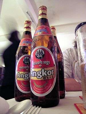
The economy of Sihanoukville province is very varied but to a great part defined by its international port and the nearby oil port with numerous import - and export companies settled in the area and the attached freight-transport sector with the local cargo storage facilities. Other sizable economic sectors of the province are fishery, aquaculture, agriculture, mining, frozen shrimp processing, the garment industry, the real estate market and the vast tourism industry.[49] Sihanoukville is the home of Angkor Beer, one of Cambodia's major breweries.
| businesses according to people employed (whole province) | |||||||||||||||||||||
| Size of Establishment | Number of Establishments | ||||||||||||||||||||
|---|---|---|---|---|---|---|---|---|---|---|---|---|---|---|---|---|---|---|---|---|---|
| 1-10 persons | 10,424 | ||||||||||||||||||||
| 11-50 persons | 177 | ||||||||||||||||||||
| 51-100 persons | 19 | ||||||||||||||||||||
| 101 or more | 29 | ||||||||||||||||||||
| Total | 10.649 | ||||||||||||||||||||
| Source: Cambodiainvestment - Preah-Sihanouk-Province[50] | |||||||||||||||||||||
Sihanoukville Special Economic Zone
The Sihanoukville Special Economic Zone (SSEZ) is an overseas economic and trade cooperation zone which was designed to promote favorable market conditions[51] such as: policy advantages, a safe political environment, favorable trade status, completed infrastructure supporting, low labor cost and excellent services, among others. In addition to its areas around the port, a sizable industrial center, exclusively composed of Chinese companies has been developed since around 2010.[52]
Sihanoukville Autonomous Port
The Sihanoukville Autonomous Port has an independent administration. In combination with the related logistics - and transport sector it is the city's economic backbone.
At present, the total operational land area of the Sihanoukville Autonomous Port is around 124.76 ha. The Old Jetty was constructed in 1956 and became operational in 1960. The jetty is 290m long by 28m wide and can accommodate 4 vessels with medium GRT at both sides. The exterior berth is -8.50m-13m depth, while the interior berth is -7.50m -8.50m depth.
In order to cope with the increasing rates of cargo throughput, the Royal Government of Cambodia had constructed another 350 m (1,148 ft) long new quay with −10.5 m (−34 ft) maximum draft in 1966. At present, this new quay can accommodate 3 vessels with −7 m (−23 ft) draft medium GRT.[53] The construction of the Container Terminal, 400 m (1,312 ft) long by −10.5 m (−34 ft) depth and a 6.5 ha (16 acres) container yard was completed in March 2007.[54]
| Sihanoukville Autonomous Port Traffic Rates[55] | ||||||||||||||
| Item | 2003 | 2004 | 2005 | 2006 | 2007 | 2008 | 9M2009 | |||||||
|---|---|---|---|---|---|---|---|---|---|---|---|---|---|---|
| Gross Throughput (Tons) | 1,772,361 | 1,503,050 | 1,380,847 | 1,586,791 | 1,818,877 | 2,057,967 | 1,405,338 | |||||||
| Not Included Fuel | 1,454,856 | 1,242,011 | 1,131,699 | 1,320,102 | 1,428,992 | 1,605,672 | 958,279 | |||||||
| Not Include Fuel &Cont. | 650,329 | 308,153 | 107,929 | 197,573 | 193,573 | 291,114 | 162,520 | |||||||
| Cargo Containerized | 804,527 | 933,858 | 1,023,770 | 1,122,529 | 1,235,419 | 1,314,559 | 795,759 | |||||||
| Container Throughput (TEUs) | 181,286 | 213,916 | 211,141 | 231,036 | 253,271 | 258,775 | 157,639 | |||||||
| Vessel Calling (Units) | 878 | 730 | 686 | 912 | 876 | 954 | 642 | |||||||
Primary Destinations: Singapore, Hong Kong,  Bangkok, Ho Chi Minh City, Shanghai, Laem Chabang, Yantian, Kaohsiung
Frequency of scheduled services: 38/week[56]
Agriculture
As one of Cambodia's smallest provinces numbers of rice tonnage (37,211) are of little relevance for the annual statistics. Still Preah Sihanouk province has been able to diversify in subsidiary and industrial crops, fruits and permanent crops and incorporates fishery (40,100 tons) into the sector.[56]
- Agricultural Land: 106,163.746ha included 15,000 of rice field
- Irrigation drainage: Total length: 132 km, Dam/dike: Total length: 90 km
Fishery
Although the province is endowed with relatively abundant natural resources, protection thereof is of greatest significance. Pollution remains a concern particularly from trade vessels, domestic waste, and local industry. Resources are being indiscriminately diminished by illegal fishing via the neighboring countries. Seagrass beds and coral reefs are also under continued stress from over-exploitation and destructive activities.[57]
The catching and processing of marine fishery products is undertaken by both small-scale family style operations as well as on a large commercial level. Most coastal fishers lack the resources to procure suitable fishing equipment for coastal fishing. They, thus, tend to use small-scale fishing gear appropriate for insland use. The offshore net catch capacity of Cambodian fishers is relatively small compared to the available exploitation potential. The marine component of the fisheries sector in Cambodia is not nearly as important as that of the inland areas because of consumer's preference for inland fish species.[58]
Transport
Roads and streets
- National Highway 4: Phnom Penh and Sihanoukville are connected by the National Road 4. The road was built and financed by the United States to accommodate heavy freight containers and gasoline tank trucks connecting the port with Phnom Penh. There are three toll stations along its entire distance of around 250 km. However, it is considered the most dangerous road of Cambodia due to dense traffic, regular traffic accidents and lack of regulation by authorities.[59]
- National Highway 3: Connects Sihanoukville with Kampot province. The road joins the NR4 at Prey Nob district. It is paved and but largely lacks traffic signs. Free roaming cattle and other livestock regularly block road traffic. The road underwent significant refurbishment in 2008 and forms part of an international "North-South economic corridor" from Kunming in China to Bangkok in Thailand.[60]
- National Highway 48: Connects Sihanoukville and Phnom Penh with Koh Kong Province, to the southwest of Cambodia. The road ends at the Thai-Cambodian border. The old 4 ferry crossing points over the esturaries along the route were replaced by solid bridges. This road has very little traffic.
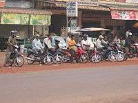
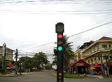
Streets in Sihanoukville town and province are in relative good condition. However, traffic does not follow Cambodian Traffic law[61] and rules, the police does little in the way of enforcement of international norms. Cambodia follows the right-hand traffic. In urban and residential areas there is an overabundance of motorbikes due to the absence of public transportation and taxis. Highways and Sihanoukville city are considered unsafe for driving. Drivers of motorbikes do not wear helmets, drive indiscriminately on any side of the street, do not have mirrors and it is common to see motorbikes with more than two passengers or vehicles driven by children and underaged people. Traffic lights are being ignored altogether.[62] In 2008 the government ordered the enforcement of the use of helmets countrywide, but these rules are not yet followed.[63]
The province does not have a scheduled public transportation system. Therefore, there exists an informal communal and urban transportation system of mini buses, taxis, motor-taxis (moto-dups) and tuk-tuks. This system is not administered by authorities, as anybody can become a bus -, motor-taxi - or tuk-tuk driver. As a consequence, prices of services are ad-hoc, insurance non-existent and service quality varies considerable. It is recommended that foreign visitors confirm prices before using any of these services and ask advice from tourist agencies and hotels.[64]
Airport
The province is served by the Sihanoukville International Airport, 18 kilometres (11 mi) from Sihanoukville town, although by 2014 it sees limited commercial operation. The airport currently only schedules national passenger flights of Cambodia Angkor Air to Siem Reap and Phnom Penh.
The Airports former name Kaong Kang (កោងកាង = mangrove) Airport reflects its location on top of a drained mangrove marsh by the sea in Ream commune in southern Sihanoukville province, 18 kilometers from Sihanoukville town, near the National Highway 4.
Buses and Long distance taxis
Long distance-buses start in Sihanoukville city near the port. Cambodia is home to many competing companies[65] that offer frequent services from/to all major provinces. Direct destinations are Phnom Penh, Koh Kong and Kampot. Some companies offer services to Bangkok, Ho Chi Minh City and Siem Reap through a connection in Phnom Penh.
Marine Transport, Island Access, Ferries
The last daily national official marine ferry service from/to Sihanoukville city to/from Krong Koh Kong ceased operation with the completion of National Highway 48 in 2007.
Koh Rong island and Koh Rong Sanloem island have daily ferry service.[44]
Access to smaller islands is generally provided by local holiday resorts, dive operators or private operators. Additionally, small long-tail boats and medium size cruising boats can be individually hired for sightseeing, fishing, diving and drinking trips at guest-houses, travel agencies and diving operators.
Marina Oceania - the first marina in Cambodia operational and fully equipped since 2013 for yachts and boats up to 25 meters with 4-5 meter deep berths for 20 boats. It is situated at the local port's pier, near Koh Preab island. (coordinates: 10° 39' 59" N / 103° 30' 41" E).[66]
Holiday Cruise ships infrequently stop by at the port during their voyages in South-East Asia.[67]
Rail Transport
The moderate railway network of Cambodia was re-constructed for freight transport during the last years by Toll Holdings, which has obtained a building and maintenance concession from the Royal Cambodian Railway.[68] The "Southern line", constructed 1960-1969 with a length of 264 km, connects the Sihanoukville Port Special Economic Zone with the capital Phnom Penh.
The currently rather deteriorated train station near the Autonomous Port used to manage passenger train transportation to Phnom Penh via Kampot before 1975.
Demographics
The 2008 census of Cambodia counted 199,902 inhabitants of Sihanoukville province.[69]
| Population Projections for Sihanoukville Province 2008-2016[70] | |||||||||||||||||||||
| Year | 2008 | 2009 | 2010 | 2011 | 2012 | 2013 | 2014 | 2015 | 2016 | ||||||||||||
|---|---|---|---|---|---|---|---|---|---|---|---|---|---|---|---|---|---|---|---|---|---|
| Total | 229,205 | 235,095 | 241,154 | 247,355 | 253,654 | 260,034 | 266,470 | 272,933 | 279,419 | ||||||||||||
| Male | 114,680 | 117,735 | 120,872 | 124,076 | 127,324 | 130,607 | 133,913 | 137,227 | 140,545 | ||||||||||||
| Female | 114,525 | 117,360 | 120,282 | 123,279 | 126,330 | 129,427 | 132,557 | 135,706 | 138,874 | ||||||||||||
| Annual Growth | 2.57 | 2.58 | 2.57 | 2.55 | 2.52 | 2.47 | 2.43 | 2.38 | |||||||||||||
| Sex Ratio | 100.1 | 100.3 | 100.5 | 100.6 | 100.9 | 101.0 | 101.1 | 101.2 | 101.3 | ||||||||||||
| Median Age | 21.8 | 22.3 | 22.8 | 23.3 | 23.7 | 24.2 | 24.7 | 25.1 | 25.6 | ||||||||||||
Khmer are the main ethnic group. In addition there are other groups like Vietnamese, Chinese, Cham, Thai, French, British, Korean Europeans, Australians and Americans, due to its status as an international port and a tourist destination. Krong Preah Sihanouk has a relative high Human Development Index (HDI)of 0.750 in average, compared to the national average HDI of 0.523.[71]
Culture
The majority of the province's inhabitants are of East Asian descent, which profoundly characterize and influence local customs, moral, commerce, cuisine and tradition based on Pan-East-Asian beliefs and ideas. Cambodian culture is of distinct ancient Khmer origin, accompanied by century-old moderate Chinese and Vietnamese cultural influences.[72] The prolonged presence of foreign and in particular Western people in Cambodia and Sihanoukville town contributes to a noticeable varied, modern, multi-cultural manifestation, which is increasingly influenced by modern media.[73]
The inhabitants of Sihanoukville province celebrate all religious, traditional and secular festivities such as Cambodian New Year (April), Chinese New Year (between January and February), Water Festival (November), Pchum Ben (honor to the ancestors in October) and Kathen Ceremony (offerings to the monks), 8 January (Day of Cambodian - Vietnamese Friendship) among others.
The ethnic and minority religious groups celebrate Christmas Day (25 December) and Holy Week for the Catholics, Ramadan for the Muslims, Valentine's Day and the International New Year (31 December).
Many urban families of Chinese or Sino-Khmer descent[74][75] in Sihanoukville city have for most of Cambodia's history constituted the commercial elite and urban upper classes. Besides the expressed Buddhist faith there is a strong dedication to Confucian work ethics, on commercial conduct and trade procedures while family bonds are very strong.[76][77]
Administration
_Cmdr._Joseph_Deleon_conduct_a_press_conference_with_local_and_international_news.jpg)
Sihanoukville used to be a municipality, it held the same status as a province. It was converted into a full province on December 22, 2008.[78] There is a provincial governor and three deputy governors. It is subdivided into 4 districts (Khan). The port is autonomously administered.[79] The districts are divided in 26 communes and 118 villages.
Kaompong Seila
Kampong Seila district, which belonged to Koh Kong Province has, per Royal decree, been transferred to Sihanoukville Province in January 2009: "The administrative boundaries of Preah Sihanouk municipality and Koh Kong province shall be adjusted by sub-dividing land from Kampong Seila district in whole and partial land of Sre Ambil district in Koh Kong province to Preah Sihanouk municipality." Officials were assigned to create a National Workshop - also in relation to other provinces - and process all necessary administrative tasks.[80] The National Institute of Statistics of Cambodia refers in its most recent and preliminary studies to a successful integration of the district, including maps,[81][82] although official statistics and numbers are expected to come with the next full report. Preah Sihanouk Province's new official domain has incorporated Kompong Seila district.[83]
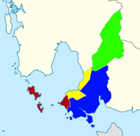
Mittakpheap (dark red), Stueng Hav (yellow), Prey Nob (blue), Kampong Seila (green)
| ISO Code | District | Romanization | Population | Communes | Villages |
|---|---|---|---|---|---|
| 1801 | មិត្តភាព | Krong Preah Sihanouk | 67,440 | 5 | 19 |
| 1802 | ព្រៃនប់ | Prey Nob | 75,142 | 14 | 65 |
| 1803 | ស្ទឹងហាវ | Stueng Hav | 13,108 | 3 | 10 |
| 1804 | ស្រុកកំពង់សីលា | Kampong Seila | 14,965 | 4 | 14 |
Port
The Sihanoukville Autonomous Port was finished in 1960 as the international sea port of Cambodia. It has an area of 290 meters length and 28 meters width. Its exterior berth depth is 8.50 to 13 meters and 7.50 to 8.50 meters depth in the interior. Four medium vessels can simultaneously moor at the port.[79]
The port is located 18 kilometers/11 miles from the Kaong Kang Airport and 4 kilometers/2 miles from Sihanoukville town. Ships' passengers are allowed to visit Sihanoukville town. The terminal itself has no shopping center, banking or tourist offices, only toilets.[84]
Religion
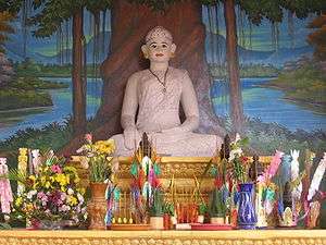
As of 2004, there were 27 Theravada Buddhist pagodas in the province with a population of 1,918 monks.[85] Buddhist Pagodas are central in Cambodian culture as the defining spiritual source of villages and cities.
| Pagodas/Wats in Sihanoukville province[86] | |||||||||||||||||||||
| Name | Official | District | Commune | Village | Abbot | Congregation (p.p.) | Monastery | Image | |||||||||||||
|---|---|---|---|---|---|---|---|---|---|---|---|---|---|---|---|---|---|---|---|---|---|
| Wat Bodh Meanchey | វត្តពោធិ៍មានជ័យ | Stung Hav | Kampenh | Ven. Leng Hee | persons | yes | |||||||||||||||
| Wat Ta Ney | វត្តតានៃ | Prey Nup | Jerng Ko | Ta Ney | persons | ||||||||||||||||
| Wat Kampong Sila | វត្ត | Kampong Sila | persons | ||||||||||||||||||
| Wat Silavontaram | វត្ត | Kampong Sila | Jamkar Hluong | Boeng Trach | persons | ||||||||||||||||
| Wat Jotannana/Wat Leu | វត្ត | Mittakpheap | Sangkat | Ven. Kiet Chanthuch | persons | yes | |||||||||||||||
| Wat Indannana/Wat Krom | វត្ត | Mittakpheap | Sangkat | Ven. Sassana Saingvara Moul Rorn | persons | yes | |||||||||||||||
| Wat O Tres | វត្ត | Mittakpheap | Sangkat 4 | persons | no |  | |||||||||||||||
| Wat Ream | វត្ត | Prey Nup | persons | ||||||||||||||||||
| Wat Uddom Vinnanaram | វត្ត | Prey Nup | persons | ||||||||||||||||||
| Wat Kiri Swa Ra | វត្ត | Prey Nup | Ream | persons | no |  | |||||||||||||||
| Wat Ream 3 | វត្ត | Prey Nup | persons |  | |||||||||||||||||
| Wat Uddom Priksa | វត្ត | Prey Nup | persons | ||||||||||||||||||
| Source: Wats in Sihanoukville province - Templenews[86] | |||||||||||||||||||||
Sihanoukville province is also home to minor communities of other religions such as: Catholics, Muslims, Protestants and Taoists. Places of worship:
- St. Michael's Church: It is the center of the Catholic communities. The church was built in 1960 by sailors, it is located on the same hill as the Upper Pagoda, facing the sea.
- Iber Bikhalifah Mosque: It is the religious center of the local Muslim community. It is located in Sihanoukville town, just in the populous, central Psah Leu (upper market) area.
 A typical shrine for the ancestors.
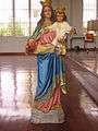 Statue of Mary at Saint Francis de Sales Chapel
- Wat Kiri Swa Ra
- Wat Otres
Education
Public spending on education in Cambodia, totaled 2.60% (of GDP) as of 2010.[87]
Cambodian general education is based on the national school curriculum that consists of:
1. Basic education
The basic education curriculum is divided into three cycles of three years each. The first cycle (grade 1-3) consists of 27-30 lessons per week lasting 40 minutes which are allocated to five main subjects. The second cycle (grade 4-6) consists of the same number of lessons but is slightly different. The third cycle (grade 7-9) consists of 32-35 lessons which are allocated for 7 major subjects.[88]
2. Upper secondary education
The upper Secondary Education curriculum consists of two different phases. The curriculum for the first phase (grade 10) is identical to the third cycle of primary education. The second phase (grade 11-12) has two main components: Compulsory and Electives.[88]
The total adult literacy rate of Sihanoukville is 95.37%.[89] The province hasn't got full educational coverage, but has improved during the last decade. The 2004 statistics[85] show the following centers of education: 33 pre-schools with 1,670 children, 52 primary schools with 34,863 students, 5 colleges with 4,794 students; 2 high schools with 1,449 students; 10 vocational training with 961 students and 13,728 students inprivate schools.
Private educational institutes in Sihanoukville are: Life University, University of Management and Economics, Built Bright University, Khmer Technology and Management Center, Don Bosco Technical School and Don Bosco Hotel School.
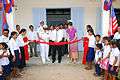 Ribbon cutting ceremony of the engineering civil action project
 Cambodians doing an exam in order to apply for the Don Bosco Technical School of Sihanoukville in 2008.
 His Majesty Norodom Sihamoni opened officially the Don Bosco Hotel School.
Sister cities
See also
- Sihanoukville Autonomous Port
- Sihanoukville International Airport
- Ream National Park
- Koh Rong
- Sihanoukville (city)
Bibliography
- Vann, Molyvann (2003). Modern Khmer Cities. Cambodia: Reyum Press. ISBN 9789995055349.
- Chandler, David (1993). A History of Cambodia. Cambodia: Allen & Unwin. ISBN 9781863734653.
- Cœdès, George (1966). The making of South East Asia. University of California Press. ISBN 0-520-05061-4.
- Kitagawa, T. 2005, "'Kampot' of the belle epoque: from the outlet of Cambodia to a colonial rule", in Southeast Asian Studies = Tonan Ajia kenkyu, vol. 42, no. 4,
- Kampot of the Belle Epoque: From the Outlet of Cambodia to a Colonial Resort
- Henri Mouhot: Travels in Siam, Cambodia, Laos, and Annam, White Lotus Co, Ltd., ISBN 974-8434-03-6
- Cœdès, George (1968). The Indianized States of Southeast Asia. University of Hawaii Press. ISBN 978-0824803681.
- Philpotts, Robert (2006). A Port for Independence. England: Blackwater Books. ISBN 2-9513524-0-9.
References
- ↑ "General Population Census of Cambodia 2008 - Provisional population totals" (PDF). National Institute of Statistics, Ministry of Planning. Retrieved December 29, 2015.
- ↑ "CITIES AND PROVINCES OF CAMBODIA" (PDF). BLC. June 1, 2008. Retrieved December 29, 2015.
- ↑ "Administrative Areas in Sihanoukville Municipality by District and Commune" (PDF). Statistics Japan. Retrieved December 29, 2015.
- ↑ Philpotts, Robert (March 2006). A Port for Independence. England: Blackwater Books. p. 18.
- ↑ "Cambodia Re-emerges". The New York Times. October 19, 2003. Retrieved May 19, 2016.
- ↑ "Economic Census of Cambodia 2011 Provincial Report 18 Preah Sihanouk Province" (PDF). Statistics Japan. Retrieved December 29, 2015.
- ↑ "Cambodia, Sihanoukville Autonomous Port". winne.com. Retrieved February 5, 2009.
- ↑ "The rise of Sihanoukville". The Phnom Penh Post. March 21, 2013. Retrieved April 18, 2015.
- ↑ "Introducing Sihanoukville". Lonely Travel. Retrieved 5 February 2009.
- ↑ Khmerization (2008-12-31). "Decree creates three new provinces". Khmerization.blogspot.com. Retrieved 2012-06-11.
- ↑ "King Sihamoni signed a royal decree that would change the municipalities of Kep, Sihanoukville and Pailin into provinces". derkeiler com. Retrieved December 29, 2015.
- ↑ "Sar Kheng Orders End to Illegal Fishing Off Coast". templenews org. September 8, 2015. Retrieved December 29, 2015.
- ↑ "Economic corridors and Industrial estates..." (PDF). Bangkok Research Center. Retrieved December 29, 2015.
- ↑ "Officials Unable to Explain Mystery Ships". The Cambodia Daily. November 6, 2015. Retrieved November 6, 2015.
- ↑ Cat Barton (September 7, 2007). "Cambodia: King Father Sihanouk holds ECCC at bay". Asian Human Rights Commission. Retrieved February 5, 2008.
- ↑ Headly, Robert K.; Chhor, Kylin; Lim, Lam Kheng; Kheang, Lim Hak; Chun, Chen. 1977. Cambodian-English Dictionary. Bureau of Special Research in Modern Languages. The Catholic University of America Press. Washington, D.C. ISBN 0-8132-0509-3
- ↑ "Saumya". Sanskritdictionary.com. Retrieved 2014-03-07.
- ↑ "kampong". Oxford University Press. Retrieved December 29, 2015.
- ↑ "A History of Cambodia by David Chandler". Google Books. Retrieved December 29, 2015.
- ↑ "THE TRUE HISTORY OF KHMER KROM by Child Khmer". KHMER KAMPUCHEA KROM. July 8, 2011. Retrieved December 29, 2015.
- ↑ "The Oc Eo archaeological site complex: An early Khmer city in the Mekong Delta ?". EFEO. February 15, 2011. Retrieved December 29, 2015.
- ↑ "Essay on Cambodian History from the middle of the 14th to the beginning of the 16th Centuries" (PDF). Sophia Angkor University. Retrieved April 18, 2015.
- ↑ "The History of Cambodia - Justin Corfield". Google Books. Retrieved June 7, 2015.
- ↑ Maritime China in Transition 1750-1850. Google Books. Retrieved April 18, 2015.
- ↑ "Kampot's Chinese heritage unearthed". Phnom Penh Post. January 31, 2013. Retrieved April 18, 2015.
- ↑ "Southeast Asia: A Historical Encyclopedia, from Angkor Wat to East... Volume 1". Google Books. Retrieved June 7, 2015.
- ↑ "Kampot of the Belle Époque: From the Outlet of Cambodia to a Colonial Resort" (PDF). Center for Southeast Asian Studies, Kyoto. Retrieved April 18, 2015.
- ↑ "London Company's Envoys Plot Siam" (PDF). Siamese Heritage. Retrieved May 7, 2015.
- ↑ Kitagawa, T. 2005, "'Kampot' of the belle epoque: from the outlet of Cambodia to a colonial rule", in Southeast Asian Studies = Tonan Ajia kenkyu, vol. 42, no. 4,
- ↑ "Sihanouk Ville" (PDF). Phnom Penh tours. Retrieved May 7, 2015.
- ↑ "GOOD QUESTIONS WRONG ANSWERS - CIA's Estimates..." (PDF). The National Security Archive. Retrieved May 7, 2015.
- ↑ US Department of Defense document "History of the Pacific Air Forces 1 July 1974-31 Dec 1975". p 426. accessed 24 Nov 2013
- ↑ "POLICY OPTIONS FOR CAMBODIA'S REAM NATIONAL PARK" (PDF). International Development Research Centre. Retrieved May 7, 2015.
- ↑ "King Sihamoni signed a royal decree that would change the municipalities of Kep, Sihanoukville and Pailin into provinces". Newsgroups derkeiler. January 1, 2009. Retrieved May 7, 2015.
- ↑ "Snake Island plans back to the drawing board". Phnom Penh Post. November 20, 2013. Retrieved June 1, 2015.
- ↑ "Luxury resort looks for new lease of life with redesigned blueprint". Phnom Penh Post. April 10, 2014. Retrieved June 1, 2015.
- ↑ "Cambodia Joins World's Most Beautiful Bay Club; Sihanoukville to Host First Sea Festival". PEMSEA. July 1, 2011. Retrieved May 7, 2015.
- ↑ "Cambodian National Parks". moc.gov.kh. Retrieved February 5, 2009.
- 1 2 "Sihanoukville Beaches". Cambodia islands – Island Species Cambodia. Retrieved May 7, 2015.
- ↑ "Ochheuteal Beach - What to See". Tourism Cambodia. Retrieved May 7, 2015.
- ↑ http://www.sokhahotels.com/sihanoukville/
- ↑ "Ferry Boat Tickets & Timetables | Koh Rong & Samloem". kohrong.guide. Retrieved 2016-03-29.
- ↑ "Koh Rong Island In Cambodia | Plan & Book Your Trip". kohrong.guide. Retrieved 2016-03-29.
- 1 2 "Ferry Boat Tickets & Timetables | Koh Rong & Samloem". kohrong.guide. Retrieved 2016-03-25.
- ↑ "Koh Rong Samloem, Cambodia | Plan & Book Your Trip". kohrong.guide. Retrieved 2016-03-25.
- ↑ "Cambodia in Focus : Developing Tourist Resorts Islands". Embassyofcambodia.org.nz. Retrieved 2014-03-07.
- ↑ "Sihanoukville weather in January". CambodiaWeather net com. Retrieved May 27, 2015.
- ↑ "Climatological Information for Sihanoukville, Cambodia", Hong Kong Observatory, 2003. Web: KOS-Airport.
- ↑ Economic Activities, pages 662-664, "Cambodia in the Early 21st Century", Royal Government of Cambodia. Phnom Penh, 2004, ISBN 2-9513524-0-9
- ↑ "Preah Sihanouk Province". Council for the Development of Cambodia(CDC), Cambodian Investment Board(CIB), Cambodian Special Economic Zone Board(CSEZB). Retrieved May 12, 2015.
- ↑ "Investment Advantage". Cambodia Sihanoukville Special Economic Zone. Retrieved May 7, 2015.
- ↑ "Sihanoukville Special Economic Zone". Cambodia Sihanoukville Special Economic Zone. Retrieved May 7, 2015.
- ↑ "modernisation of Cambodia's main port of Sihanoukville continues amidst worldwide slowdown of traffic in bigger ports such as Los Angeles and Long Beach". derkeiler com. January 22, 2009. Retrieved May 27, 2015.
- ↑ "Sihanoukville Autonomous Port(PAS) - Sihanoukville, Cambodia". SihanoukVille Web. Retrieved May 27, 2015.
- ↑ http://pas.gov.kh/traffic-handling.html
- 1 2 "Preah Sihanouk Province". Council for the Development of Cambodia(CDC). Retrieved May 7, 2015.
- ↑ "Main Resources in the Cambodia's Coastal Zone" (PDF). CZMCAM. Retrieved December 29, 2015.
- ↑ "CAMBODIA COASTAL SITUATIONAL ANALYSIS" (PDF). INTERNATIONAL UNION FOR CONSERVATION OF NATURE. Retrieved December 29, 2015.
- ↑ "Travel Guide for Sihanoukville". realtravel.com. Retrieved February 5, 2009.
- ↑ In isolated hills of Asia, new roads to speed trade., Thomas Fuller, New York Times, 31-03-2008.
- ↑ "Cambodia Traffic Law - download". SCO Cambodia. Retrieved December 29, 2015.
- ↑ "Cambodia: more deaths on the roads than in minefields". International Federation of Red Cross and Red Crescents. September 20, 2007. Retrieved February 5, 2009.
- ↑ Sok Khemara, Voa Khmer (January 3, 2009). "Police begin enforcement". Retrieved February 5, 2009.
- ↑ "Getting Around Sihanoukville". sihanoukvillebackpacker.com. Retrieved February 5, 2009.
- ↑ "Bus Company in Cambodia - Transportation in Cambodia". Ministry of Tourism Cambodia (MOT). Retrieved May 12, 2015.
- ↑ "MARINA OCEANIA SIHANOUKVILLE CAMBODIA". MARINA OCEANIA. Retrieved May 12, 2015.
- ↑ "Cruise Ship Docks at Preah Sihanoukville International Seaport". Cambodia Grand Tour. February 9, 2013. Retrieved May 12, 2015.
- ↑ "News Update". Toll Royal Railways (Cambodia). February 16, 2015. Retrieved May 12, 2015.
- ↑ "General Population Census of Cambodia 2008 - Provisional population totals" (PDF). National Institute of Statistics, Ministry of Planning. September 3, 2008.
- ↑ "POPULATION PROJECTIONS FOR CAMBODIA, 2008-2030" (PDF). The Statistics Bureau and the Director-General for Policy Planning of Japan. Retrieved May 12, 2015.
- ↑ Normal Template, . Retrieved 2012.
- ↑ "Cambodia Chinese Religion". Photius. Retrieved May 12, 2015.
- ↑ "Task Force Meeting 7th: Reporting Through Smartphone". Urban Voice Cambodia. October 23, 2014. Retrieved May 12, 2015.
- ↑ "A history of the Chinese in Cambodia by Jean-Michel Filippi". Phnom Penh Post. February 8, 2013. Retrieved June 20, 2015.
- ↑ The Chinese in Cambodia. Google Books. Retrieved May 12, 2015.
- ↑ "Cambodia Today - The Life of The Khmers Today". Holiday In Angkor Wat. Retrieved May 12, 2015.
- ↑ "Corruption hits urban families hardest, study shows". Phnom Penh Post. March 11, 2005. Retrieved May 12, 2015.
- ↑ "Decree creates three new provinces". SCO Cambodia. December 31, 2008. Retrieved December 29, 2015.
- 1 2 "The Sihanoukville Autonomous Port (PAS)". pas.gov.kh. Retrieved February 5, 2009.
- ↑ "Closing Speech by HE Sar Kheng at National Workshop on the Formulation of the 2013 NCDD Annual Work Plan and Budget on 11-12 December 2012, Phnom Penh" (PDF). NCDD. Retrieved May 12, 2015.
- ↑ "Preliminary Results of Cambodia Inter-censal Economic Survey 2014" (PDF). National Institute of Statistics. Retrieved May 12, 2015.
- ↑ "Census of Agriculture in Cambodia 2013 Preliminary Report" (PDF). National Institute of Statistics. Retrieved May 12, 2015.
- ↑ "ដ្ឋបាលខេត្តព្រះសីហនុ - Home". Sihanoukville Gov. Retrieved May 12, 2015.
- ↑ Cruise Asean: The Autonomous Port of Sihanoukville, APS
- 1 2 Structure of Sihanoukville Municipality, pag. 670, "Cambodia in the Early 21st Century", Royal Government of Cambodia. Phnom Penh, 2004, ISBN 2-9513524-0-9
- 1 2 "Wats in Sihanoukville province". templenews org. Retrieved December 29, 2015.
- ↑ "Cambodia - Public spending on education". Indexmundi. Retrieved May 12, 2015.
- 1 2 "The Education System in Cambodia". Bookbridge. March 19, 2012. Retrieved May 12, 2015.
- ↑ "GENDER EQUALITY AND WOMEN'S EMPOWERMENT IN PUBLIC ADMINISTRATION" (PDF). United Nations Development Programme. Retrieved May 12, 2015.
| Wikimedia Commons has media related to Sihanoukville. |
External links
Government
- Preah Sihanouk Province official homepage
- Ministry of Tourism
- National Institute of Statistics of Cambodia
- Royal Government of Cambodia (English Version)
- Sihanoukville Autonomous Port
- Agence Kampuchea Presse
- Ministry of Public Works and Transport
Industry
- Sihanoukville Special Economic Zone(SSEZ)
- Toll Royal Railways - Cambodian rail operator
- Chemical Waste Dumped near Sihanoukville
- Cambodia Airports
Info, History & Geography
- Independent Travel Guide on Koh Rong & Koh Rong Sanloem
- Cambodian Research Centre for Development (CRCD)
- Cambodia’s islands - Island Species Cambodia
- Canbypublications
- Website with full information about Sihanoukville
- SihanoukVille Tourism Site
 |
Koh Kong Province | Kampong Speu Province | | |
| Gulf of Thailand | |
|||
| ||||
| | ||||
| Gulf of Thailand Kiên Giang Province, |
Kampot Province |
| Provinces | ||
|---|---|---|
| Municipalities | ||