Sikaiana
| Native name: <span class="nickname" ">Stewart Islands | |
|---|---|
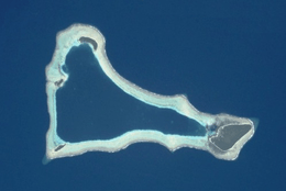 NASA picture of Sikaiana Atoll] | |
 Sikaiana | |
| Geography | |
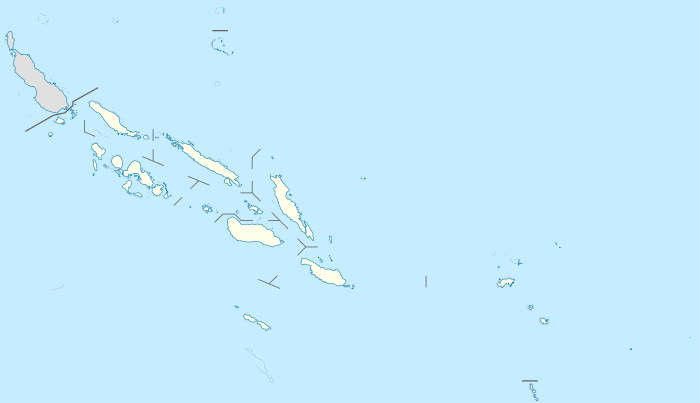
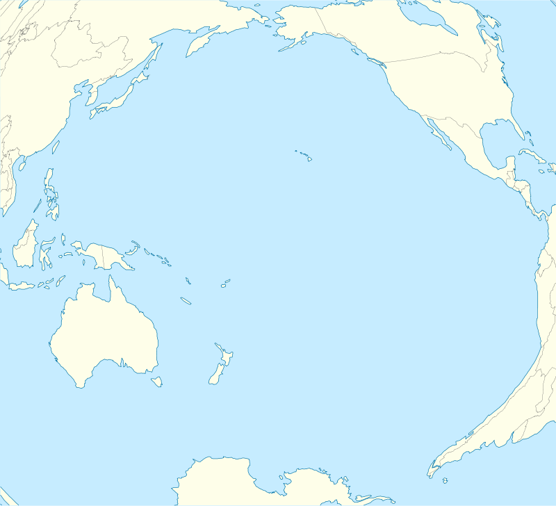
| Location | Pacific Ocean |
| Archipelago | Solomon Islands |
| Area | 2 km2 (0.77 sq mi) |
| Administration | |
|
Solomon Islands | |
| Demographics | |
| Population | 249 (2009) |
Sikaiana (formerly called the Stewart Islands) is a small atoll in the Solomon Islands 212 kilometres (132 miles) NE of Malaita. It is almost 14 kilometres (8.7 miles) in length and its lagoon, known as Te Moana, is totally enclosed by the coral reef. Its total land surface is only 2 square kilometres (0.77 square miles). There is no safe anchorage close to this atoll, which makes it often inaccessible.
Geography
Sikaiana is located Latitude: 8° 25' 0 South and Longitude: 162° 52' 0 East. The main island, located at the easternmost corner, is called Sikaiana. The three small islands in the west of the atoll are Tehaolei, Matuiloto and Matuavi. There are also two artificial islands on the reef, Te Palena and Hakatai'atata.
History
Administratively Sikaiana is an outlying region of Malaita Province in the Solomon Islands. Sikaiana's population is approximately 300 people of Polynesian descent. In 1856, when Hawai‘i was offered the sovereignty of Sikaiana, the Privy Council voted to accept the cession. King Kamehameha IV approved the action, making Hawai‘i an imperial power of sorts. But there were second thoughts. The great distance of the atoll from Honolulu would make administration impossible, and the cession was never formalized. Some residents have claimed to be native Hawaiians and citizens of the United States. According to these residents, the Stewart Islands were given to King Kamehameha IV in 1856, and therefore the islands were part of the Kingdom of Hawai‘i at the time of the United States' annexation in 1898. The United States disagrees, arguing that the 1898 law annexed only the "Hawaiian Islands and their dependencies", and that the law defined dependencies as the islands named by a report by the Hawaiian Commission that omitted the Stewart Islands. Some residents applied to register to vote in Hawai‘i in 1996, but their applications were turned down by the Hawaiian Sovereignty Election Council.[1]
References
- Portions of the Book of Common Prayer in Sikaiana, 1932 Anglican liturgical document in Sikaiana.
- The US Position concerning Sikaiana is stated on page 39 in footnote 2.
- Oceandots at the Wayback Machine (archived December 23, 2010)
- ↑ "U.S. Insular Areas: Application of the U.S. Constitution" (pdf). Report to the Chairman, Committee on Resources, House of Representatives. United States General Accounting Office. November 1997. Page 39, footnote 2.
External links
| Wikimedia Commons has media related to Sikaiana. |
Coordinates: 8°22′43″S 162°42′47″E / 8.37861°S 162.71306°E