Silver Bell Mountains
| Silver Bell Mountains | |
|---|---|
|
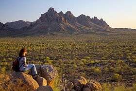
Ragged Top is a prominent landmark just north of the main range of the Silver Bell mountains | |
| Highest point | |
| Peak | Silver Bell Peak |
| Elevation | 4,261 ft (1,299 m) |
| Coordinates | 32°24′30″N 111°29′32″W / 32.4084°N 111.4923°WCoordinates: 32°24′30″N 111°29′32″W / 32.4084°N 111.4923°W |
| Dimensions | |
| Length | 6 mi (9.7 km) N-NW x SE |
| Width | 5 mi (8.0 km) |
| Geography | |
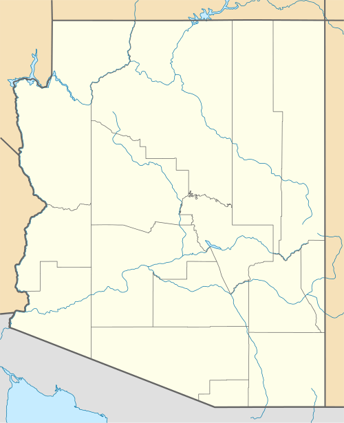 Silver Bell Mountains Location in the state of Arizona. | |
| Country | United States |
| State | Arizona |
| Region |
Ironwood Forest National Monument (northeast)-Sonoran Desert (Avra Valley) |
| District | Pima County |
| Settlement | Silver Bell, AZ |
| Borders on |
West Silver Bell Mountains-NW Waterman Mountains-S Aguirre Valley-W & SW Avra Valley-E & I-10-NE |
The Silver Bell Mountains are an arid north-northwest x southeast trending small mountain range in north-central Pima County, Arizona. The range lies 14 miles (23 km) west of Marana, Arizona, located on Interstate-10, northwest of Tucson.
The range is located in the east of the Ironwood Forest National Monument, and is located in a group of four mountain ranges. Ragged Top, located in the north of the range, is a well known landmark, as good roads extend through this sightseeing and former mining region.
Description
The range is named for the Silver Bell Mine located at the southern end of the mountains. The range abuts the Waterman Mountains to the southeast, where palynology-(pollen) studies have shown some of the recent floristic history of Arizona during the Pliocene. Both ranges lie in the northeast Sonoran Desert; the Madrean Sky Island ranges begin just southeast of here, with the large, and most western sky island range, the Baboquivari Mountains-Quinlans 20-35 mi south.
The Silver Bell range can be accessed by Avra Valley Rd and Silver Bell Rd from the south of Marana.
Climate
Climate type is characterized by extremely variable temperature conditions. The Köppen Climate Classification sub-type for this climate is "Bsh" (Mid-Latitude Steppe and Desert Climate).[1]
| Climate data for Silver Bell Mountains | |||||||||||||
|---|---|---|---|---|---|---|---|---|---|---|---|---|---|
| Month | Jan | Feb | Mar | Apr | May | Jun | Jul | Aug | Sep | Oct | Nov | Dec | Year |
| Average high °C (°F) | 17 (63) |
19 (66) |
22 (71) |
26 (79) |
31 (88) |
37 (98) |
37 (98) |
36 (96) |
34 (93) |
29 (84) |
22 (72) |
17 (62) |
27 (81) |
| Average low °C (°F) | 6 (43) |
8 (46) |
9 (49) |
13 (55) |
17 (63) |
22 (72) |
23 (74) |
22 (72) |
21 (70) |
16 (61) |
11 (51) |
6 (43) |
14 (58) |
| Average precipitation mm (inches) | 23 (0.9) |
23 (0.9) |
20 (0.8) |
5 (0.2) |
5 (0.2) |
8 (0.3) |
64 (2.5) |
64 (2.5) |
33 (1.3) |
30 (1) |
20 (0.8) |
33 (1.3) |
325 (12.8) |
| Source: Weatherbase [2] | |||||||||||||
See also
- Ironwood Forest National Monument
- List of mountain ranges of Pima County, Arizona
- List of mountain ranges of Arizona
References
- ↑ Climate Summary for Silver Bell
- ↑ "Weatherbase.com". Weatherbase. 2013. Retrieved on July 30, 2013.
External links
Silver Bell Peak
Ragged Top Peak
| Wikimedia Commons has media related to Silver Bell Mountains. |