Simonszand
 Location of Simonszand | |
| Geography | |
|---|---|
| Coordinates | 53°31′N 6°24′E / 53.517°N 6.400°ECoordinates: 53°31′N 6°24′E / 53.517°N 6.400°E |
| Archipelago | (West) Frisian Islands |
| Adjacent bodies of water |
North Sea Wadden Sea |
| Administration | |
|
Netherlands | |
| Province | Groningen |
| Municipality | Eemsmond |
| Demographics | |
| Population | Uninhabited |
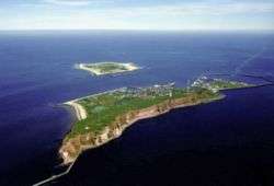
Simonszand (Dutch pronunciation: [ˈsimɔnsˌzɑnt]) is a sandbank between the West Frisian Islands of Schiermonnikoog and Rottumerplaat in the Netherlands. It is located in the municipality of Eemsmond in the province of Groningen.
The sandbank was originally mapped as being an Intertidal zone in approximately 1811, but changed in later mappings to be shown as a Supratidal zone after it became larger and migrated seaward.[1]
References
- ↑ van der Velde, L. (1995). "Geologica Ultraiectina". Geologica Ultraiectina. 125-126.
External links
-
 Media related to Simonszand at Wikimedia Commons
| West Frisian Islands (Netherlands) |
|  | |||||||||
|---|---|---|---|---|---|---|---|---|---|---|---|
| East Frisian Islands (Germany) |
| ||||||||||
| Heligoland Bight (Germany) | |||||||||||
| North Frisian Islands (Germany) |
| ||||||||||
| Danish Wadden Sea Islands (Denmark) |
| ||||||||||
This article is issued from Wikipedia - version of the 11/24/2016. The text is available under the Creative Commons Attribution/Share Alike but additional terms may apply for the media files.