Singarayakonda
| Singarayakonda సింగరాయకొండ | |
|---|---|
| Census town | |
|
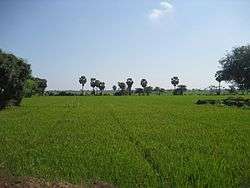
Paddy fields near Singarayakonda | |
 Singarayakonda Location in Andhra Pradesh, India | |
| Coordinates: 15°15′N 80°02′E / 15.25°N 80.03°ECoordinates: 15°15′N 80°02′E / 15.25°N 80.03°E | |
| Country | India |
| State | Andhra Pradesh |
| District | Prakasam |
| Area[1] | |
| • Total | 11.20 km2 (4.32 sq mi) |
| Elevation | 15 m (49 ft) |
| Population (2011)[2] | |
| • Total | 19,400 |
| • Density | 1,700/km2 (4,500/sq mi) |
| Languages | |
| • Official | Telugu |
| Time zone | IST (UTC+5:30) |
| Vehicle registration | AP |
Singarayakonda is a census town in Prakasam district of the Indian state of Andhra Pradesh. It is the mandal headquarters of Singarayakonda mandal.[3]
Geography
Singarayakonda is located at 15°15′N 80°02′E / 15.25°N 80.03°E.[4] It has an average elevation of 15 metres (49 feet).
Demographics
As of 2011 India census,[5] Singarayakonda had a population of 28,675. Males constitute 48% of the population and females 52%. Singarayakonda has an average literacy rate of 68%, higher than the national average of 59.5%: male literacy is 73%, and female literacy is 61%. In Singarayakonda, 11% of the population is under 6 years of age.
Transport
Singarayakonda railway station is classified as a B–category station in the Vijayawada railway division of South Central Railway zone.[6]
Education
The primary and secondary school education is imparted by government, aided and private schools, under the School Education Department of the state.[7][8] The medium of instruction followed by different schools are English, Telugu.
References
- ↑ "District Census Handbook - Prakasam" (PDF). Census of India. p. 16,17,48. Retrieved 18 January 2015.
- ↑ "Census 2011". The Registrar General & Census Commissioner, India. Retrieved 25 July 2014.
- ↑ "Chittoor District Mandals" (PDF). Census of India. pp. 167, 180. Retrieved 19 June 2015.
- ↑ Falling Rain Genomics, Inc - Singarayakonda
- ↑ "Census of India 2001: Data from the 2001 Census, including cities, villages and towns (Provisional)". Census Commission of India. Archived from the original on 2004-06-16. Retrieved 2008-11-01.
- ↑ "Divisional info" (PDF). Indian Railways. Retrieved 18 July 2015.
- ↑ "School Eduvation Department" (PDF). School Education Department, Government of Andhra Pradesh. Retrieved 7 November 2016.
- ↑ "The Department of School Education - Official AP State Government Portal | AP State Portal". www.ap.gov.in. Retrieved 7 November 2016.