Singida Rural
| Singida Rural District | |
|---|---|
| District | |
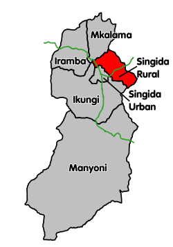 Singida Rural District's location within Singida Region. | |
| Coordinates: 04°44′S 35°02′E / 4.733°S 35.033°ECoordinates: 04°44′S 35°02′E / 4.733°S 35.033°E | |
| Country | Tanzania |
| Region | Singida Region |
| Population (2012) | |
| • Total | 225,521 |
Singida Rural District is one of the six districts of the Singida Region of Tanzania. It is bordered to the north by Mkalama District, to the east by Manyara Region and Dodoma Region, to the south by Ikungi District and to the west by Singida Urban District. Its administrative seat is the town of Singida.
According to the 2012 Tanzania National Census, the population of Singida Rural District was 225,521.[1]
Transport
Paved trunk road T14 from Singida to Babati passes through the district.[2]
Administrative subdivisions
As of 2012, Singida Rural District was administratively divided into 21 wards.[1]
Wards
|
|
|
|
References
- 1 2 "Census 2012". National Bureau of Statistics. Retrieved 16 February 2016.
- ↑ "Singida Roads Network" (PDF). Tanroads. Retrieved 11 March 2016.
This article is issued from Wikipedia - version of the 3/21/2016. The text is available under the Creative Commons Attribution/Share Alike but additional terms may apply for the media files.