Sirikit Dam
| Sirikit Dam | |
|---|---|
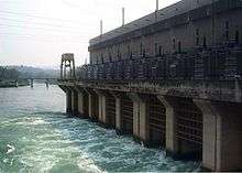 The dam's power station at its base | |
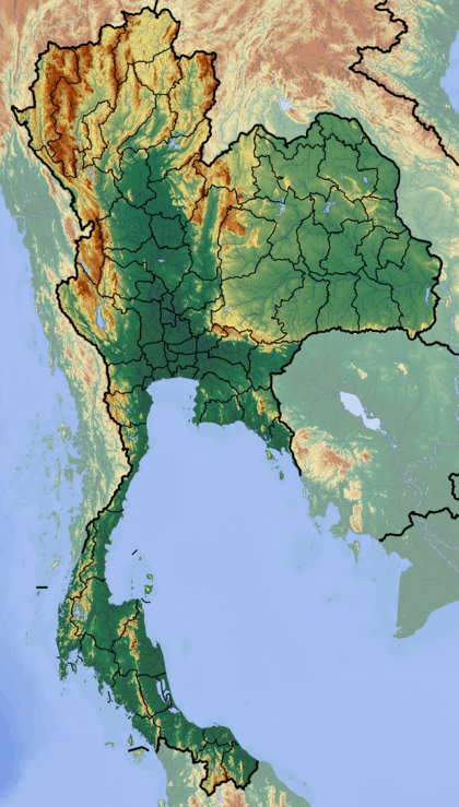 Location of Sirikit Dam in Thailand | |
| Official name | Queen Sirikit Dam |
| Country | Thailand |
| Location | Uttaradit Province |
| Coordinates | 17°45′50″N 100°33′48″E / 17.76389°N 100.56333°ECoordinates: 17°45′50″N 100°33′48″E / 17.76389°N 100.56333°E |
| Status | In use |
| Construction began | 1968 |
| Opening date | 1974 |
| Owner(s) | Electricity Generating Authority of Thailand |
| Dam and spillways | |
| Type of dam | Embankment |
| Impounds | Nan River |
| Height | 113.6 m (373 ft) |
| Length | 800 m (2,625 ft) |
| Width (crest) | 12 m (39 ft) |
| Width (base) | 630 m (2,067 ft) |
| Spillway type | Tunnel, service |
| Spillway capacity | 3,250 m3/s (114,773 cu ft/s) |
| Reservoir | |
| Creates | Sirikit Reservoir |
| Total capacity | 9,510,000,000 m3 (7,709,882 acre·ft) |
| Active capacity | 6,668,000,000 m3 (5,405,836 acre·ft) |
| Catchment area | 13,130 km2 (5,070 sq mi) |
| Surface area | 259 km2 (100 sq mi) |
| Power station | |
| Commission date | 1974, 1995 |
| Hydraulic head | 75.4 m (247 ft) (rated) |
| Turbines | 4 x 125 MW Francis-type |
| Installed capacity | 500 MW |
The Queen Sirikit Dam is an embankment dam on the Nan River, a tributary of the Chao Phraya River, in Uttaradit Province, Thailand. It is at the southeastern edge of the Phi Pan Nam Range. The dam was built for the purpose of irrigation, flood control and hydroelectric power production. It is named after Queen Sirikit of Thailand.[1]
Background
The Sirikit Dam among others in the Chao Phraya basin were constructed beginning in the 1950s to exploit the agricultural and hydroelectric potential of the basin. Preliminary construction on the dam began in 1968 and it was finished in 1972. The power plant and first three units were commissioned in 1974, the fourth in 1995.[2] Previously in 1964, the Bhumibol Dam was completed on the Ping River, one of two major tributaries of the Chao Phraya including the Nan. The Bhumibol and Sirkit Dams control 22% of the Chao Phraya's annual runoff combined.[3] Both dams also help provide for the irrigation of 1,200,000 ha (4,633 sq mi) in the wet season and 480,000 ha (1,853 sq mi) in the dry season.[4]
Design

The dam is a 113.6 m (373 ft) high and 800 m (2,625 ft) long embankment dam that is 630 m (2,067 ft) wide at its base and 12 m (39 ft) wide at its crest. The dam withholds a reservoir of 9,510,000,000 m3 (7,709,882 acre·ft) of which 6,666,000,000 m3 (5,404,214 acre·ft) is active or "useful" storage. The reservoir has a surface area of 259 km2 (100 sq mi).[2] The dam's spillway consists of a tunnel controlled by two radial gates, it has a capacity of 3,250 m3/s (114,773 cu ft/s). The dam's power station contains 4 x 125 MW Francis turbines for an installed capacity of 500 MW.[1][2]
See also
References
- 1 2 "Hydroelectric Power Plants in Thailand". Industcards. Retrieved 6 March 2011.
- 1 2 3 "Sirikit Dam". Electricity Generating Authority of Thailand. Retrieved 6 September 2016.
- ↑ "Chao Phraya River Basin (Thailand)" (PDF). UNESCO. p. 293. Retrieved 6 March 2011.
- ↑ "Bhumibol Dam". Royal Irrigation Department - Thailand. Retrieved 6 March 2011.
External links
| Wikimedia Commons has media related to Sirikit Dam. |
- Sirikit Dam at Electricity Generating Authority of Thailand