Slano
| Slano | |
|---|---|
| Settlement | |
|
Slano | |
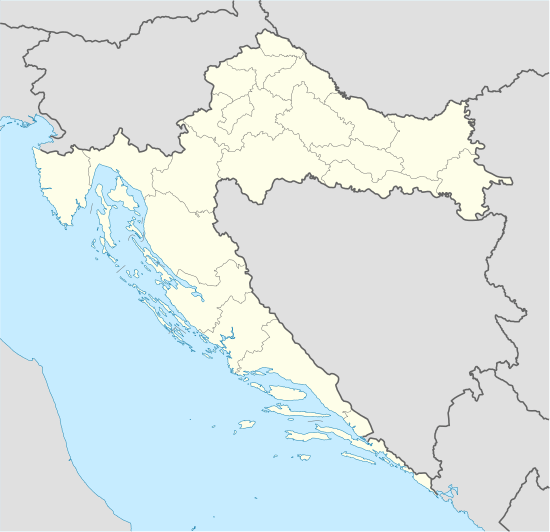 Slano Location of Slano within Croatia | |
| Coordinates: 42°47′13″N 17°53′24″E / 42.78694°N 17.89000°E | |
| Country | Croatia |
| County | Dubrovnik-Neretva County |
| Municipality | Dubrovačko Primorje |
| Population (2011)[1] | |
| • Total | 579 |
| Time zone | CET (UTC+1) |
| • Summer (DST) | CEST (UTC+2) |
| Postal code | 20232 Slano |
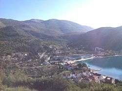
Slano (Islana in Italian) is a village in southern Croatia with a small harbour in the bay of the same name. It is located 27 km northwest of Dubrovnik.
Farming, olive-growing, viniculture, fruit-growing, tobacco, herbs (sage, laurel), fishing and tourism are the main occupations. Slano lies on the main coastal road (M2, E65). Yachts can anchor in the small protected Banja cove and an anchoring-ground for larger yachts lies off the entrance to the cove, to the southwest of Cape Gornji.
The area of Slano was already populated in the prehistoric period (ruins of a hill-fort and tumuli on the nearby hills) and in ancient times (a Roman castrum on the hill Gradina; early Christian sarcophagi, today exhibited in front of the Franciscan church).[2] In 1399, Slano fell under the rule of the Republic of Ragusa; once the duke's seat (duke's palace, reconstructed at the end of the 19th century). The summer villa of the Ohmučević family is situated in the vicinity.
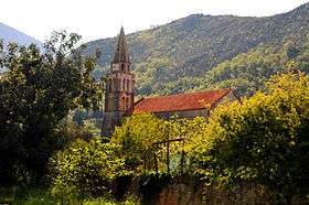
The present Franciscan church was built in the 16th century; the main altar is adorned with a polyptych by Lovro Dobričević. The parish church of Saint Blaise from 1407 was reconstructed in the Baroque period. The churches of the Annunciation and of St. Peter, both dating back to the 13th century, are located in Banja.
References
- ↑ "Population by Age and Sex, by Settlements, 2011 Census: Slano". Census of Population, Households and Dwellings 2011. Zagreb: Croatian Bureau of Statistics. December 2012.
- ↑ Croatia: Aspects of Art, Architecture and Cultural Heritage by John Julius Norwich
Coordinates: 42°47′13″N 17°53′24″E / 42.78694°N 17.89000°E
| Wikimedia Commons has media related to Slano. |