Smoleva
| Smoleva | |
|---|---|
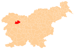
 Smoleva Location in Slovenia | |
| Coordinates: 46°12′39.99″N 14°9′57.19″E / 46.2111083°N 14.1658861°ECoordinates: 46°12′39.99″N 14°9′57.19″E / 46.2111083°N 14.1658861°E | |
| Country |
|
| Traditional Region | Upper Carniola |
| Statistical region | Upper Carniola |
| Municipality | Železniki |
| Elevation | 591.8 m (1,941.6 ft) |
| Population (2002) | |
| • Total | 59 |
| [1] | |
Smoleva (pronounced [smɔˈleːʋa]) is a village in the Municipality of Železniki in the Upper Carniola region of Slovenia. It lies in the valley of Lower Smoleva Creek (Slovene: Prednja Smoleva) between Špik Hill (882 meters or 2,894 feet) to the northeast and Mount Vancovec (1,085 meters or 3,560 feet) to the southwest.
References
External links
| Settlements | Administrative centre: Železniki
|  | ||||||
|---|---|---|---|---|---|---|---|---|
| Landmarks |
| |||||||
| Notable people | ||||||||
This article is issued from Wikipedia - version of the 11/18/2016. The text is available under the Creative Commons Attribution/Share Alike but additional terms may apply for the media files.