Solander Islands
| Maori: Hautere | |
|---|---|
 Overview map | |
| Geography | |
| Location | Southland District |
| Coordinates | 46°34′S 166°53′E / 46.567°S 166.883°E |
| Area | 70 ha (170 acres) |
| Highest elevation | 330 m (1,080 ft) |
| Administration | |
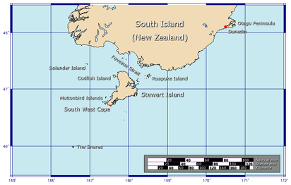
The Solander Islands/Hautere are a small chain of uninhabited volcanic islets lying at 46°34′S 166°53′E / 46.567°S 166.883°E, close to the western end of the Foveaux Strait in southern New Zealand. They lie some 38 km (24 mi) south of Prices Point on the southern coast of South Island, New Zealand, close where Lake Hakapoua drains through Big River to the Pacific Ocean due west of Te Waewae Bay, and 64 km (40 mi) WNW of the Putatara (Rugged) Point in the northwest of Stewart Island/Rakiura, or 56 km (35 mi) from Codfish Island west of Stewart Island/Rakiura. They measure about 0.7 km2 (0.27 sq mi) in area. Administratively, they are part of Southland District.
History
The island chain was sighted by Captain James Cook on 11 March 1770 and named by him for the Swedish naturalist Dr Daniel Solander, one of the scientific crew aboard Cook's expedition's ship Endeavour. The Maori name Hautere translates into English as "flying wind", an apt description of the islands' weather.
The islands have only ever been briefly inhabited, and then only due to shipwreck or other marooning. Five Europeans were marooned there between 1808 and 1813, the longest continual period of habitation for the island group.
Geology
The islands are remnants of an isolated extinct Pleistocene volcano with andesite rocks one to two million years old. They lie on a bank with depths less than 100 m (328 ft), but are separated from the continental shelf around Foveaux Strait by a 4 km (2.5 mi) narrow trough with depths in excess of 200 m (656 ft) (at least 237 m or 778 ft). Therefore, the islands are included in the New Zealand Outlying Islands, despite their proximity to the mainland. The Solander Islands are the only New Zealand volcanic land features related to the subduction of the Australian Plate beneath the Pacific Plate.[1]
Flora and fauna
There are 53 vascular plant species, one third of which are very rare. The flora is dominated by ferns and orchids. The southern, and nominate, subspecies of Buller's albatross (Thalassarche b. bulleri) breeds only on the Solanders and the Snares.
Solander Islands were historically well-known area for migrating whales especially southern right and sperm whales, and sperm whales in this area was said to be exceptionally large in size and quantities of blubbers.[2]
Important Bird Area
The Solander group has been identified as an Important Bird Area (IBA) by BirdLife International because of its significance as a breeding site for Buller's albatrosses (with about 5000 pairs) and common diving petrels.[3]
The islands
- Solander Island/Hautere, the main island, covers some 65 ha (160 acres) in area, rising steeply to a peak 330 metres (1,083 ft) above sea level. It is wooded with the exception of its northeast end, which appears as bare, white rock. There is a deep cave on the east side, Sealers Cave.
- Little Solander Island is 1.9 km (1.2 mi) west of the main island. It is 148 m (486 ft) high, with an area of 4 ha (9.9 acres). It has a barren appearance and is guano-covered.
- Pierced Rock is 250 m (273 yd) south of the main island. It rises to 54 m (177 ft) and measures just 2,000 m2 (22,000 sq ft) in area.
See also
References
- Wise's New Zealand guide: A gazeteer of New Zealand (4th ed.) (1969) Dunedin: H. Wise & Co. (N.Z.) Ltd.
- ↑ Keith Lewis, Scott D. Nodder and Lionel Carter. 'Sea floor geology - Solander Island', Te Ara - the Encyclopedia of New Zealand. Updated 21 September 2007. Accessed 29 March 2009.
- ↑ http://docs.niwa.co.nz/library/public/NIWAis76.pdf
- ↑ BirdLife International. (2012). Important Bird Areas factsheet: Solander Islands. Downloaded from http://www.birdlife.org on 2012-01-27.
External links
| Administrative divisions of the Realm of New Zealand | |||||||||||
|---|---|---|---|---|---|---|---|---|---|---|---|
| Sovereign states | |
|
| ||||||||
| Regions | 11 non-unitary regions | 5 unitary regions | Chatham Islands | Outlying islands outside any regional authority (the Kermadec Islands, Three Kings Islands, and Subantarctic Islands) |
Ross Dependency | |
15 islands | 14 villages | |||
| Territorial authorities | 13 cities and 53 districts | ||||||||||
| Notes | Some districts lie in more than one region | These combine the regional and the territorial authority levels in one | Special territorial authority | The outlying Solander Islands form part of the Southland Region | New Zealand's Antarctic territory | Non-self-governing territory of New Zealand | States in free association with New Zealand | ||||