Sorgschrofen
| Sorgschrofen | |
|---|---|
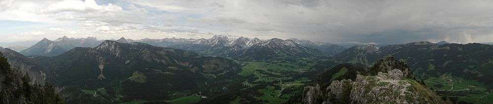
 Sorgschrofen and Zinken | |
| Highest point | |
| Elevation | 1,634.9 m (5,364 ft) |
| Prominence | 577 m (1,893 ft) |
| Coordinates | 47°33′21″N 10°27′15″E / 47.55583°N 10.45417°ECoordinates: 47°33′21″N 10°27′15″E / 47.55583°N 10.45417°E |
| Geography | |
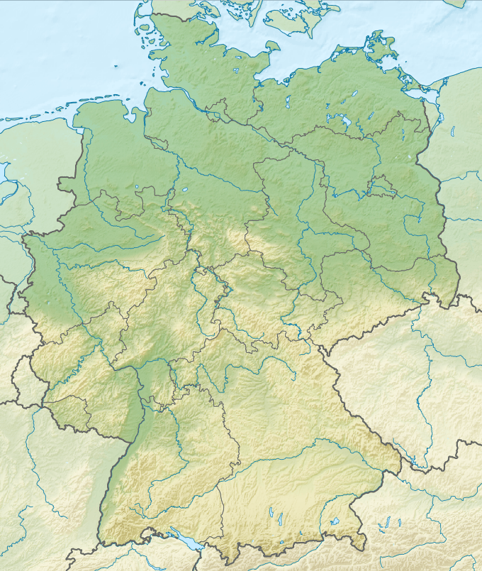 Sorgschrofen Location in Germany | |
| Location | Bavaria, Germany |
| Parent range | Allgäu Alps |
| Climbing | |
| Easiest route | From Jungholz |
Sorgschrofen is a 1,635 m (5,364 ft) tall mountain in the Allgäu Alps of Bavaria, Germany. A lower summit of Sorgschrofen is the 1,613 m (5,292 ft) tall Zinken. There is a summit cross on both Sorgschrofen and Zinken.[1]
Quadripoint
The summit is the only landlink Jungholz has to the rest of Austria. A rare occurrence found on the summit is that four borders (two German and two Austrian) meet in a quadripoint:
- Bad Hindelang (West, Bavaria, Germany)
- Pfronten (East, Bavaria, Germany)
- Jungholz (North, Tyrol, Austria)
- Schattwald (South, Tyrol, Austria)
History
The border between this section of Bavaria and Tyrol was defined by the border treaty of 1844, which was complemented in 1850; "Grenzberichtigungsvertrag vom 30. Jänner 1844, mit dem Ergänzungsvertrag vom 16. Dezember 1850". The treaty declares, that the borders meet at border marker 110, which is carved into a stone on the summit of the mountain.[2]
Ascent
Sorgschrofen is a popular hiking mountain. A hiker can climb the mountain in two different ways: Directly to the peak from Jungholz or from Unterjoch and over Zinken, which is located 265 m (869 ft) south-west of the main summit and also on the border.
From Jungholz
From Jungholz you can either take a ski lift to cut corners or hike up a path to Älpele Hut. From there you need to follow the steep slope until you reach the area beneath the peak. Here you have to climb up the rocky surface to the peak.[3]
From Unterjoch
Starting from the parking lot in Unterjoch, you walk past the church and go east to Zehrerhöfe on a road, where the paving abruptly stops. A dirt path at a right angle leads you to the main path to the peak. From there, you follow the path up the slope. It becomes much steeper, and some places are secured by steel wire. At one point you'll have to squeeze through a crevice. After you reach Zinken, you need to cross a ridge to get to the main summit. The path over the ridge is reserved for experienced hikers who are absolutely sure-footed, because although the path is partially secured, it is often very exposed. The trail can be icy until late spring. Before that, a climb - even for experts - is not recommended.[1][4][5]
References
- 1 2 "Sorgschrofen (1635 m), Zinken (1613 m)". Hoehenrausch.de (in German). Retrieved 9 June 2013.
- ↑ "The boundary cross at Jungholz". Enclaves.org. Retrieved 9 June 2013.
- ↑ "Rundwanderung mit Kletterei über den Sorgschrofen zum Zinken". Allgäu-ausflüge.de (in German). Retrieved 14 June 2013.
- ↑ "Über den Sorgschrofen". Gipfelsuechtig.de (in German). Retrieved 9 June 2013.
- ↑ Kulmus, Hubert; Heck, Christl (1994). Das Allgäu-Wanderbuch (5 ed.). BLV Buchverlag. p. 28. ISBN 3-405-13751-9.
External links
| Wikimedia Commons has media related to Sorgschrofen. |
- Hikr.org (in German): Many different tour guides and routes.