Sorgu
 | |
| Geography | |
|---|---|
| Location | Gulf of Riga |
| Coordinates | 58°10′42.23″N 24°11′58.63″E / 58.1783972°N 24.1996194°ECoordinates: 58°10′42.23″N 24°11′58.63″E / 58.1783972°N 24.1996194°E |
| Area | 5.07 ha (12.5 acres) |
| Coastline | 2.4 km (1.49 mi) |
| Highest elevation | 5 m (16 ft) |
| Administration | |
|
Estonia | |
| County | Pärnu County |
| Municipality | Tõstamaa Parish |
| Settlement | Manija village |
| Demographics | |
| Population | 0 |
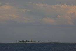
Sorgu is a 5-hectare (12-acre)[1] uninhabited Estonian islet in the Gulf of Riga, 5 km (3.1 mi) southeast of the island of Manilaid. Administratively Sorgu belongs to the Manija village in Tõstamaa Parish, Pärnu County.
The reefs of Sorgu were already mentioned on the Willem Janzoon Blaeu's 1662 Livonian map as Sorkholm. In 1904 a 16-metre (52 ft) brick lighthouse with outbuildings was built. Later in 1913 the complex was expanded to accommodate the lighthouse keeper's family. The lighthouse has been automated since the 1970s.[2][3][4]
See also
References
- ↑ "Sorgu saar" (in Estonian). EELIS – Estonian Nature Infosystem. Retrieved 24 May 2011.
- ↑ "Sorgu" (in Estonian). Eesti Saarte Kogu. Retrieved 23 May 2011.
- ↑ "Sorgu saar" (in Estonian). Tõstamaa vald. Retrieved 23 May 2011.
- ↑ "Sorgu saar" (in Estonian). Kihnu Kultuuri Instituut. Retrieved 23 May 2011.
This article is issued from Wikipedia - version of the 1/11/2015. The text is available under the Creative Commons Attribution/Share Alike but additional terms may apply for the media files.