Speedway Field
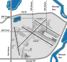
Speedway Field was the original name for the airfield that was to evolve into Minneapolis-St. Paul International Airport, the twelfth busiest airport in the United States; it was also the largest hub for Northwest Airlines[1] and the third largest hub for Delta Air Lines, Northwest's successor.
Speedway Field has its beginning on December 11, 1919, when the Adjutant General recommended to civic groups of Minneapolis and Saint Paul in the U.S. state of Minnesota that the site of the former bankrupted Twin City Motor Speedway be acquired for a new airfield.
The 160 acres (0.65 km2) of land inside the concrete race track oval was first used as an airfield in 1920. It was known as "Speedway Field" and also "Snelling Field" before being dedicated Wold-Chamberlain Field after two World War I pilots, Ernest Groves Wold and Cyrus Foss Chamberlain on July 10, 1923.[2]

- Access to the airfield inside the oval was originally through tunnels under the race track.
- The field used landing strips W-SE - 2700' E-W 2300'
- 1921 hangars for National Guard Observation Squadron were constructed with an appropriation of approximately $45,000 from the Minnesota Legislature.
- 1920 - First hangar for airmail (80' x 90') financed by $15,000 from later used for airmail by Northwest Airlines.
- U.S. Navy Squadron Hangar constructed in 1928.
- Minneapolis Park Board took possession of the field on June 1, 1928. At that time, there were the airmail hangar, the 3 hangars of the National Guard. 1 hangar of Navy and 1 small hangar.[3]
Notes
- ↑ Millett, Larry (2007). AIA Guide to the Twin Cities: The Essential Source on the Architecture of Minneapolis and St. Paul. Minnesota Historical Society Press. p. 177. ISBN 0-87351-540-4.
- ↑ Johnson, Fred (2008) Richfield: Minnesota's Oldest Suburb, Richfield Historical Society
- ↑ Minneapolis-St. Paul Metropolitan Airports Commission History, Volume I: Early Aviation, Metropolitan Area, 1911-1943
Coordinates: 44°53′20″N 93°12′54″W / 44.889°N 93.215°W