St Margaret's Hope
| St Margaret's Hope | |
| Scots: Saunt Marget's[1] | |
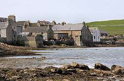 Buildings on the shore at St Margaret's Hope |
|
 St Margaret's Hope |
|
| Population | 550 (approx.) |
|---|---|
| OS grid reference | ND445935 |
| Council area | Orkney Islands |
| Lieutenancy area | Orkney Islands |
| Country | Scotland |
| Sovereign state | United Kingdom |
| Post town | KIRKWALL |
| Postcode district | KW17 2SW |
| Dialling code | 01856 |
| Police | Scottish |
| Fire | Scottish |
| Ambulance | Scottish |
| EU Parliament | Scotland |
| UK Parliament | Orkney and Shetland |
| Scottish Parliament | Orkney |
Coordinates: 58°49′34″N 2°57′40″W / 58.826°N 2.961°W
St Margaret's Hope, known locally as The Hope, is a village in the Orkney Islands, off the north-east coast of Scotland. It has a population of about 550, making it Orkney's third largest settlement after Kirkwall and Stromness.
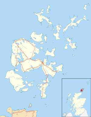
Situated off Water Sound at the head of a sheltered bay on the northern coast of the island of South Ronaldsay, it is connected to the Orkney Mainland by the A961 road across the Churchill Barriers.
The Hope is South Ronaldsay's main village, and is named either after Margaret, Maid of Norway, who may have died there, or St. Margaret, Queen of Scotland, the wife of Malcolm III. The latter explanation is suggested by Victorian Ordnance Survey maps which show the ancient site of an early Christian chapel dedicated to St Margaret. No remnants of this structure can now be seen but it was near the Smiddy Museum (on the present day site of a local authority housing development - Erlend Terrace).
The village has a primary school, a small blacksmith's museum, a number of shops and restaurants. Pentland Ferries run a regular service from the pier in the bay to Gills Bay on the Scottish mainland.
It is also known for its annual Boys' Ploughing Match, a local tradition where young boys plough in the sands at the nearby Sand of Wright, and young girls (or boys, though this is now a rarity) wear traditional 'horse' costumes, called The Festival of the Horse.
Scant traces of an Iron Age broch can be found in a field off the Ontaft road above the village. Again, the site could once be identified by Victorian OS maps, but with the passage of time and all but a 'crop mark' remaining, modern maps fail to show its location.
References
- ↑ "Letter S". The Online Scots Dictionary. Retrieved 1 January 2015.
External links
| Wikimedia Commons has media related to St Margaret's Hope. |