Stabblandet
 Location in Møre og Romsdal | |
| Geography | |
|---|---|
| Location | Nordmøre, Norway |
| Coordinates | 63°11′45″N 8°12′27″E / 63.1959°N 8.2074°ECoordinates: 63°11′45″N 8°12′27″E / 63.1959°N 8.2074°E |
| Area | 25 km2 (9.7 sq mi) |
| Length | 7.5 km (4.66 mi) |
| Width | 6.4 km (3.98 mi) |
| Highest elevation | 908 m (2,979 ft) |
| Highest point | Innerbergsalen |
| Administration | |
| County | Møre og Romsdal |
| Municipality | Aure Municipality |
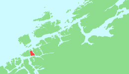
Stabblandet is an island in Aure Municipality in Møre og Romsdal county, Norway. The 25-square-kilometre (9.7 sq mi) island lies to the west of the island of Ertvågsøya, south of Solskjelsøya, east of Tustna, and north of the mainland of Halsa Municipality. Most of the population lives on the northern part of the island. The highest point on the island is the 908-metre (2,979 ft) tall mountain Innerbergsalen.[1]
References
- ↑ "Stabblandet" (in Norwegian). yr.no. Retrieved 2010-12-11.
This article is issued from Wikipedia - version of the 11/17/2016. The text is available under the Creative Commons Attribution/Share Alike but additional terms may apply for the media files.