Staden
| Staden | |||
|---|---|---|---|
| Municipality | |||
 | |||
| |||
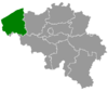
 Staden Location in Belgium | |||
|
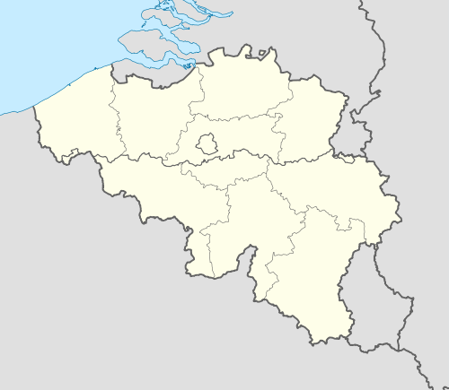
Location of Staden in West Flanders  | |||
| Coordinates: 50°59′N 03°01′E / 50.983°N 3.017°ECoordinates: 50°59′N 03°01′E / 50.983°N 3.017°E | |||
| Country | Belgium | ||
| Community | Flemish Community | ||
| Region | Flemish Region | ||
| Province | West Flanders | ||
| Arrondissement | Roeselare | ||
| Government | |||
| • Mayor | Francesco Vanderjeugd [1] | ||
| • Governing party/ies | NVA, Open VLD and SP.A | ||
| Area | |||
| • Total | 46.24 km2 (17.85 sq mi) | ||
| Population (1 January 2016)[2] | |||
| • Total | 11,173 | ||
| • Density | 240/km2 (630/sq mi) | ||
| Postal codes | 8840 | ||
| Area codes | 051 | ||
| Website | www.staden.be | ||


Staden is a village and rural municipality in the Belgian province of West-Flanders. The municipality has around 11 000 inhabitants.
In the local West-Flemish dialect, the d is not pronounced, which results in Staen as pronunciation.
Geography
In 1976, Staden fused with the smaller villages of Oostnieuwkerke and Westrozebeke into a single municipality. As Staden was the bigger village, its name was used for the resulting municipality. Next to those three village centres, there are also a number of smaller hamlets. At the boundary between Staden, Westrozebeke and Poelkapelle, you can find the hamlet Vijfwegen. And on the boundary between Oostnieuwkerke and Hooglede, you can find the hamlet Sleihage. Both these hamlets had their own church and parish. The remaining population is spread over even smaller hamlets.
| # | Name | Area (km²) | Population (31/12/2009) |
|---|---|---|---|
| I | Staden | 25,43 | 5.424 |
| II | Oostnieuwkerke | 10,80 | 3.447 |
| III (IV) | Westrozebeke - Vijfwegen | 10,00 | 2.181 |
- Source: Website gemeente Staden
The municipality of Staden borders the following villages and municipalities:
- a. Roeselare (town of Roeselare)
- b. Passendale (municipality of Zonnebeke)
- c. Poelkapelle (municipality of Langemark-Poelkapelle)
- d. Houthulst (municipality of Houthulst)
- e. Zarren (municipality of Kortemark)
- f. Handzame (municipality of Kortemark)
- g. Hooglede, (municipality of Hooglede)

History
The village of Staden was founded nearby the castle of Staden, around 1100. That castle was built in the forests, near the road between Ypres and Bruges. The castle of Staden fell mostly under the control of Ypres, but also partially under the control of Bruges.[3] The castle itself was completely destroyed in 1917, during the First World War. Only a part of the moat remains, and a bench built from the stones of the old castle.
Politics
Staden has always been known as a Christian-democrat municipality, like so many other rural municipalities in West-Flanders, where the CVP and later CD&V always held the majority or even absolute majority of the seats, and thus was always able to deliver the mayor.
However, after the election of 2012, it appeared that the Christian-democrats only got 10 of the 21 seats. On the evening of the counting, the three opposition parties: Open Vld, N-VA and sp.a got to an agreement and formed the majority with 11 of 21 seats. After the inauguration in 2013, Francesco Vanderjeugd from the Open Vld was the mayor of Staden. But the tight majority where all seats are needed caused some troubles. Near the end of 2014, Koen Demonie threatened to leave the N-VA, which would cost the majority one seat, and would make the municipality ungovernable.[4]
Mayors of Staden since the fusion
- 1976-1982 : Eugene Dermaut, CVP
- 1983-1992 : Godfried De Tavernier, CVP
- 1992-2012 : Josiane Lowie, CD&V
- 2013-present : Francesco Vanderjeugd, Open Vld
Resultaten gemeenteraadsverkiezingen sinds 1976
| Party | 10-10-1976[5] | 10-10-1982 | 9-10-1988 | 9-10-1994 | 8-10-2000 | 8-10-2006[6] | 14-10-2012[7] | |||||||
|---|---|---|---|---|---|---|---|---|---|---|---|---|---|---|
| Votes / Seats | % | 21 | % | 21 | % | 21 | % | 21 | % | 21 | % | 21 | % | 21 |
| CVP1/CD&V2 | 50,291 | 11 | 42,781 | 10 | 48,211 | 12 | 57,211 | 12 | 57,881 | 12 | 60,122 | 14 | 41,92 | 10 |
| N-VA | - | - | - | - | - | - | 26,89 | 6 | ||||||
| SP1/sp.a2 | - | 13,981 | 2 | 8,631 | 1 | - | - | - | 8,442 | 1 | ||||
| AKTIE | 36,77 | 8 | - | 21,47 | 4 | - | - | - | - | |||||
| NIEUW | 12,95 | 2 | - | - | - | - | - | - | ||||||
| PVV/Open Vld | - | 8,56 | 1 | 21,68 | 4 | - | - | - | 22,77 | 4 | ||||
| AKTIE-N | - | 34,68 | 8 | - | - | - | - | - | ||||||
| SAMEN | - | - | - | 42,79 | 9 | 42,12 | 9 | 32,46 | 7 | - | ||||
| V.V.D.S. | - | - | - | - | - | 7,42 | 0 | - | ||||||
| Total number of votes | 7744 | 7915 | 7993 | 8063 | 8063 | 8219 | 8155 | |||||||
| Attendance % | 96,51 | 96,21 | 95,17 | 95,96 | 94,31 | |||||||||
| Blank and invalid % | 3,06 | 3,49 | 4,5 | 5,53 | 6,23 | 5,84 | 5,42 | |||||||
References
- ↑ Francesco Vanderjeugd new Mayor, accessed 2014-10-06, Dutch
- ↑ Population per municipality as of 1 January 2016 (XLS; 397 KB)
- ↑ http://www.staden.be/WWW/gemeente/onzegemeente/historiek.html
- ↑ http://www.nieuwsblad.be/cnt/dmf20141230_01452354
- ↑ Gegevens 1976-2000:Verkiezingsdatabase Binnenlandse Zaken
- ↑ Gegevens 2006: http://www.vlaanderenkiest.be/verkiezingen2006
- ↑ Gegevens 2012: www.vlaanderenkiest.be/verkiezingen2012
External links
 Media related to Staden at Wikimedia Commons
 |
Kortemark | | ||
| Houthulst Langemark-Poelkapelle |
|
Hooglede Roeselare | ||
| ||||
| | ||||
| Zonnebeke |