Stagecoach Trail
| |
|---|---|
| Route information | |
| Length: | 40 mi (64 km) |
| Existed: | 1837 – present |
| Major junctions | |
| East end: | Lena, Illinois |
| West end: | Galena, Illinois |
| Highway system | |

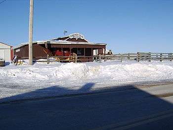
Horsefarm with stagecoach rental on the Stagecoach Trail (the road in the front) in Apple River Township, somewhat west of the village of Apple River (January, 2008)
Stagecoach Trail is a historic route through northern Jo Daviess County and western Stephenson County, in the northwest of Illinois. The trail was a part of the larger Galena–Chicago trail that crossed the entire state.
Stagecoach Trail connects Galena and Lena through the communities of Scales Mound, Apple River, Warren and Nora. It also runs close to the highest point in Illinois, Charles Mound, and the Illinois-Wisconsin border.
The route can be used as an alternative for U.S. Route 20 between Lena and Galena, through picturesque communities and landscapes. Stagecoach rides are offered at several points along the trail. The communities on the Stagecoach Trail, from Lena through Scales Mound feature an annual festival in June.
See also
- "Old Stagecoach Trail" in California.
Bibliography
- Selbert P: "Coach travel, NW Illinois trail traces stage routes". Chicago Tribune, December 5, 1999.
This article is issued from Wikipedia - version of the 7/24/2015. The text is available under the Creative Commons Attribution/Share Alike but additional terms may apply for the media files.