Stahovica
| Stahovica | |
|---|---|
 | |
 Stahovica Location in Slovenia | |
| Coordinates: 46°16′16.76″N 14°36′24.31″E / 46.2713222°N 14.6067528°ECoordinates: 46°16′16.76″N 14°36′24.31″E / 46.2713222°N 14.6067528°E | |
| Country |
|
| Traditional region | Upper Carniola |
| Statistical region | Central Slovenia |
| Municipality | Kamnik |
| Area | |
| • Total | 1.89 km2 (0.73 sq mi) |
| Elevation | 442.9 m (1,453.1 ft) |
| Population (2002) | |
| • Total | 187 |
| [1] | |
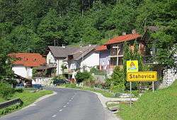
Stahovica (pronounced [staˈxoːʋitsa]) is a settlement that stretches along the road leading into the upper Kamnik Bistrica Valley in the Municipality of Kamnik in the Upper Carniola region of Slovenia.
References
External links

This article is issued from Wikipedia - version of the 1/1/2016. The text is available under the Creative Commons Attribution/Share Alike but additional terms may apply for the media files.