Stains, Seine-Saint-Denis
| Stains | ||
|---|---|---|
|
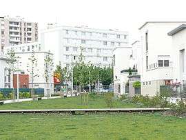
Landscaping in Stains | ||
| ||
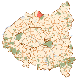 Paris and inner ring departments | ||
| Coordinates: 48°57′00″N 2°23′00″E / 48.9500°N 2.3833°ECoordinates: 48°57′00″N 2°23′00″E / 48.9500°N 2.3833°E | ||
| Country | France | |
| Region | Île-de-France | |
| Department | Seine-Saint-Denis | |
| Arrondissement | Saint-Denis | |
| Canton | Stains | |
| Intercommunality | Plaine Commune | |
| Government | ||
| • Mayor | Azzédine Taïbi | |
| Area1 | 5.39 km2 (2.08 sq mi) | |
| Population (2009)2 | 33,951 | |
| • Density | 6,300/km2 (16,000/sq mi) | |
| Time zone | CET (UTC+1) | |
| • Summer (DST) | CEST (UTC+2) | |
| INSEE/Postal code | 93072 / 93240 | |
|
1 French Land Register data, which excludes lakes, ponds, glaciers > 1 km² (0.386 sq mi or 247 acres) and river estuaries. 2 Population without double counting: residents of multiple communes (e.g., students and military personnel) only counted once. | ||
Stains is a commune in the northern suburbs of Paris, France. It is located 11.6 km (7.2 mi) from the center of Paris.
Heraldry
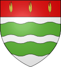 |
The arms of Stains are blazoned : Argent, 2 fesses wavy vert, on a chief gules 3 stalks of wheat slipped and leaved Or. | |
| motto: semina metes (sow and you shall reap) | ||
Transport
Stains is served by Pierrefitte – Stains station on Paris RER line D. This station is located at the border between the commune of Stains and the commune of Pierrefitte-sur-Seine, on the Pierrefitte-sur-Seine side of the border.
Education
Schools in Stains:[1]
- 11 public preschools/nursery schools (maternelles)
- 13 public elementary schools
- 3 public junior high schools: Barbara, Joliot Curie, and Pablo Neruda
- 1 public senior high school/sixth-form college: Lycée polyvalent Maurice Utrillo
- 1 private junior high school: Collège privé Sainte-Marie
International relations
Main article: List of twin towns and sister cities in France
Twin towns — Sister cities
Stains is twinned with:
See also
References
- ↑ "Les établissements scolaires." Stains, Seine-Saint-Denis. Retrieved on September 8, 2016.
External links
| Wikimedia Commons has media related to Stains. |
- Official website
- Official website (in French)
This article is issued from Wikipedia - version of the 9/10/2016. The text is available under the Creative Commons Attribution/Share Alike but additional terms may apply for the media files.