Stamford, Connecticut
| Stamford, Connecticut | ||
|---|---|---|
| City | ||
|
Stamford | ||
| ||
| Nickname(s): The City That Works, Lock City | ||
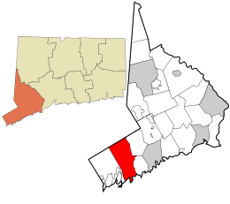 Location in Fairfield County and the state of Connecticut. | ||
 Stamford, Connecticut Location in the United States | ||
| Coordinates: 41°03′10″N 73°32′20″W / 41.05278°N 73.53889°WCoordinates: 41°03′10″N 73°32′20″W / 41.05278°N 73.53889°W | ||
| Country | United States | |
| State | Connecticut | |
| County | Fairfield | |
| NECTA | Bridgeport-Stamford | |
| Region | South Western Region | |
| Settled (town) | 1641 | |
| Incorporated (city) | 1949 | |
| Consolidated | 1949 | |
| Government | ||
| • Type | Mayor-Board of representatives | |
| • Mayor | David Martin (D) | |
| Area | ||
| • City | 52.1 sq mi (134.9 km2) | |
| • Land | 37.7 sq mi (97.9 km2) | |
| • Water | 14.3 sq mi (37.0 km2) | |
| • Urban | 465 sq mi (1,205 km2) | |
| Elevation | 23 ft (7 m) | |
| Population (2014)[1] | ||
| • City | 128,278 | |
| • Density | 3,180/sq mi (1,226/km2) | |
| • Metro | 916,829 | |
| Demonym(s) | Stamfordian | |
| Time zone | Eastern (UTC-5) | |
| • Summer (DST) | Eastern (UTC-4) | |
| ZIP code | 069xx | |
| Area code | 203/475 | |
| FIPS code | 09-73000 | |
| GNIS feature ID | 0211129 | |
| Website |
www | |

Stamford is a city in Fairfield County, Connecticut, United States. According to the 2010 census, the population of the city is 122,643. As of July 1, 2014, according to the Census Bureau, the population of Stamford had risen to 128,278, making it the third largest city in the state and the seventh largest city in New England. Approximately 30 miles (50 kilometers) from Manhattan, Stamford is in the Bridgeport-Stamford-Norwalk Metro area which is a part of the Greater New York metropolitan area.
Stamford is home to four Fortune 500 Companies,[2] nine Fortune 1000 Companies, and 13 Courant 100 Companies, as well as numerous divisions of large corporations. This gives Stamford the largest financial district in New York Metro outside New York City itself and one of the largest concentrations of corporations in the nation.Stamford is also home to the Stamford Waterside Design District - a creative neighborhood and shopping destination dedicated to Interior Design and Architecture.
History
Stamford was known as Rippowam by the Native American inhabitants to the region, and the very first European settlers to the area also referred to it as such. The name was later changed to Stamford after the town Stamford, Lincolnshire, England. The deed to Stamford was signed on July 1, 1640 between Captain Turner of the New Haven Colony and Chief Ponus. By the 18th century, one of the primary industries of the town was merchandising by water, which was possible due to Stamford's proximity to New York.
In 1692, Stamford was home to a less famous witch trial than the well-known Salem witch trials, which also occurred in 1692. The accusations were less fanatical and smaller-scale but also grew to prominence through gossip and hysterics.[3]
Starting in the late 19th century, New York residents built summer homes on the shoreline, and even back then there were some who moved to Stamford permanently and started commuting to Manhattan by train, although the practice became more popular later. Stamford incorporated as a city in 1893.
In 1950, the Census Bureau reported the city's population as 94.6% white and 5.2% black.[4]
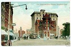
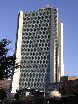
In the 1960s and 1970s, Stamford's commercial real estate boomed as corporations relocated from New York City to peripheral areas.[5] A massive urban redevelopment campaign during that time resulted in a downtown with many tall office buildings. The F.D. Rich Co. was the city-designated urban renewal developer of the downtown in an ongoing redevelopment project that was contentious, beginning in the 1960s and continuing through the 1970s. The company put up what was the city's tallest structure, One Landmark Square, at 21 floors high, and the GTE building (now One Stamford Forum), along with the Marriott Hotel, the Stamford Town Center and many of the other downtown office buildings. One Landmark Square has since been dwarfed by the new 35-story Trump Parc condominium tower (topped out), and soon by the 400-foot 39 story Ritz Carlton Hotel and Residences development, another project by the Rich Company in partnership with Cappelli Enterprises.[6] Over the years, other developers have joined in building up the downtown, a process that continued, with breaks during downturns in the economy, through the 1980s, 1990s and into the new century.
Since 2008, an 80-acre mixed-use redevelopment project for the Stamford's Harbor Point neighborhood has added additional growth south of the city's Downtown area. Once complete, the redevelopment will include 6,000,000 square feet (560,000 m2) of new residential, retail, office and hotel space, and a marina. As of July 2012, roughly 900 of the projected 4,000 Harbor Point residential units had been constructed.[7]
Geography
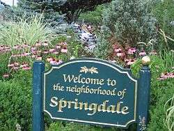
Stamford is situated near the southwestern point of Connecticut. It comprises a number of neighborhoods and villages including Cove-East Side, Downtown, North Stamford, Glenbrook, West Side, Turn Of River, Waterside, Springdale, Belltown, Ridgeway, Newfield, South End, Westover, Shippan, Roxbury and Palmers Hill. There are still a number of references to North Stamford as a separate town, but they legally and functionally act as one town. Surrounding towns include Pound Ridge, New York to the north, Greenwich to the west, and both Darien and New Canaan to the east.
The city has an area of 52.09 square miles, making it the largest city by area in the state.
Climate
Stamford, like the rest of coastal Connecticut, lies in the broad transition zone between the cold continental climate to the north (Köppen climate classification: Dfa) and the more mild temperate/subtropical climate (Köppen Cfa), to the south. Coastal Connecticut, Long Island/NYC, and northern New Jersey are the general dividing line between theses two climate zones.
The warm/hot season in Stamford is from mid-April through late October. Late day thundershowers are common in the hottest months (June, July, August), despite the mostly sunny skies. The cool/cold season is from late November though mid March. Winter weather is far more variable than summer weather along the Connecticut coast, ranging from sunny days with higher temperatures to cold and blustery conditions with occasional snow. Like much of the Connecticut coast and nearby Long Island, NY, some of the winter precipitation is rain or a mix and rain and wet snow in Stamford. Stamford averages about 30 inches (75 cm) of snow annually, compared to inland areas like Hartford and Albany which average 45–60 inches (110–150 cm) of snow annually.
Although infrequent, tropical cyclones (hurricanes/tropical storms) have struck Connecticut and the Stamford metropolitan area. Hurricane landfalls have occurred along the Connecticut coast in 1903, 1938, 1944, 1954 (Carol), 1960 (Donna), 1985 (Gloria). Tropical Storm Irene (2011) also caused moderate damage along the Connecticut coast, as did Hurricane Sandy (which made landfall in New Jersey) in 2012.
Coastal Connecticut is the broad transition zone where so-called "subtropical indicator" plants and other broadleaf evergreens can successfully be cultivated. Stamford averages about 90 days annually with freeze - about the same as Baltimore, Maryland. As such, Southern Magnolias, Needle Palms, Windmill palm, Loblolly Pines, and Crape Myrtles are grown in private and public gardens. Like much of coastal Connecticut, Long Island, and coastal New Jersey, the growing season is rather long in Stamford - averaging 210 days from April 8 to November 5 according to the National Weather Service in Bridgeport.
| Climate data for Stamford, Connecticut | |||||||||||||
|---|---|---|---|---|---|---|---|---|---|---|---|---|---|
| Month | Jan | Feb | Mar | Apr | May | Jun | Jul | Aug | Sep | Oct | Nov | Dec | Year |
| Record high °F (°C) | 69 (21) |
74 (23) |
85 (29) |
96 (36) |
97 (36) |
97 (36) |
102 (39) |
104 (40) |
97 (36) |
86 (30) |
82 (28) |
76 (24) |
104 (40) |
| Average high °F (°C) | 38.2 (3.4) |
41.3 (5.2) |
50.4 (10.2) |
62.1 (16.7) |
72.8 (22.7) |
80.7 (27.1) |
85.4 (29.7) |
83.3 (28.5) |
75.5 (24.2) |
64.7 (18.2) |
53.3 (11.8) |
42.5 (5.8) |
62.52 (16.96) |
| Average low °F (°C) | 19.2 (−7.1) |
21.0 (−6.1) |
28.7 (−1.8) |
37.6 (3.1) |
47.4 (8.6) |
56.2 (13.4) |
61.6 (16.4) |
60.6 (15.9) |
53.2 (11.8) |
41.6 (5.3) |
33.5 (0.8) |
24.8 (−4) |
40.45 (4.69) |
| Record low °F (°C) | −18 (−28) |
−14 (−26) |
−6 (−21) |
16 (−9) |
28 (−2) |
35 (2) |
43 (6) |
37 (3) |
28 (−2) |
16 (−9) |
7 (−14) |
−13 (−25) |
−18 (−28) |
| Average precipitation inches (mm) | 4.50 (114.3) |
3.32 (84.3) |
4.70 (119.4) |
4.51 (114.6) |
4.97 (126.2) |
4.33 (110) |
4.09 (103.9) |
4.26 (108.2) |
4.82 (122.4) |
4.42 (112.3) |
4.58 (116.3) |
4.29 (109) |
52.79 (1,340.9) |
| Average snowfall inches (cm) | 9.3 (23.6) |
8.3 (21.1) |
4.9 (12.4) |
.8 (2) |
trace | 0 (0) |
0 (0) |
0 (0) |
0 (0) |
0 (0) |
.7 (1.8) |
4.6 (11.7) |
28.6 (72.6) |
| Average precipitation days | 10.5 | 9.7 | 10.9 | 12.5 | 12.5 | 11.7 | 10.2 | 9.7 | 9.8 | 9.2 | 10.6 | 11.3 | 128.6 |
| Average snowy days | 4.8 | 4.3 | 2.5 | .4 | 0 | 0 | 0 | 0 | 0 | 0 | .4 | 2.7 | 15.1 |
| Source #1: NCDC[8] | |||||||||||||
| Source #2: Weather Channel[9] | |||||||||||||
Neighborhoods
Stamford is composed of approximately 45 distinct neighborhoods, including 2 historic districts.

Zip Codes
The commonly known neighborhoods throughout Stamford (with ZIP Codes that roughly cover the same areas) are as follow:
- 06901 - Downtown.
- 06902 - Cove, Dolphin Cove, East Side, Harbor Point, Roxbury, Shippan, Shippan Point, South End, Waterside, West Side, and Westover.
- 06903 - Long Ridge, North Stamford, and Scofieldtown.
- 06905 - Belltown, Bulls Head, Hubbard Heights, Mid-Ridges, Newfield, Revonah Woods, Ridgeway, and Turn of River.
- 06906 - Glenbrook.
- 06907 - Springdale.
Islands
Five islands are situated in Long Island Sound: Cove Island, Grass Island, Greenway Island, Jack Island, and Vincent Island.
Demographics
| Historical population | |||
|---|---|---|---|
| Census | Pop. | %± | |
| 1880 | 2,540 | — | |
| 1890 | 10,396 | 309.3% | |
| 1900 | 15,997 | 53.9% | |
| 1910 | 25,138 | 57.1% | |
| 1920 | 35,096 | 39.6% | |
| 1930 | 46,346 | 32.1% | |
| 1940 | 47,938 | 3.4% | |
| 1950 | 74,293 | 55.0% | |
| 1960 | 92,713 | 24.8% | |
| 1970 | 108,798 | 17.3% | |
| 1980 | 102,466 | −5.8% | |
| 1990 | 108,056 | 5.5% | |
| 2000 | 117,083 | 8.4% | |
| 2010 | 122,643 | 4.7% | |
| Est. 2015 | 128,874 | [10] | 5.1% |
| U.S. Decennial Census 2013 Estimate | |||
The population density is 3,101.9 people per square mile (1,197.5/km²).
Age and gender
The proportion of the population under the age of 18 was 21.6%, age 18 to 24 was 7.8%, age 25 to 44 was 32.5%, age 45 to 64 was 25.0%, and 65 years of age or older was 13.1%. The median age of 37.1 is slightly lower than the US median age of 37.2. Composition of the population based on sex is 50.7 females to 49.3 males. (Source: 2000 U.S. Census)
Education
Stamford has one of the highest educated populations in the US. Nine out of ten are high school graduates. Those possessing a bachelor's degree or higher is estimated at 43.6% of the population. Stamford is tied with Iowa City, Iowa for the US metropolitan area with the highest percentage of the adult population holding a bachelor's degree or higher; 44 percent of adults hold a degree.[11]
Ethnicity and race
The 2010 Census Population for Stamford is 122,643. A 2009 Census survey estimated 48,676 housing units to be in existence. Stamford's population characteristics are as follows (Source:U.S. Census Bureau, 2010 US Census):
- White - 53.3%
- Hispanic - 23.8%
- Black - 13.1%
- Asian - 7.8%
- Two or More Races - 1.4%
- All Other Races - 0.5%
More than one out of three residents (35%) are foreign born. A language other than English is spoken at home by 45% of the population. The main ancestries of the population (Source: 2013 American Community Survey Estimate) are: Italian (12.4%), Irish (5.9%), Polish (4.5%), English (2.9%), German (2.9%), and Russian (2.3%). The top ten countries of origin for the foreign-born population (Source: 2010 US Census Bureau) are:
- Guatemala - 7,707
- India - 5,133
- Haiti - 5,071
- Jamaica - 2,753
- Colombia - 2,679
- Peru - 2,560
- Mexico - 2,478
- Ecuador - 2,313
- China - 1,991
- Honduras - 1,279
Housing
There are 47,317 housing units at an average density of 1,253.6 per square mile (484.0/km²). There are 45,399 households out of which 28.7% had children under the age of 18 living with them, 48.5% were married couples living together, 11.5% had a female householder with no husband present, and 36.2% were non-families. 28.7% of all households were made up of individuals and 9.8% had someone living alone who was 65 years of age or older. The average household size was 2.54 and the average family size was 3.13.
Income
According to a 2007 estimate, the median income for a household in the city was $72,315, and the median income for a family was $88,205.[12] Males had a median income of $48,386 versus $36,958 for females. The per capita income for the city was $34,987. About 5.4% of families and 7.9% of the population were below the poverty line, including 8.7% of those under age 18 and 9.7% of those age 65 or over.
Politics
Stamford is predominantly Democratic, yet the least Democratic of Connecticut's urban cities. The current mayor is David Martin, a Democrat. Notable Republicans include former US representative Chris Shays, former Lieutenant Governor Michael Fedele, and former mayor Michael Pavia. Democrats include Governor Dannel Malloy, US Senator/former CT Attorney General Richard Blumenthal, CT Attorney General George Jepsen, former US Attorney General/mayor Homer Stille Cummings, and CT Supreme Court Justice Andrew J. McDonald. Other notable politicians with Stamford roots include Independent (former Democrat) US Senator/2000 Vice-Presidential nominee/CT Attorney General Joseph Lieberman, conservative commentator William F. Buckley, Jr., and French Prime Minister Georges Clemenceau.
| Voter registration and party enrollment as of October 30, 2014[13] | |||||
|---|---|---|---|---|---|
| Party | Active voters | Inactive voters | Total voters | Percentage | |
| Republican | 12,660 | 582 | 13,242 | 21.17% | |
| Democratic | 23,564 | 1,547 | 25,111 | 40.15% | |
| Unaffiliated | 21,491 | 1,603 | 23,094 | 36.93% | |
| Minor parties | 1,015 | 80 | 1,095 | 1.75% | |
| Total | 58,730 | 3,812 | 62,542 | 100% | |
Transportation
Mass transit
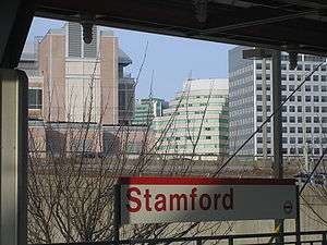
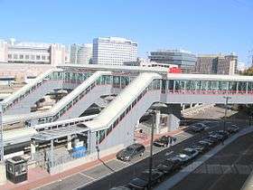
Stamford is located on the main branch of the New Haven Line on the Metro-North Railroad, the commuter rail system for northern metropolitan New York City. Stamford is the third busiest station on the Metro-North system and serves as a major transfer point for local trains. Stamford Station is also the terminus of a Metro-North branch that ends in New Canaan, 8 mi (13 km) away, and a part-time terminal of Shore Line East trains. Two smaller train stations in Stamford are Glenbrook and Springdale, both a part of the New Canaan branch. With a recent spike in development in the East Side neighborhood, the city is considering putting in a proposal to construct a new stop to service the East Main Street area close to the New Canaan branch overpass.
Commuter trains come into Stamford from all points between New London to the east and New York (Grand Central Terminal) to the south. Many express (non-stop) trains leave Stamford each morning and evening for Grand Central. The average non-stop commute is forty-seven minutes. Stamford has seen a significant increase in ridership. Much of this increase is a result of reverse commuting, individuals commuting from New York City to Stamford for work. Trains operate from the Stamford station between 4:43 AM (first departure to Grand Central) until 12:55 AM (last departure to Grand Central). On the weekends the first departure for Grand Central occurs at 5:03 AM. Fares during rush hour (on peak) are higher than during non-rush hour (off peak). On peak fares are charged between 4:43 AM – 9:10 AM for trains originating to Grand Central. Trains in transit to Stamford are charged on peak fares from 5:35 AM – 8:37 AM and from 4:02 PM – 7:40 PM. On peak fares do not apply on weekends and/or holidays. Tickets can be bought on board, yet the surcharge can make the price steep.
Stamford also serves as a station along the Amtrak route. Acela, the high speed train service between Boston and Washington, makes several daily stops in Stamford. Amtrak's Regional (Springfield, Massachusetts to Washington, D.C.) and Vermonter (Saint Albans, Vermont to Washington, D.C.) also make daily stops in Stamford. Amtrak tickets can be purchased on the upper level of the Stamford station.
Late in 2007 the city contracted a private San Francisco company to conduct a 6-month feasibility study to look at the possibility of creating an inner-city light rail line. With the proposed Harbor Point development set to break ground in the South End neighborhood sometime in 2008, the idea is to create a line that would connect the new developments to points north, such as the transportation center, Landmark Square in downtown and other various points up to the Bulls Head area.
Airports
Stamford is within reasonable driving distance of four airports: One regional, three international. Regional: Westchester County Airport (often referred to as White Plains Airport) which borders the town of Greenwich. International: LaGuardia Airport and John F. Kennedy International Airport both in Queens, N.Y., and Newark Liberty International Airport in Newark & Elizabeth, New Jersey.
Buses
City bus transportation is provided by CT Transit, which is run and financed by the Connecticut Department of Transportation. The main terminal is adjacent to the train station on State Street, under the I-95 highway. Bus service runs along major arterial roads through the towns of Darien, Norwalk, Greenwich and Port Chester, New York. A non-stop direct route is also offered to White Plains, New York. Commuters can connect in Norwalk to points as far east as Milford and as far north as Danbury. Additional connections can be made in Port Chester and White Plains to all points covered by the Bee-Line bus system in Westchester County.
Greyhound and Peter Pan provides some bus service from the lower level of the Stamford train station. Same bus service is provided to New Haven (Union Station), Boston (South Station), and New York (Port Authority).
Highways
Two limited-access highways run through the city. Interstate 95 serves as the main route through downtown Stamford with four exits (6-9). The Merritt Parkway runs through the northern part of the city. This road is designated for passenger vehicles only. Any congestion on the Merritt Parkway is mostly likely to occur on the southbound lane in the morning and the northbound in the evening (route to and from New York). At night, due to the absence of lighting, visibility on the Merritt Parkway is relatively poor. Stamford exits on the Merritt Parkway are 33-35, and exit 36 is just over the border in New Canaan.
Stamford is also served by four other state highways. Route 1, also known as Main Street in Stamford, is also used as a major artery during the morning and evening commute. Most traffic via Route 1 is short distance or fairly local, yet vehicles have utilized Route 1 during times of heavy congestion on I-95 as a re-route. Route 137 (Washington Boulevard and High Ridge Road) is the main north-south road of the city and runs from the Stamford Transportation Center and serves the Turn of River, North Stamford, and High Ridge sections of the city. Route 104 (Long Ridge Road) branches off from Route 137 to serve the Long Ridge section. Route 106 (Courtland Avenue) serves the Glenbrook neighborhood and continues towards the town of Darien.
Economy
Stamford's cluster of corporate headquarters includes a number of Fortune 500, Fortune 1000 and Courant 100 companies.
Among the larger companies with headquarters in Stamford are United Rentals, Vineyard Vines, WWE, Tasty Bite, Pitney Bowes, Gen Re, GenWorth, Nestle Waters, Synchrony Financial, Oracle, Frontier Communications, Starwood Hotels and Resorts Worldwide, Crane Co., and Charter Communications. UBS also has its North American headquarters here and its trading floor holds the Guinness World Record as the largest column-less trading floor in the world. The Royal Bank of Scotland moved its North American operations into Stamford in 2009, including its RBS Greenwich Capital subsidiary.[14]
The Harbor Point development, located in the South End, is one of the largest private-sector development projects in the United States.[15] Many large retail stores, such as Design within Reach and Fairway Market have moved in, along with multiple hedge funds.
Crime
Stamford was the ninth-safest city in the US in 2006 (among cities with populations of 100,000 or more), up from the 11th safest in 2005, according to the FBI. The 2006 ranking represented the sixth consecutive year the city ranked in the top 11. FBI crime statistics for the city showed crime went down 1.7 percent in 2006 because of a plunge in property crimes. But the rate of violent crime went up by a total of 29 percent in the two years 2005 and 2006 combined. The increase was due in part due to violent gang battles, often on the West Side.[16]
The violent crime rate climbed five years in a row up through 2006, and the 2005 increase was also in the double digits. The city's 300-officer police force responded to 393 reports of violent crimes in 2006, up from 353 in 2005 and 305 in 2004. The total number of serious assaults dropped from 183 in 2005 to 172 in 2006, according to city records. Robberies rose from 150 to 197 in 2006. Serious assaults dropped 6 percent.[16]
There were three homicides and 23 rapes in 2006, up from two homicides and 18 rapes in 2005. The city reported 2,697 total crimes. With populations close to that of Stamford, Bridgeport (ranked 25th) reported 8,496, Hartford (ranked 26th) reported 10,955 and Waterbury reported 6,447 (New Haven hasn't reported statistics to the FBI in years.)[16]
Criminal cases are prosecuted by The State's Attorney's Office and Stamford is home to a State Superior Court which is located on Hoyt Street.
Emergency services
Stamford Emergency Medical Services
A not-for-profit agency, Stamford Emergency Medical Services (SEMS) provides pre-hospital emergency care in Stamford, Connecticut. SEMS also provides contracted paramedic intercept response to Darien Emergency Medical Services, located in Darien, Connecticut. SEMS is the only Connecticut EMS service accredited by the Commission on the Accreditation of Ambulance Services (CAAS). All SEMS units are staffed by at least one Connecticut-licensed paramedic.[17] Stamford EMS responds to 14,000 calls annually.
In Stamford, medical facilities include;
- Stamford Hospital , Level II Trauma Center
- Tully Health Center
- Franklin Street Community Health Center
Fire department
Fire protection in the city of Stamford is provided by the paid The Stamford Fire Department(SFD) and 4 all-volunteer Fire Departments: Glenbrook-New Hope, Belltown, Springdale, Turn of River, and 1 Combination Company, Long Ridge. The Stamford Fire Department operates out of 7 Fire Stations(including 2 Substations) and share quarters with 2 volunteer fire departments(Glenbrook-New Hope and Springdale). The SFRD's primary response district includes the southern, more urban sections of the city, including Downtown, East Side, West Side, Woodside, and South End areas of the city. The 5 volunteer fire departments' primary response districts include the Northern, more residential sections of the city, from Downtown to the New York State border. The SFRD's 290 paid members staff a total of 9 Engines, 3 Trucks, 1 Rescue, and a Deputy Chief's Command Vehicle. The Stamford Fire Department Department responds to over 11,000 emergency calls annually. The 5 all-volunteer fire departments each operate 1 to 2 Fire Stations in their own tax districts. The volunteers man a combined apparatus fleet of 14 Engines, 3 Trucks, 5 Rescues, and their own Command Vehicles, as many other special units and respond to all calls in their respected districts in conjunction with the paid fire department.
Budgeting and districting of the various fire departments throughout the city has been unstable since 2007, due to an extended legal conflict between the volunteer departments and the Malloy administration.[18] As of May 16, 2012, a decision was reached by the city's charter revision committee to combine the paid and volunteer fire departments into one combination fire department, known as the Stamford Fire Department. The new department would be headed by a paid Chief of Department, appointed by the mayor, and 2 paid Assistant Chiefs, 1 appointed by the mayor to oversee the operations of the paid wing of the new department, and 1 appointed by the volunteer fire companies to oversee the operations of the volunteer wing of the new department. The joining of the paid and 5 -volunteer fire departments would promote better public safety for the city, a smoother incident command system, and a better incident response system.[19]
Below is a list of the paid Stamford Fire Department firehouses and companies.
| Engine Company | Truck Company | Special Unit | Chief | Address | Neighborhood |
|---|---|---|---|---|---|
| Engine 1 | Truck 1 | Unit 9 (Field Command Unit), LDH Hose Wagon 1, Engine 12 (Reserve) | Unit 1 (Chief of Dept.), Unit 2 (Asst. Chief), Unit 3 (Asst. Chief), Unit 4 (Deputy Chief) | 629 Main St. | Downtown |
| Engine 2 | Truck 2 | Haz-Mat. Unit 1, Haz-Mat. Unit 2, Decon. Trailer | 215 Washington Blvd. | South End | |
| Engine 3 | Truck 3 | Trench Rescue Trailer | 80 Fairfield Ave. | West Side | |
| Engine 4 | ATV Unit, Engine 15 (Reserve) | 364 Shippan Ave. | East Side/Shippan | ||
| Engine 5 | Rescue 1, Tech. Rescue Trailer | 1600 Washington Blvd. | Woodside | ||
| Engine 6 | 17 Arthur Pl. | Glenbrook (Glenbrook-New Hope Vol. FD) | |||
| Engine 7 | 950 Hope St. | Springdale (Springdale Vol. FD) | |||
| Engine 8 | 28 Vine Rd. | Turn of River | |||
| Engine 9 | 50 Roxbury Rd. | Roxbury (Turn of River Vol. FD) | |||
| Maintenance Facility | Engine 10 (Reserve), Engine 11 (Training), Engine 13 (Spare), Engine 14 (Spare), Engine 15 (Spare), Truck 4 (Spare), Truck 5 (Spare), Rescue 2 (Spare) | Unit 6 (Deputy Chief), Unit 7 (Safety Officer) | 148 Magee Ave. | Shippan |
Police department
The Stamford Police Department(SPD) is Stamford's only police force and has lost four officers in the line of service since 1938. The 2008 force was composed of 1 chief, 2 assistant chiefs, 7 captains, 11 lieutenants, 52 sergeants, 215 officers and 67 civilian employees.[20] Aside from Police Headquarters, located at 805 Bedford St. in Downtown Stamford, SPD also operates substations in Stamford's West Side at Wilson St. and W. Main St. and at 1137 High Ridge Rd and Hope Street. The current Chief of Police is Jonathan Fontneau.[21]
Education
Stamford has branches of the University of Connecticut, University of Bridgeport and Sacred Heart University. The University of Connecticut's campus is located in a large modern building in downtown that opened in 1998 after extensive renovations to an abandoned former Bloomingdale's store that closed in 1990.[22] The branches of the University of Bridgeport and Sacred Heart University are located in the River Bend Executive Center, Fairfield County's premier communication and information high tech park. All are commuter campuses.
As no study has been conducted to assess the cost of education in Stamford, it is difficult to tell whether or not Stamford has a well-funded public education system. Although providing a public education is a state responsibility, Connecticut ranks near the bottom in state share of public education expenditures. Thus, the majority of education funding must come from local governments like that of Stamford. According to the State Department of Education, in the 2004-05 academic year, 42.7% of Stamford's public school students were economically disadvantaged, 34.8% did not have English as a home language and 11.6% were students with disabilities. Research has shown that these populations need additional resources to meet state academic standards. Owing to the state school finance system, the burden of these extra necessary costs of education falls primarily on Stamford's local government. The public school system is an integrated district with racial balance requirements exceeding those of the state of Connecticut. State standards require that a school's racial makeup be within 25% of the community's racial makeup. Stamford's standard is a more strict 10%. Over the years, schools have become unbalanced.
Stamford has several public high schools, Westhill High School, Stamford High School, and the Academy of Information Technology and Engineering. The city also has several private schools, including King Low Heywood Thomas, The Long Ridge School, Trinity Catholic High School, Villa Maria School, and Bi-Cultural Jewish Day School as well as two state charter schools: Trailblazers Academy Charter Middle School[23] and Stamford Academy Charter High School,[24] both operated by human services nonprofit Domus.[25]
Libraries
Stamford's public library, the Ferguson Library, is one of the largest in Connecticut. The main library downtown is the second in the country to rent space to a Starbucks (since September 1999).[26] The store has its own doors to the street and to the library, and is open earlier and later than the library. The library also shows movies and has a used-book store run by Friends of Ferguson Library.
The library has branches in South End, Springdale, and the Turn of River sections of the city, it also has a bookmobile that runs daily to different neighborhoods. The Turn of River branch, officially called the Harry Bennett Branch, is the largest library branch in the state. That branch also has a used book store run by Friends of Ferguson Library.
Sports
The first Marathon race to be held in the United States, on September 19, 1896, had its start line at Stamford Armory. The race, which finished in Williamsbridge, Bronx, was won by John J. McDermott of New York City in a time of 3:25:55.6.
The New England Force, a professional soccer team based in Stamford, made its debut in the American Soccer League in August 2014.[27]
Parks and recreation sites
- Cummings Park, a public beach, was once a popular spot for shellfishing. The park, developed in 1906, had been known as Halloween Park because Mayor Homer Cummings cast the deciding vote to create it on Halloween Night.[28]
- The 83-acre (340,000 m2) Cove Island Park, once a farm and then an enormous factory site (Stamford Manufacturing Company), offers visitors a choice of beaches as well as picnic grounds and bluffs. It has a small wildlife sanctuary in the southwest corner that might be interesting for bird watchers. SoundWaters Community Center for Environmental Education is located at the northeast part of the park.
- Jackie Robinson Park on the West Side is named after baseball legend Jackie Robinson, who lived in Stamford.
- Terry Connors Ice Rink[29] shares a parking lot with Cove Island Park. It offers public ice skating for all ages and ability levels, group lessons, and ice hockey. It is the home of the Stamford Youth Hockey Association.[30] Open skating is scheduled regularly, and costs are $6 for children or students and $8 for adults. Skate rentals are also available for $4.
- Scalzi Park on Bridge Street has a playground, baseball and softball fields, volleyball courts, tennis courts, bocce courts, basketball courts, roller hockey courts, and a baseball stadium named "Cubeta Stadium." Stamford baseball leagues play baseball there. J.M. Wright Technical High School is next to the park. A skate park was opened at Scalzi in July 2007. The city sought input from users in planning the $309,850, concrete skate park and hired Grindline Skateparks Inc. of Seattle, Washington to provide a unique design and build it.[31]
- Stamford has two municipal golf courses. Sterling Farms Golf Course[32] opened in May 1972 and is the more popular of the two courses.[33] The facility also has a driving range, restaurant, and six tennis courts. In the fall of 2005, Sterling Farms began Phase 1 of an extensive renovation project which will result in improvements to the entire golf course and adjacent facilities. Each fall and spring since 2005, 3 to 4 different holes have been renovated resulting in new tees, bunkers and cart paths. At this point, the entire front 9 has been completed and the back 9 is well underway. All is expected to be completed in the fall of 2010. E. Gaynor Brennan Golf Cours,[34] referred to locally as Hubbard Heights, opened for play in 1922 as a private course and was purchased by the city in 1949. A long range Master Plan is being designed by Stephen Kay - Doug Smith Golf Course Design and renovation work is scheduled to begin in the fall of 2010.
- Mill River Park - This park is located in the center of downtown but its ancient grist mill (present when George Washington traveled through Stamford) was modernized in the 1920s. The result was interference with the seasonal changes in the riverflow, chronic backup of silt, a loss of wildlife and an accumulation of debris. Demolition of the dam to re-establish the natural flow of the river and create a park designed by OLIN (the same firm that designed Bryant Park in New York) is complete or nearly complete. There are numerous fun community activities offered at the park coordinated by the Mill River Park Collaborative, including fitness and yoga classes, movie nights and various kids activity programs.The renovation of this park established a great location and source for community interaction, especially in an ever expanding city like Stamford.
- Dorothy Heroy Park Is located in North Stamford, just south of Pound Ridge, NY.
- he Italian Center[35] features tennis courts, swimming pools, fitness centers, a playground and a miniature golf course.
- The YMCA[36] of Stamford offers swimming lessons and sports which include; basketball and indoor soccer. Programs are also available periodically for physical fitness.
- The Stamford Yacht Club[37] is a private organization that provides members with access to Boating activities and additional amenities.
Arts, science, and cultural attractions
Science and nature
- The Stamford Museum and Nature Center on a 118-acre (0.48 km2) site in the northern end of town, has a collection of works by Gutzon Borglum, the sculptor of Mount Rushmore, who was a Stamford resident for a decade.
- The Fairfield County Astronomical Society was started up in 1954 runs the Stamford Observatory, which has a 22-inch (560 mm) telescope.
- Bartlett Arboretum and Gardens is a 91-acre (370,000 m2) botanical gardens and science education center boasting over 850 specimen trees and plants from around the world. It is also home to several Champion Trees; the largest of their species within Connecticut.
- SoundWaters Community Center for Environmental Education is located in Cove Island Park.
Theatre and film
- Curtain Call Inc. presents plays and other entertainment at the Sterling Farms Theatre Complex, 1349 Newfield Ave.
- Stamford Center for the Arts: The Palace Theatre, originally opened as a vaudeville house in 1927, reopened as a nonprofit theater in 1983. It was joined in 1992 by the Rich Forum, another downtown venue. Both have been run by the Stamford Center for the Arts. The Rich Forum is now being rented by NBC Universal as a television studio.
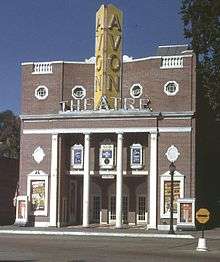
- Bow Tie Cinemas has two first-run movie houses in Stamford with a total of 15 movie screens: Landmark 9 and Majestic 6. On February 13, 2004, the Avon Theatre Film Center, a 2 screen nonprofit movie house focusing on first-run independent films, opened in the historic Avon Theatre on Bedford Street. In Springdale, the two-screen State Cinema, run by Garden Homes Cinemas of Stamford, also shows first-run films. The Ferguson Library also shows films.
Films shot in Stamford
Music
- Stamford Symphony Orchestra In a typical season, the SSO gives five pairs of classical concerts and three pops concerts at the 1,586-seat Palace Theatre, as well as a concert for elementary school students and a family concert series.
- Connecticut Grand Opera, a not-for-profit, professional opera company performs at the Palace Theatre. On its web site, the CGO claims to offer "the most ambitious opera season of any company between New York and Boston."
- Alive @ Five is an annual summer concert located in Columbus park typically lasting 6 weeks.
- Treetops CMS, a non-profit chamber music organization, is located in Westover, providing six chamber music concerts annually, as well as art exhibits and installations.
Fine Art
- Franklin Street Works maintains an art space in the downtown area.
- Stamford Loft Artists Association provides support for visual artists and opportunities to exhibit their work.
Interior Design Community
The Stamford Waterside Design District is a creative neighborhood and shopping destination dedicated to Interior Design and Architecture.
- AWK Design Antiques
- Dedar
- Duralee
- Fordham Marble - Founded in 1905 by Salvatore Sardo, Fordham Marble has stood the test of time. For more than 110 years, and under the guidance of the same family, Fordham Marble has built a rock solid reputation for superior workmanship and innovation one project at a time.Fordham Marble's focus on craftsmanship and relationships, coupled with investments in the latest technologies has resulted in a superior product worthy of your next project.
- J.D. Staron provides original carpet and rug designs that range from edgy contemporary weaves to reproductions of exquisite antique carpets.
- Kravet Inc. is an industry leader in to-the-trade home furnishings including fabrics, furniture, wall coverings, trimmings, carpets, drapery hardware and accessories
- Schwartz Design Showroom is a family-run business with interior design showrooms in New Jersey and Connecticut, both catering exclusively to the trade. Their mission is to help interior designers and architects create unique experiences for their clients...and grow their businesses.
- Stark
- SWC Office Furniture
Media
- NBCUniversal moved the offices of its sports division[38] to Stamford from the company's Rockefeller Center headquarters in Manhattan. All studio shows are now based out of Stamford, including Football Night in America. In addition, three of NBCU's syndicated programs relocated to the Rich Forum Theatre: Maury came to Stamford from New York City, while The Jerry Springer Show and The Steve Wilkos Show had been based in Chicago.
- The Yes Network headquarters[38]
- WWE has its international headquarters in Stamford.
- Soap operas All My Children and One Life to Live were taped in Stamford in 2013.
- Stamford, Connecticut served as a location for one of five branches of the fictional Dunder Mifflin paper company from the US television series, The Office.
- The 2001-2005 television sitcom My Wife and Kids starring Damon Wayans was set in Stamford.
- The TBS sitcom Are We There Yet was filmed at the Connecticut Film Center located in Stamford.
- The fictional movie, Take My Hand, from the episode, "I Heart Connecticut" of the NBC show 30 Rock was set and filmed in Stamford.
- Television show The People's Court[38] tapes at the Connecticut Film Center since 2012
- Who Wants to Be a Millionaire started taping in 2014 at the Connecticut Film Center.[38]
- Like the rest of metro New York City, Stamford is served by New York City's local news and media
Print media
- Stamford Magazine, published by Moffly Media
- Stamford Advocate, daily newspaper, owned by the Hearst Corporation.
- The Stamford Times, weekly newspaper, owned by The Hour Newspapers.
- Stamford Plus magazine is published by Canaiden LLC.
- El Sol News, weekly Spanish language newspaper.
- La Voz, weekly Spanish language newspaper.
- Like the rest of metro New York City, Stamford is served by New York City's local news and media
Radio stations in the city
- WSTC-AM 1400; 1,000 watts; shares programming with WNLK-AM 1350
- WEDW-FM 88.5; 2,000 watts, a National Public Radio station
- Like the rest of metro New York City, Stamford is served by New York City's local news and media
Notable people
Sister cities
-
 Afula, Israel[39]
 -
 Jiangdu, China[40]
 -
 Lima, Peru
 -
 Minturno, Italy
 - Settefrati, Italy[41]
-
 Sparti, Greece[42]
See also
- History of Stamford, Connecticut
- National Register of Historic Places listings in Stamford, Connecticut
References
Notes
- ↑ "Connecticut population in 2010" (CSV). 2011 Population Estimates. U.S. Census Bureau, Population Division. March 2011. Retrieved 2007-07-09.
- ↑ "Four Stamford Companies Make The Fortune 500 List". The Stamford Daily Voice. 6 May 2013.
- ↑ Godbeer, Richard (January 2005). "Chapter 1: Katherine Branch's Fits". Escaping Salem. Oxford. ISBN 0-19-516130-0.
- ↑ "Race and Hispanic Origin for Selected Cities and Other Places: Earliest Census to 1990". U.S. Census Bureau.
- ↑ Jackson, Kenneth T. (1985), Crabgrass Frontier: The Suburbanization of the United States, New York: Oxford University Press, ISBN 0-19-504983-7, p.268
- ↑ http://query.nytimes.com/gst/fullpage.html?res=9F04E7DA173FF935A1575AC0A96F958260&sec=&pagewanted=print
- ↑ "Trending: Why one city is booming". Connecticut Post.
- ↑ "Climatography of the United States No. 20: STAMFORD 5 N, CT 1971–2000" (PDF). National Oceanic & Atmospheric Administration. Retrieved 2011-12-07.
- ↑ "Monthly Averages for Stamford, CT (06902)". The Weather Channel. Retrieved 2011-12-07.
- ↑ "Annual Estimates of the Resident Population for Incorporated Places: April 1, 2010 to July 1, 2015". Retrieved July 2, 2016.
- ↑ US Census Bureau. "Census.gov". census.gov.
- ↑ http://factfinder.census.gov/servlet/ACSSAFFFacts?_event=ChangeGeoContext&geo_id=16000US0973000&_geoContext=01000US%7C04000US09%7C16000US0955990&_street=&_county=stamford&_cityTown=stamford&_state=04000US09&_zip=&_lang=en&_sse=on&ActiveGeoDiv=geoSelect&_useEV=&pctxt=fph&pgsl=010&_submenuId=factsheet_1&ds_name=ACS_2006_SAFF&_ci_nbr=null&qr_name=null®=null%3Anull&_keyword=&_industry=
- ↑ "Registration and Party Enrollment Statistics as of October 30, 2014" (PDF). Connecticut Secretary of State. Archived from the original (PDF) on 2015-04-26. Retrieved 2015-04-26.
- ↑ http://www.stamfordadvocate.com/ci_11928453
- ↑ "Harbor Point Spurs Stamford's Economic Growth with Thousands of New Jobs". PRWeb. 11 March 2012.
- 1 2 3 Lowe, Zach, "Stamford named ninth safest city in U.S." article in The Advocate of Stamford, June 20, 2007, page 1, Stamford edition
- ↑ http://www.stamfordems.org/
- ↑ Morganteen, Jeff (December 2, 2009). "Stamford fire service consolidation part of Malloy's legacy". stamfordadvocate.com. Retrieved August 29, 2011.
- ↑ O'Connor, Kara (May 16, 2012). "Charter Revision Commission recommends single fire chief". thehour.com. Retrieved May 17, 2012.
- ↑ Archived June 20, 2010, at the Wayback Machine.
- ↑ http://www.ci.stamford.ct.us/content/25/52/140/214/216/default.aspx
- ↑ Dunlap, David W. (January 5, 1997). "Stamford Reinvents Its Downtown Once Again". The New York Times. Retrieved May 24, 2010.
- ↑ "Trailblazers Academy - Charter Schools of Stamford Connecticut". trailblazersacademy.org.
- ↑ "Welcome to Stamford Academy". stamfordacademy.org.
- ↑ "Domuskids.org". Domuskids.org.
- ↑ http://www.fergusonlibrary.org/about_us/starbucks/starbucks.html
- ↑ Scavuzzo, Diane (April 8, 2014). "Soccer News: New England Force Joins American Soccer League for Inaugural Season". soccernation.com. Retrieved July 11, 2014.
- ↑ "Stamford Historical Society, The Stamford Historical Society: Photo Selection of the Month, July 2004, Shippan Point". stamfordhistory.org.
- ↑ http://www.tcrink.com
- ↑ "Stamford Youth Hockey Association". syha.org.
- ↑ Porstner, Donna, "Curve appeal/ Area's new skate park opens", news article in The Advocate of Stamford, July 13, 2007, pp 1, A6
- ↑ http://www.sterlingfarmsgc.com/sterlingfarms/outside_frame.asp
- ↑ Porstner, Donna (June 28, 2006). "Sterling Farms golfers fight to keep money". Stamford Advocate.
- ↑ "E. Gaynor Brennan Golf Course - Stamford, CT". brennangolf.com.
- ↑ "Italian Center of Stamford, CT ::: Outdoor Pools, Indoor Pool, Tennis, Fitness Center, Nursery School, Camps, Banquet Hall". italiancenter.org.
- ↑ "Stamford Family YMCA". Stamford YMCA.
- ↑ "Guest Welcome - Stamford Yacht Club". stamfordyc.com.
- 1 2 3 4 Just, Olivia (July 3, 2014). "Disney moves filming of 'Millionaire' to Stamford". CT Post. Hearst Media Services Connecticut, LLC. Retrieved May 22, 2015.
- ↑ "Jewish congregation working with sister city in Israel" (PDF). congregationagudathsholom.org.
- ↑ "International Trade Council... Overview". www.stamfordchamber.com. Retrieved 2016-05-08.
- ↑ http://www.sister-cities.org/icrc/directory/USA/CT
- ↑ http://www.sister-cities.org/icrc/directory/usa/CT
Further reading
- Huntington, E.B. (1868). History of Stamford, Connecticut: from its settlement in 1641, to the present. Stamford, CT: The Author. OCLC 11665950.
- Burns, Rosemary (1982). Springdale remembered : the history of a section of Stamford, Connecticut, 1640-1949. Stamford, CT: Stamford Historical Society. OCLC 9093878.
- Mecca, Gregg D. (1984). "Made in Stamford: A History of Stamford as a Manufacturing Center". Stamford, CT: Stamford Historical Society. Retrieved July 8, 2014.
- Majdalany, Jeanne; Wicks, Edith (1992). The story of the early settlers of Stamford, Connecticut, 1641-1700. Bowie, MD: Heritage Books. ISBN 9781556136108.
External links
| Wikimedia Commons has media related to Stamford, Connecticut. |
-
 Stamford, Connecticut travel guide from Wikivoyage
 - Official website
- Stamford Historical Society
- Stamford Downtown Special Services District
Municipalities and communities of Fairfield County, Connecticut, United States | ||
|---|---|---|
| Cities | 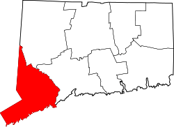 | |
| Towns | ||
| Borough | ||
| CDPs | ||
| Other communities | ||
| Topics | |||||||||||
|---|---|---|---|---|---|---|---|---|---|---|---|
| States | |||||||||||
| Major cities | |||||||||||
| State capitals | |||||||||||
| Transportation |
| ||||||||||
| |||||||||||
| ||
| ||