Standard baseline
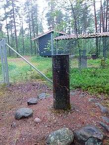
Standard baseline is a constant distance used to calibrate rangefinders.[1] In Finland, standard baseline is located in municipality of Vihti, Nummelanharju (esker) where it was built in 1932.[2] Winding ridge of stratified gravel and sand was chosen as a location for measurements since temperature variations cause very little displacement on soil where benchmarks are located. Measurement devices such as theodolite and mirrors are then placed on those pillars. Careful preliminary measurements such as levelling height differences of observation pillars reference points are required before actual measurements can begin.
In 1947, white light interference based measurement system was taken to use.[3] It was developed by Yrjö Väisälä. Before that baseline was defined by quartz made measuring rod, which was used to calibrate 24-meter long invar-wire. Standard baselines length is invar-wire multiplied by 36, which is 864 meters.[4]
Measured numerical value for the 2007 standard baseline is 864 122.86 millimetres ±0.002 mm to ±0.007 mm uncertainty.[2] 864 122.86 mm ≈ 864 m. Previously used quartz rod had 0.1 mm deviation from 1 meter – intended length – and it was taken account in new measurements.[2]
Sources
- ↑ Jokela, jorma; Häkli, P.; Poutanen, M.; Kallio, U.; Ahola, J. (2012) [2011]. Kenyon, Steve; Pacino, Maria Christina; Marti, Urs, eds. Geodesy for Planet Earth. International Association of Geodesy Symposia. Improving Length and Scale Traceability in Local Geodynamical Measurements. Buenos Aires, Argentina: Springer Berlin Heidelberg. p. 59. doi:10.1007/978-3-642-20338-1_8. ISBN 978-3-642-20338-1.
- 1 2 3 Jokela, Jorma; Häkli, Pasi (2010). "Interference measurements of the Nummela standard baseline in 2005 and 2007" (PDF). The finnish geodetic institute. Publications of the finnish Geodetic institute. 144. ISBN 978-951-711-283-3. Archived from the original on 12 August 2011. Retrieved 2016-06-16.
- ↑ Jokela, Jorma; Häkli, Pasi (8–13 October 2006). "Current research and development at the Nummela Standard Baseline. Conference proceedings" (PDF). Shaping the Change, XXIII FIG Congress.
- ↑ Pollinger, Florian; Meyer, Tobias; Beyer, Jens; R Doloca, Nicolae; Schellin, Wolfgang; Niemeier, Wolfgang; Jokela, Jorma; Häkli, Pasi; Abou-Zeid, Ahmed; Meiners-Hagen, Karl (2012). "The upgraded PTB 600 m baseline: a high-accuracy reference for the calibration and the development of long distance measurement devices},". {Measurement Science and Technology. 23 (9): 094018. doi:10.1088/0957-0233/23/9/094018. Retrieved 2016-06-16.
External links
- Nummela Standard Baseline – The Finnish Geospatial Research Institute
- MIKES and Finnish Geodetic Institute perform the most accurate geodetic baseline measurements in the world
Coordinates: 60°20′21.72″N 24°18′36.47″E / 60.3393667°N 24.3101306°E