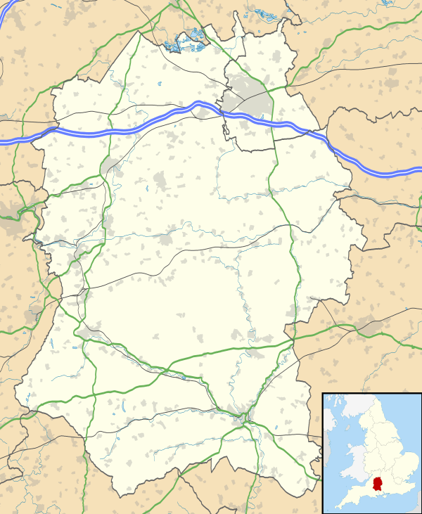
Stapleford, Wiltshire
| Stapleford | |
 Stapleford |
|
 Stapleford |
|
| Population | 264 (in 2011)[1] |
|---|---|
| OS grid reference | SU070374 |
| Civil parish | Stapleford |
| Unitary authority | Wiltshire |
| Ceremonial county | Wiltshire |
| Region | South West |
| Country | England |
| Sovereign state | United Kingdom |
| Post town | Salisbury |
| Postcode district | SP3 |
| Dialling code | 01722 |
| Police | Wiltshire |
| Fire | Dorset and Wiltshire |
| Ambulance | South Western |
| EU Parliament | South West England |
| UK Parliament | Salisbury |
Coordinates: 51°08′10″N 1°54′07″W / 51.136°N 1.902°W
Stapleford is a village and civil parish about 4 miles (6.4 km) north of Wilton, Wiltshire, England. The village is on the River Till just above its confluence with the River Wylye.
The village is on the B3083 road, which joins the A36 at the southern end of the village. The parish includes the hamlet of Serrington, on the A36 0.25 miles (400 m) west of the B3083 junction.
By the Till to the north are the earthwork remains of Stapleford Castle, a medieval ringwork and bailey castle.[2]
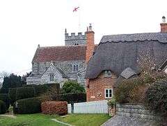
The Anglican Church of St Mary dates from the 12th century and is Grade I listed.[3]
There is a village hall[4] and a pub/restaurant, the Pelican Inn at Serrington.[5]
References
- ↑ "Wiltshire Community History - Census". Wiltshire Council. Retrieved 9 May 2015.
- ↑ Historic England. "Stapleford Castle (1005686)". National Heritage List for England. Retrieved 10 May 2015.
- ↑ Historic England. "Church of St Mary, Stapleford (1146222)". National Heritage List for England. Retrieved 10 May 2015.
- ↑ "Stapleford Village Hall". The Charity Commission. Retrieved 10 May 2015.
- ↑ "The Pelican Inn". Retrieved 10 May 2015.
External links
- "Victoria County History - Wiltshire - Vol 15 pp252-263 - Parishes: Stapleford". University of London. Retrieved 10 May 2015.
-
 Media related to Stapleford, Wiltshire at Wikimedia Commons
This article is issued from Wikipedia - version of the 2/15/2016. The text is available under the Creative Commons Attribution/Share Alike but additional terms may apply for the media files.